|
Chuck Buntjer's
Volcano Visits!
|
|
These are the volcanoes and volcanic areas I have visited since 1999. I have photos and a brief description of each place.
-
Rano Kau Volcano - Easter Island - 1999
-
Gellért Thermal Baths - Hungary - 2000
-
Kilauea Volcano - Hawaii - 2002
-
Volcán Atitlán - Guatemala - 2004
-
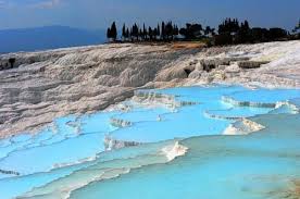
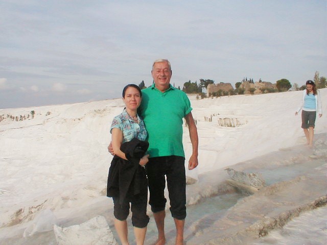
Pamukkale Terraces - Turkey - 2004
-
Arenal Volcano - Costa Rico - 2005
-
Mount St. Helen - Washington State - 2007
-
Geysers - Sonoma California - 2007
-
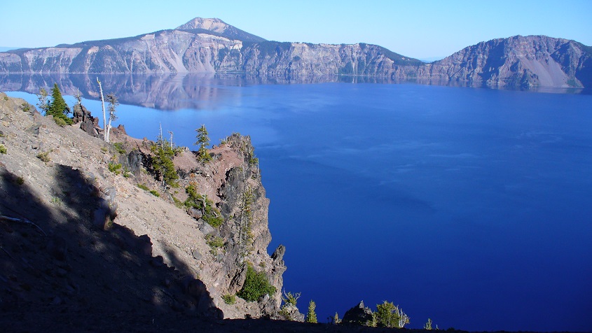
Crater Lake - Oregon - 2007
-
Masaya Volcano - Nicaragua - 2008
|
-
Yellowstone Caldera - Wyoming - 2010
-
Wai-o-Tapu Thermals - New Zealand - 2013
-
Whakaari Volcano - New Zealand - 2013
-
Craters of the Moon - Idaho - 2014
-
Mount Agung - Indonesia - 2017
-
Mt. Shasta - California - 2019
-
Caldera - Santorini - 2021
-
Sete Cidades - Azore Islands Portugal - 2022
-
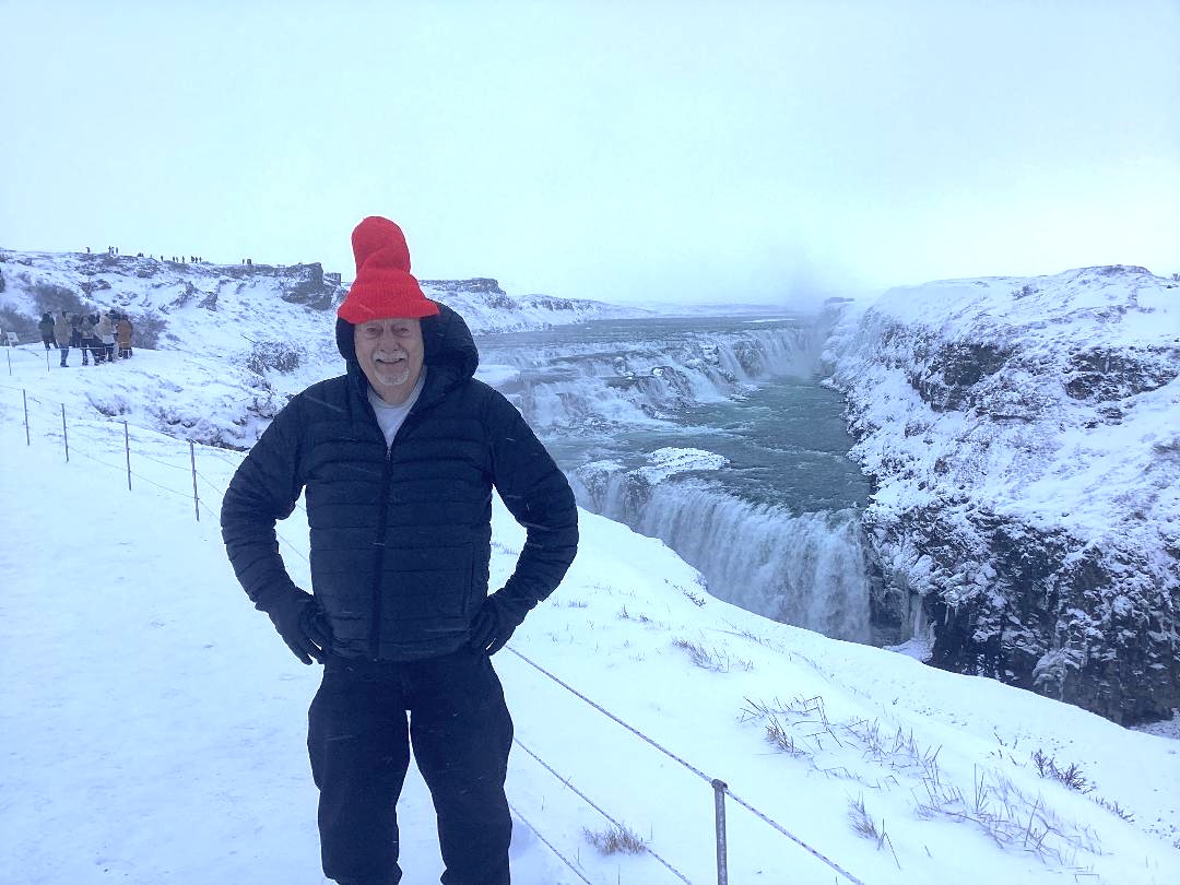
The Great Geysir - Iceland - 2025
- The Twin Craters - Galapagos Islands - 2026
|

|
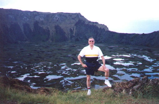
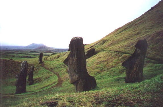
Visiting the Statues and Volcanoes on Easter Island - 1999
|
Rano Kau Volcano - Easter Island - 1999
|
The triangular Rapa Nui (also known as Isla de Pascua, or Easter Island), is renowned for its dramatic megalithic statues of hand carved basalt. The island sits atop the largely submarine Salas y Gomez Ridge, which trends eastward from the East Pacific Rise. It is composed of three principal volcanoes and more than 70 subsidiary vents. Rano Kau at the SW tip includes flat-bottomed crater 1.5 km wide, while Poike volcano is at the E point; both are of Pleistocene age. Terevaka is a broad shield volcano of Pliocene to Pleistocene age at the northern point of the island, which is capped by many pyroclastic cones; the last stage of activity consisted of eruptions from multiple rift zones. The latest lava flows, at Hiva-Hiva near the west-central coast, are thought to be less than 2,000 years old.
This volcano is located within the Rapa Nui National Park, a UNESCO World Heritage property.
|
|
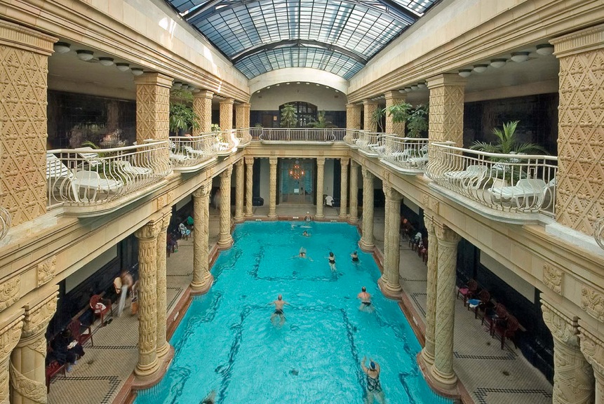
Gellért Thermal Baths - Hungary - 2000
|
Celebrating the Millenium New Year in Vienna & Budapest with Viviane!
|
Hungary may lack ocean access, but it has its own brand of water wealth. The landlocked nation is teeming with thermal water springs - more than 1,300, with 123 in Budapest alone - which bring infinite opportunities for year - round bathing in spas all over the country. These water sources are rich in dissolved minerals, with the exact mineral content varying depending on the location. They are curative as well as luxuriously calming. Some are sulfurous - smelling, some are salty, and some have other special properties; they are each specifically recommended for healing certain health conditions. Wellness and spa culture have been a part of the Hungarian lifestyle for hundreds of years. Soaking in the warm mineral waters may feel decadent, but these spas aren’t seen as indulgences. In Hungary they are just part of a balanced life.
Hungary’s spa culture began in Roman times, but some of Budapest’s most stunning bathhouses were built during the 150 years of Ottoman rule. These 16th-century bathhouses have similar structures with central octagon-shaped pools topped by high domed ceilings through which rays of light pierce the water. There are smaller pools surrounding the main one, and saunas and steam rooms beyond.
|
|
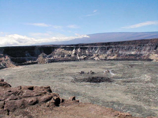
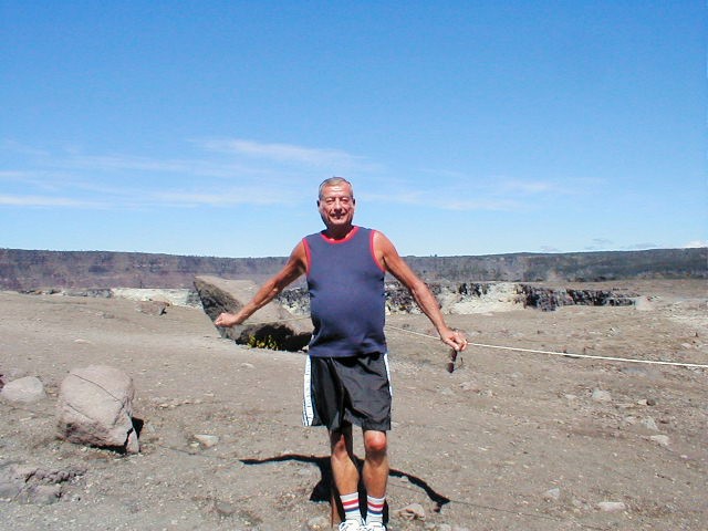
Kilauea Volcano - Hawaii - 2002
|
|
The Big Island and Volcano
Located 30 miles southwest of Hilo, this is the home of Kilauea volcano, one of the most active volcanoes on earth. The chance to witness the primal process of creation and destruction make this park one of the most popular visitor attraction in Hawaii and a sacred place for Native Hawaiians.
Founded in 1916, the Park encompasses 333,000 acres from the summit of Maunaloa to the sea. Here you'll find 150 miles of hiking trails through volcanic craters, scalded deserts and rainforests as well as a museum, petroglyphs, a walk-in lava tube and two active volcanoes: Maunaloa, which last erupted in 1984 and Kilauea which has been erupting since January 3rd, 1983.
Kilauea is sometimes called "the world's only drive-in volcano." This prolific volcano currently produces 250,000-650,000 cubic yards of lava per day, enough to resurface a 20-mile-long, two-lane road daily. Pele, the volcano goddess who lives here, is very unpredictable.
|
|
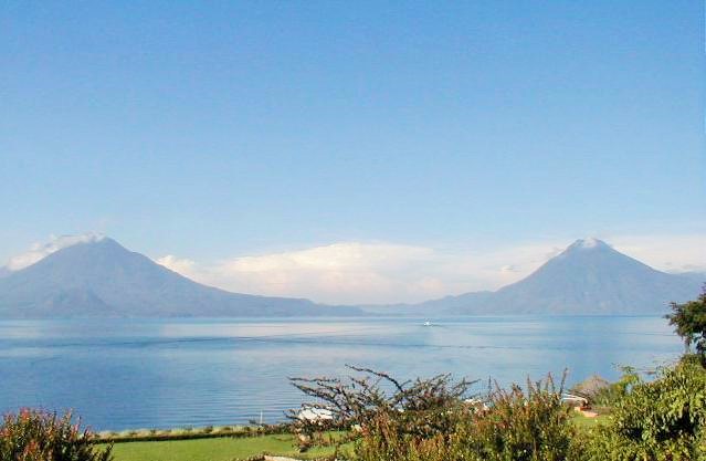
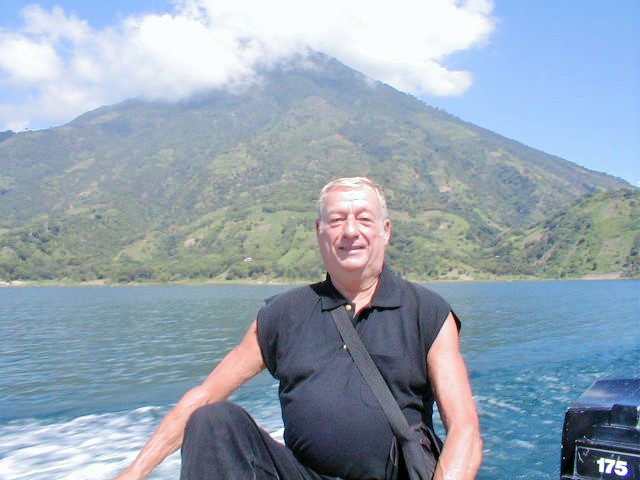
Volcán Atitlán - Guatemala - 2004
|
|
Guatemala and Volcanoes
Volcán Atitlán - Spanish pronunciation: (ati'tlan) is a large, conical, active stratovolcano adjacent to the caldera of Lake Atitlán in the Highlands of Guatemala. The volcano has been quite active historically, with more than a dozen eruptions recorded between 1469 and 1853, the date of its most recent eruption. Atitlán is part of the Central American Volcanic Arc. The arc is a chain of volcanoes stretching along Central America formed by subduction of the Cocos Plate underneath the Caribbean Plate. These volcanoes are part of the Ring of Fire around the Pacific Ocean.
Volcán Atitlán is few miles south of Volcán Tolimán, which rises from the southern shore of Lake Atitlán. Volcán San Pedro rises above Lake Atitlán northwest of Volcán Atitlán. A long narrow bay separates Volcán Atitlán and Volcán Toliman from Volcán San Pedro.
|
|
Pamukkale Terraces - Turkey - 2004
|
|
|
|
Turkey
Pamukkale's terraces are made of travertine, a sedimentary rock deposited by water from the hot springs.
In this area, there are 17 hot water springs in which the temperature ranges from 35 °C (95 °F) to 100 °C (212 °F). The water that emerges from the spring is transported 320 metres (1,050 ft) to the head of the travertine terraces and deposits calcium carbonate on a section 60 to 70 metres (200 to 230 ft) long covering an expanse of 24 metres (79 ft) to 30 metres (98 ft). When the water, supersaturated with calcium carbonate, reaches the surface, carbon dioxide de-gasses from it, and calcium carbonate is deposited. The depositing continues until the carbon dioxide in the water balances the carbon dioxide in the air. Calcium carbonate is deposited by the water as a soft jelly, but this eventually hardens into travertine.
This reaction is affected by the weather conditions, ambient temperature, and the flow duration. Precipitation continues until the carbon dioxide in the thermal water reaches equilibrium with the carbon dioxide in the atmosphere. Measurements made at the source of the springs find atmospheric levels of 725 mg/l carbon dioxide, by the time this water flows across the travertines, this figure falls to 145 mg/l. Likewise calcium carbonate falls from 1200 mg/l to 400 mg/l and calcium 576.8 mg/l to 376.6 mg/l. From these results it is calculated that 499.9 mg of CaCO3 is deposited on the travertine for every liter of water. This means that for a flow rate of 1 i/s of water 43191 grams are deposited daily. The average density of a travertine is 1.48 g/cm3 implying a deposit of 29.2 dm3. Given that the average flow of the water is 465.2 l/s this implies that it can whiten 13,584 square metres (146,220 sq ft) a day, but in practice this area coverage is difficult to attain. These theoretical calculations indicate that up to 4.9 square kilometres (1.9 sq mi) it can be covered with a white deposit of 1 millimetre (0.039 in) thickness.
|
|
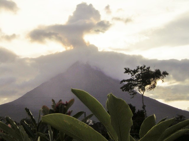
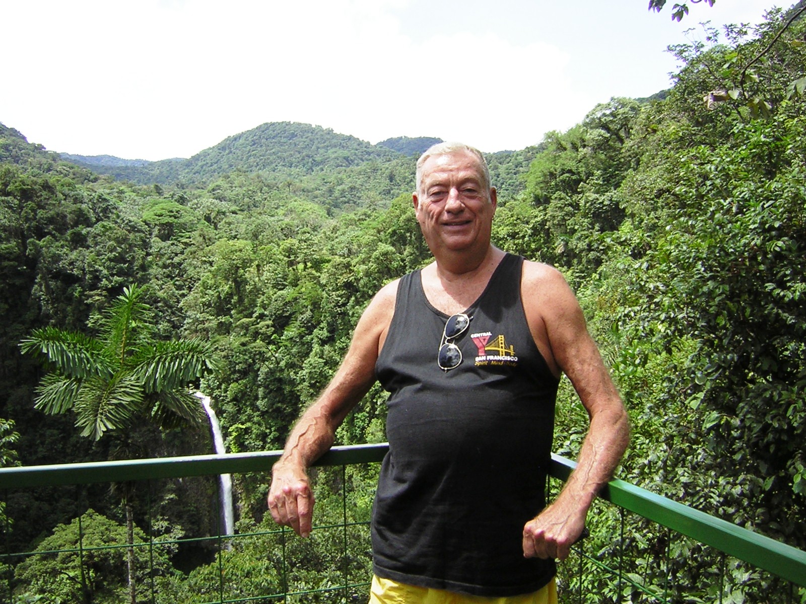
Arenal Volcano - Costa Rico - 2005
|
|
Costa Rico
Arenal Volcano National Park is a Costa Rican national park in the central part of the country, forming the Arenal Tilaran Conservation Area. The park encompasses the Arenal Volcano, which "was" the most active in the country, which had previously been believed to be dormant until a major eruption in 1968. It neighbors Lake Arenal, which is the site of the country's largest hydroelectricity project, the Lake Arenal Dam.
The park also contains a second volcano, Chato, whose crater contains a lagoon. It is also called Cerro Chato (literally Mount Chato) as it has been inactive for around 3500 years–coinciding with the creation and growth of Arenal itself. In and around the park are various lodges and hotels, some with their own hot springs, and others focused on the wildlife of the area. Within the national park are the Museum of Vulcanicity and a ranger station.
|
|
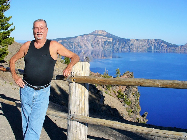
Crater Lake - Oregon - 2007
|
|
|
|
Oregon
Crater Lake is a caldera lake in the western United States, located in south-central Oregon. It is the main feature of Crater Lake National Park and is famous for its deep blue color and water clarity. The lake partly fills a nearly 2,148-foot (655 m)-deep caldera that was formed around 7,700 (± 150) years ago by the collapse of the volcano Mount Mazama. There are no rivers flowing into or out of the lake; the evaporation is compensated for by rain and snowfall at a rate such that the total amount of water is replaced every 250 years. At 1,943 feet (592 m), the lake is the deepest in the United States, and the seventh or ninth deepest in the world, depending on whether average or maximum depth is measured.
Crater Lake is also known for the "Old Man of the Lake", a full-sized tree which is now a stump that has been bobbing vertically in the lake for over a century. The low temperature of the water has slowed the decomposition of the wood, hence the longevity of the bobbing tree.
Two islands are in Crater Lake; Wizard Island formed from a cinder cone that erupted after Crater Lake began to fill with water, and the smaller Phantom Ship has seven different trees living on it. There are also colonies of violet green swallows and several varieties of wildflowers and lichens living there.
While having no indigenous fish population, the lake was stocked from 1888 to 1941 with a variety of fish. Several species have formed self-sustaining populations
|
|
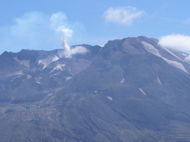
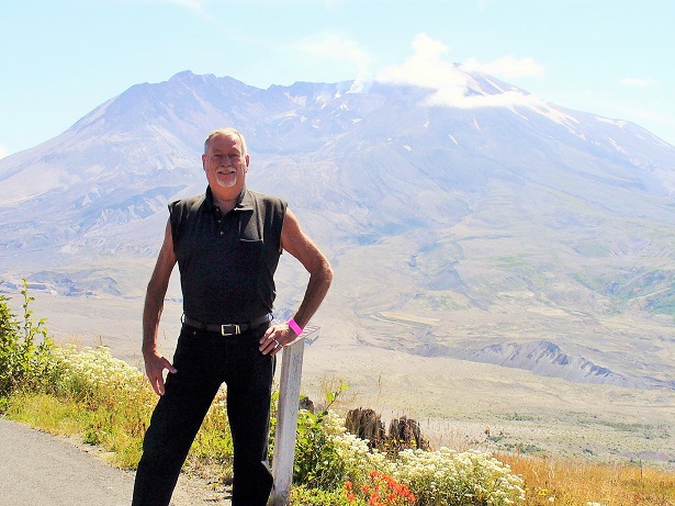
Mount St. Helen - Washington State - 2007
|
|
|
|
Washington State
Mount St. Helens (known as Lawetlat'la to the indigenous Cowlitz people, and Loowit to the Klickitat) is an active stratovolcano located in Skamania County, Washington, in the Pacific Northwest region of the United States. It is 96 miles (154 km) south of Seattle, Washington, and 50 miles (80 km) northeast of Portland, Oregon. Mount St. Helens takes its English name from the British diplomat Lord St Helens, a friend of explorer George Vancouver who made a survey of the area in the late 18th century. The volcano is located in the Cascade Range and is part of the Cascade Volcanic Arc, a segment of the Pacific Ring of Fire that includes over 160 active volcanoes. This volcano is well known for its ash explosions and pyroclastic flows.
Mount St. Helens is most notorious for its catastrophic eruption on May 18, 1980, at 8:32 a.m. PDT, the deadliest and most economically destructive volcanic event in the history of the United States. Fifty-seven people were killed; 250 homes, 47 bridges, 15 miles (24 km) of railways, and 185 miles (298 km) of highway were destroyed. A massive debris avalanche triggered by an earthquake measuring 5.1 on the Richter scale caused an eruption that reduced the elevation of the mountain's summit from 9,677 ft (2,950 m) to 8,365 ft (2,550 m), replacing it with a 1 mile (1.6 km) wide horseshoe-shaped crater. The debris avalanche was up to 0.7 cubic miles (2.9 km3) in volume. The Mount St. Helens National Volcanic Monument was created to preserve the volcano and allow for its aftermath to be scientifically studied.
As with most other volcanoes in the Cascade Range, Mount St. Helens is a large eruptive cone consisting of lava rock interlayered with ash, pumice, and other deposits. The mountain includes layers of basalt and andesite through which several domes of dacite lava have erupted. The largest of the dacite domes formed the previous summit, and off its northern flank sat the smaller Goat Rocks dome. Both were destroyed in the 1980 eruption.
|
|
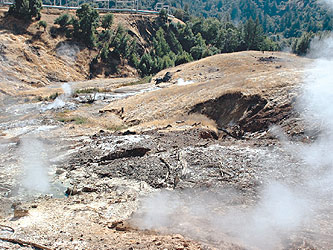
Geysers - Sonoma County California - 2007
|
|

|
|
Sonoma County California
The
Geysers
are located in Sonoma, the wine country, and has many fantastic spas where one can soak in the hot lava sands, enjoy a massage and have a glass of wine or even hard liquor.
For about 12,000 years, Indians built steambaths at the Geysers and used the steam and hot water for healing purposes and cooking. When Euro/Americans first entered the area, six Indian tribes inhabited the area around the Geysers, three bands of Pomo people, two bands of Wappo people, and the Lake Miwok people. According to Stephen Powers in 1871, "Wappo invalids were accustomed to wallow in the hot, steaming mud and pools, receiving benefit therefrom into their bodies." The Wappo also collected sulphur which they called te'ke and a Wappo village, named tekena'ntsonoma (teke sulphur + nan well containing water + tso ground + no'ma village) was located about 12 miles (19 km) southeast of Cloverdale and on the present-day Sulphur Creek.
The Geysers were first seen by Euro/Americans and named in 1847 during John Fremont's survey of the Sierra Mountains and the Great Basin by William Bell Elliot who called the area "The Geysers," although the geothermal features he discovered were not technically geysers, but fumaroles. Between 1848 and 1854, The Geysers was developed into a spa named
The Geysers Resort Hotel
, which attracted tourists including Ulysses S. Grant, Theodore Roosevelt and Mark Twain.
The Geysers, comprising 45 square miles along the Sonoma and Lake County border and it is the largest complex of geothermal power plants in the world.
Geothermal power is energy derived from the heat of the earth's core. "Geo" means "from the earth" and "thermal" means "heat." This type of energy is clean and predictable, offering a reliable and renewable energy source.
In the Mayacamas Mountains, located north of San Francisco, naturally occurring steam field reservoirs below the earth's surface are being harnessed by Calpine to make clean, green, renewable energy for homes and businesses across Northern California.
The Geysers meets the typical power needs of Sonoma, Lake and Mendocino counties, as well a portion of the power needs of Marin and Napa counties. In fact, The Geysers satisfies nearly 60 percent of the average electricity demand in the North Coast region from the Golden Gate Bridge to the Oregon border. The Geysers is one of the most reliable energy sources in California, delivering extremely high availability and on-line performance, and accounts for one-fifth of the green power produced in California.
|
|
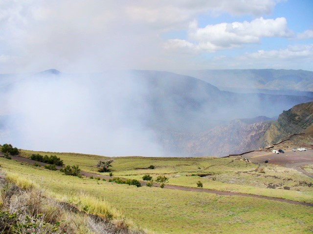
Masaya Caldera - Nicaragua - 2008
|
|
Nicaragua
Masaya is a caldera located in the department of Masaya, 20 km south of Managua, Nicaragua. It is Nicaragua's first and largest National Park, and one of 78 protected areas of Nicaragua. The complex volcano is composed of a nested set of calderas and craters, the largest of which is Las Sierras shield volcano and caldera. Within this caldera lies a sub-vent, which is Masaya Volcano sensu stricto. The vent is a shield type composing of basaltic lavas and tephras and includes a summit crater. This hosts Masaya caldera, formed 2500 years ago by an 8-kmł basaltic ignimbrite eruption.
Inside this caldera a new basaltic complex has grown from eruptions mainly on a semi-circular set of vents that include the Masaya and Nindiri cones. The latter host the pit craters of Masaya, Santiago, Nindiri and San Pedro. Observations in the walls of the pit craters indicate that there have been several episodes of cone and pit crater formation.
|
|
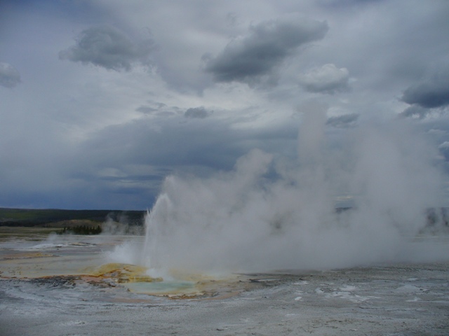
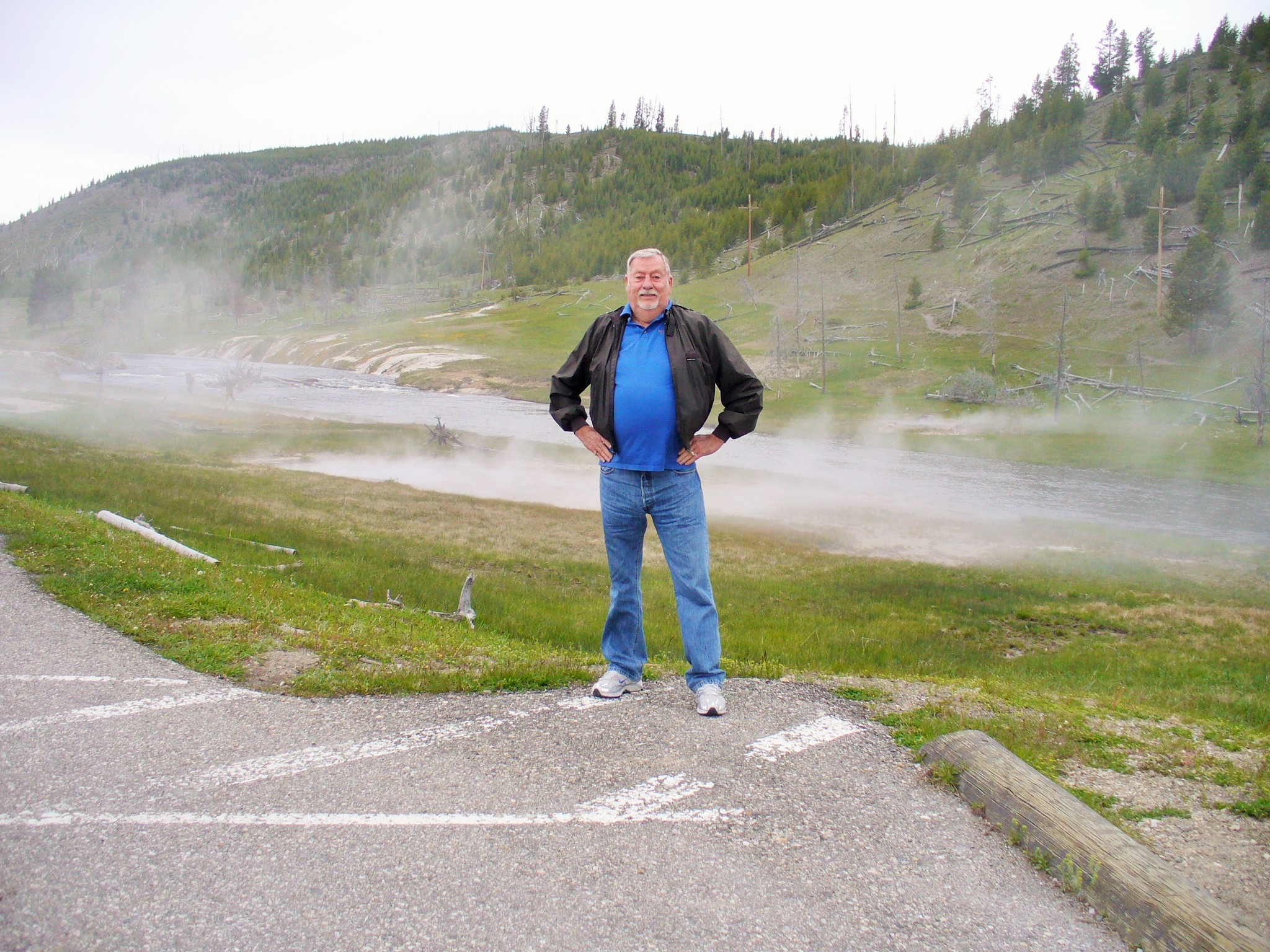
Yellowstone Caldera - Wyoming - 2010
|
|
|
|
Wyoming
Yellowstone, widely held to be the
first national park in the world
, is known for its wildlife and its many geothermal features, especially Old Faithful Geyser, one of the most popular features in the park. It has many types of ecosystems, but the subalpine forest is most abundant. It is part of the South Central Rockies forests ecoregion.
Yellowstone National Park spans an area of 3,468.4 square miles (8,983 km2), comprising lakes, canyons, rivers and mountain ranges. Yellowstone Lake is one of the largest high-altitude lakes in North America and is centered over the Yellowstone Caldera, the largest supervolcano on the continent. The caldera is considered an active volcano. It has erupted with tremendous force several times in the last two million years. Half of the world's geothermal features are in Yellowstone, fueled by this ongoing volcanism. Lava flows and rocks from volcanic eruptions cover most of the land area of Yellowstone. The park is the centerpiece of the Greater Yellowstone Ecosystem, the largest remaining nearly-intact ecosystem in the Earth's northern temperate zone.
|
|
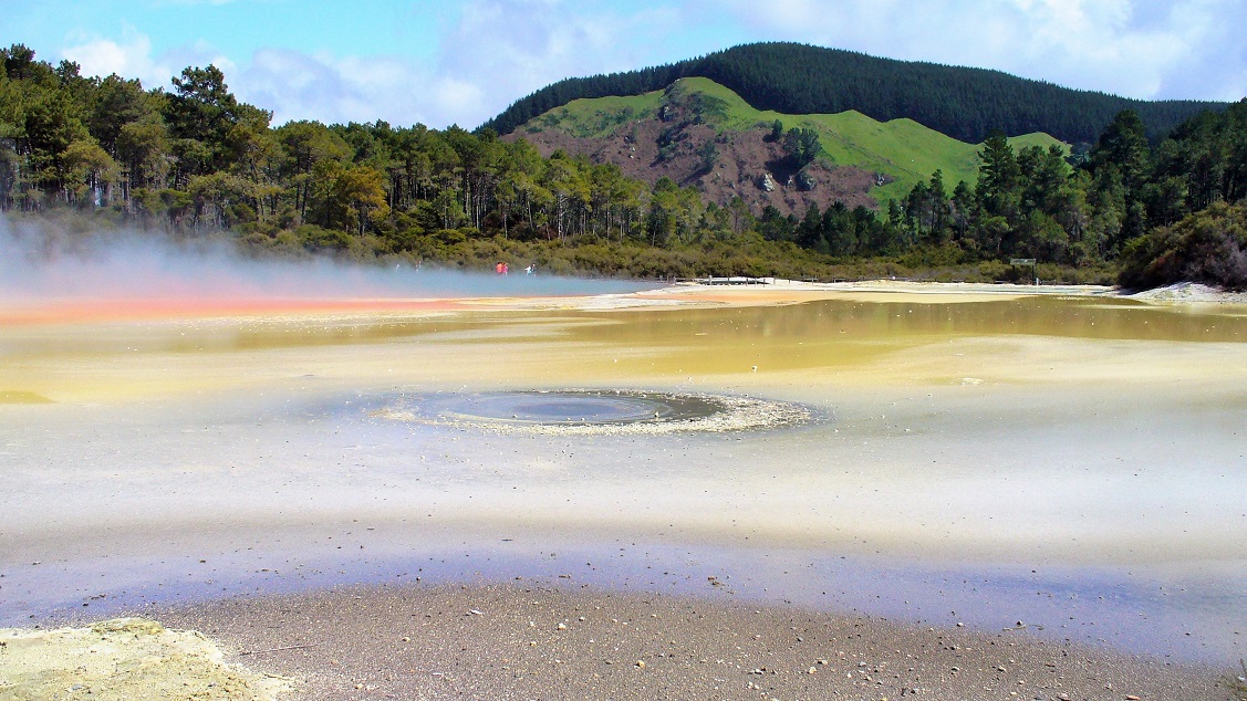
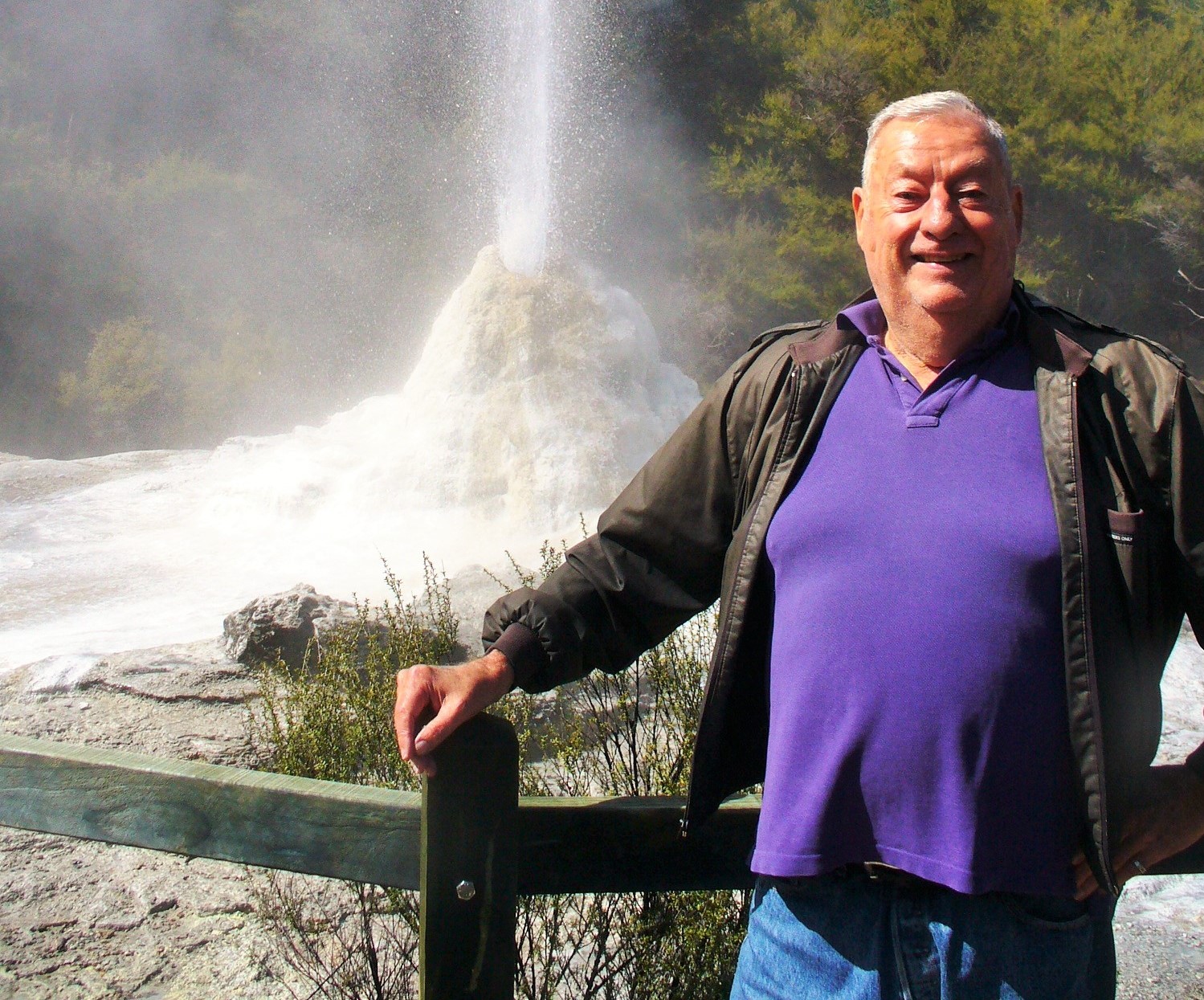
Wai-o-Tapu Thermals - New Zealand - 2013
|
|
|
|
New Zealand
Waiotapu, (Maori for "sacred waters") is an active geothermal area at the southern end of the Okataina Volcanic Centre, just north of the Reporoa caldera, in New Zealand's Taupo Volcanic Zone. It is 27 kilometres south of Rotorua. The area has many hot springs noted for their colourful appearance, in addition to the Lady Knox Geyser, Champagne Pool, Artist's Palette, Primrose Terrace and boiling mud pools. The geothermal area covers 18 square kilometres. Prior to European occupation the area was the homeland of the Ngati Whaoa tribe who descended from those on the Arawa waka (canoe).
The area has a long history as a tourist attraction. While the area has been protected as a scenic reserve since 1931, a tourist operation occupies part of the reserve under a concession. It operates under the name "Wai-O-Tapu Thermal Wonderland". The business was bought in 2012 by Te Arawa Group Holdings, a local Maori tribal business, from the Sewell/Leinhardt family, who had run it for 30 years.
|
|
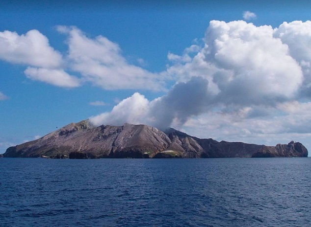
Whakaari Volcano - New Zealand - 2013
|
|
|
|
New Zealand
Whakaari, (is an active stratovolcano situated 48 km (30 mi) from the east coast of the North Island of New Zealand, in the Bay of Plenty. The island covers an area of approximately 325 ha (800 acres), which is just the peak of a much larger submarine volcano.
The island is New Zealand's most active cone volcano, and has been built up by continuous volcanic activity over the past 150,000 years. The nearest mainland towns are Whakatane and Tauranga. The island has been in a nearly continuous stage of releasing volcanic gas at least since it was sighted by James Cook in 1769. Whakaari erupted continually from December 1975 until September 2000, and also erupted in 2012, 2016, and 2019.
Sulphur was mined on the island until the 1930s. Ten miners were killed in 1914 when part of the crater wall collapsed.
A large eruption occurred at 14:11 on 9 December 2019, which resulted in 22 fatalities, including two people who were missing and ruled to be dead by a coroner. Twenty-five survivors were injured, many critically and with severe burns. Forty-seven people were reportedly on the island when it erupted. A second eruption closely followed the first.
As Barbara and I visited the coast and took photos of the volcano, we were told it was way too dangerous for us to take a tour boat to the island as it was starting to erupt again!
|
|
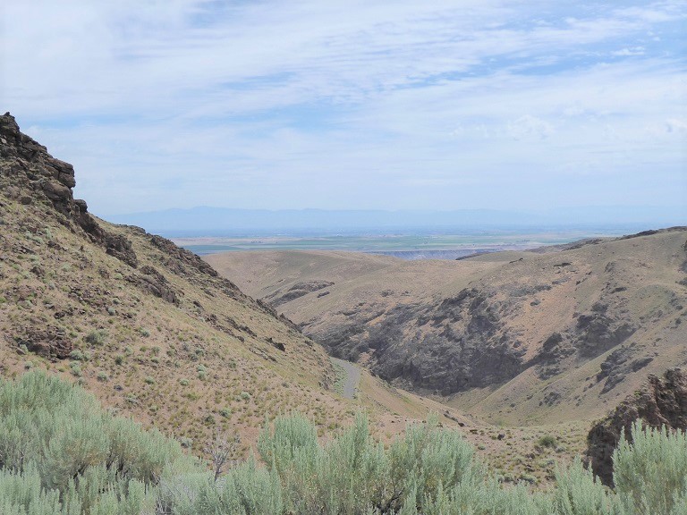
Craters of the Moon - Idaho - 2014
|
|
|
|
Idaho
Craters of the Moon, National Monument and Preserve is a U.S. National Monument and national preserve in the Snake River Plain in central Idaho. It is along US 20 (concurrent with US 93 and US 26), between the small towns of Arco and Carey, at an average elevation of 5,900 feet (1,800 m) above sea level. The protected area's features are volcanic and represent one of the best-preserved flood basalt areas in the continental United States.
The Monument was established on May 2, 1924. In November 2000, a presidential proclamation by President Clinton greatly expanded the Monument area. The National Park Service portions of the expanded Monument were designated as Craters of the Moon National Preserve in August 2002. It lies in parts of Blaine, Butte, Lincoln, Minidoka, and Power counties. The area is managed cooperatively by the National Park Service and the Bureau of Land Management (BLM).
The Monument and Preserve encompass three major lava fields and about 400 square miles (1,000 km2) of sagebrush steppe grasslands to cover a total area of 1,117 square miles (2,893 km2). The Monument alone covers 53,571 acres (21,679 ha). All three lava fields lie along the Great Rift of Idaho, with some of the best examples of open rift cracks in the world, including the deepest known on Earth at 800 feet (240 m). There are excellent examples of almost every variety of basaltic lava, as well as tree molds (cavities left by lava-incinerated trees), lava tubes (a type of cave), and many other volcanic features.
|
|
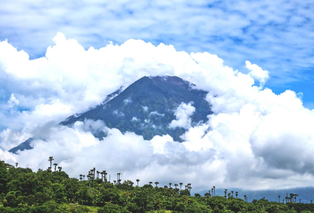
Mount Agung - Indonesia- 2017
|
|
|
|
Indonesia
Mount Agung, is an active volcano in Bali, Indonesia, southeast of Mount Batur volcano, also in Bali. It is the highest point on Bali, and dominates the surrounding area, influencing the climate, especially rainfall patterns. From a distance, the mountain appears to be perfectly conical. From the peak of the mountain, it is possible to see the peak of Mount Rinjani on the nearby island of Lombok, to the east, although both mountains are frequently covered in clouds. Agung is a stratovolcano, with a large and deep crater. Its most recent eruptions occurred from 2017-2019.
In late 2017, the area experienced 844 volcanic earthquakes, peaking at 300 to 400 earthquakes on 26 September. The frequency and intensity of these quakes caused much alarm among seismologists, as similar volcanoes have historically been known to erupt with even fewer warning signs. The alert level was raised to the highest level and about 122,500 people were evacuated from their houses around the volcano. The Indonesian National Disaster Management Authority declared a 12-kilometre exclusion zone around the volcano on 24 September.
In June 2018, Agung erupted with 2 km high plumes interrupting air traffic. On 3 July, a Strombolian explosion occurred, sending debris in all directions. In late May 2019 an eruption spewed lava and rocks over about 3 km, with some ash falling on nearby villages and temporarily interrupting international flights.
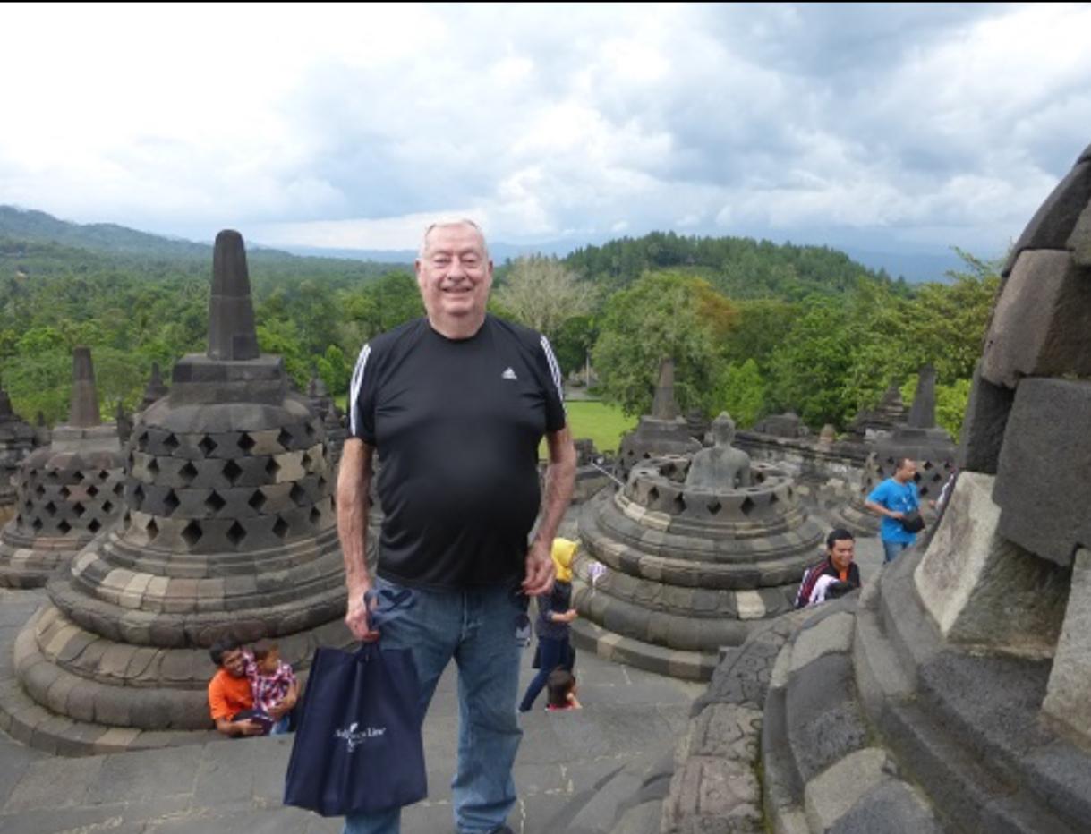
Borobudur, also transcribed Barabudur, is a 9th-century Mahayana Buddhist temple in Magelang Regency, near the city of Magelang and the town of Muntilan, in Central Java, Indonesia.
Constructed of gray andesite-like stone, the temple consists of nine stacked platforms, six square and three circular, topped by a central dome. It is decorated with 2,672 relief panels and originally 504 Buddha statues. The central dome is surrounded by 72 Buddha statues, each seated inside a perforated stupa. The monument guides pilgrims through an extensive system of stairways and corridors with 1,460 narrative relief panels on the walls and the balustrades. Borobudur has one of the world's most extensive collections of Buddhist reliefs.
Borobudur is the largest Buddhist temple in the world, and ranks with Bagan in Myanmar and Angkor Wat in Cambodia as one of the great archeological sites of Southeast Asia. Borobudur remains popular for pilgrimage, with Buddhists in Indonesia celebrating Vesak Day at the monument. Among Indonesia's tourist attractions, Borobudur is the most-visited monument.
|
|
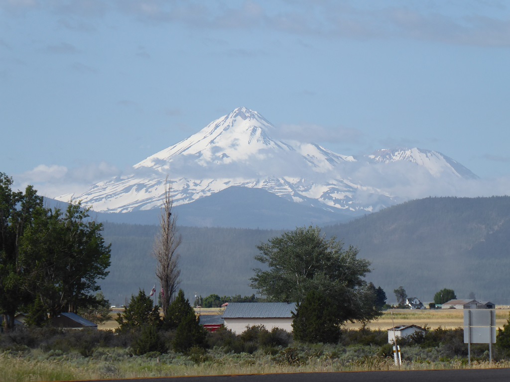
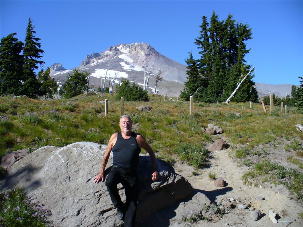
Mt Shasta - Siskiyou County in California - 2019
|
|
|
|
Siskiyou County in California
Mount Shasta
is a potentially active volcano at the southern end of the Cascade Range in Siskiyou County, California. At an elevation of 14,179 feet (4,321.8 meters), it is the second-highest peak in the Cascades and the fifth-highest in the state. Mount Shasta has an estimated volume of 85 cubic miles (350 cubic kilometers), which makes it the most voluminous stratovolcano in the Cascade Volcanic Arc. The mountain and surrounding area are part of the Shasta - Trinity National Forest.
During the last 10,000 years, Mount Shasta has erupted an average of every 800 years, but in the past 4,500 years the volcano has erupted an average of every 600 years.
USGS seismometers and GPS receivers operated by UNAVCO form the monitoring network for Mount Shasta. The volcano has been relatively quiet for at least the past 15 years, with only a handful of small magnitude earthquakes and no demonstrable ground deformation. Although geophysically quiet, periodic geochemical surveys indicate that volcanic gas emanates from a fumarole at the summit of Mount Shasta from a deep-seated reservoir of partly molten rock.[35]
Mount Shasta's west face as seen from Hidden Valley high on the mountain. The west face gulley is an alternate climbing route to the summit.
Mount Shasta can release volcanic ash, pyroclastic flows or dacite and andesite lava. Its deposits can be detected under nearby small towns. Mount Shasta has an explosive, eruptive history. There are fumaroles on the mountain, which show Mount Shasta is still alive.
The worst-case scenario for an eruption is a large pyroclastic flow, similar to that which occurred in the 1980 eruption of Mount St. Helens. Since there is ice, such as Whitney Glacier and Mud Creek Glacier, lahars would also result. Ash would probably blow inland, perhaps as far as eastern Nevada. There is a small chance an eruption could result in a collapse of the mountain, as happened when Mount Mazama in Oregon collapsed to form what is now called Crater Lake, but this is of much lower probability.
The United States Geological Survey monitors Mount Shasta and rates it as a very high-threat volcano.
|
|
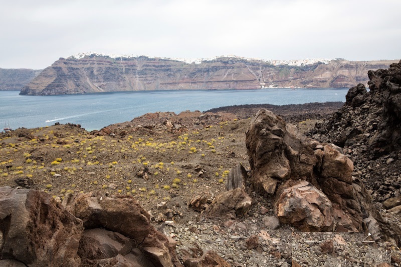
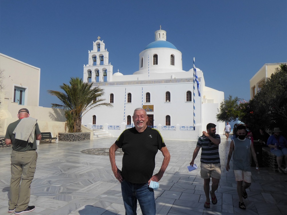
Caldera - Sanorini - 2021
|
|
|
|
Island of Sanorini
Santorini’s half-moon-shaped bay is the center of the caldera (a cauldron-like volcanic depression), which collapsed after a volcanic eruption during the Minoan civilization, eventually leading to their decline, just like Pompeii. Indeed, the eruption was so massive that it seems to have caused significant climate perturbations; it was possibly one of the biggest volcanic eruptions on Earth. The outer edge of the ancient volcano gave birth to Thira, the main island. Subsequent eruptions during the 16th and 17th centuries are responsible for the creation of the islands Palea Kameni and Nea Kameni. Furthermore, excavation works done at the site of Akrotiri have shown that the island, at the time named Kallisti, was the cradle of an advanced civilization dating back to 4000 BC.
In 1956, an earthquake struck the island, which led to the collapse of the volcano’s magma chamber. The disaster also destroyed over 2,000 houses. But the largest known eruption happened about 3500 years ago and shaped the caldera we know today, which is considered one of the most beautiful in the world and which attracts hundreds of thousands of visitors every year, who come to admire the splendor of the sunset from Oia.
|
|
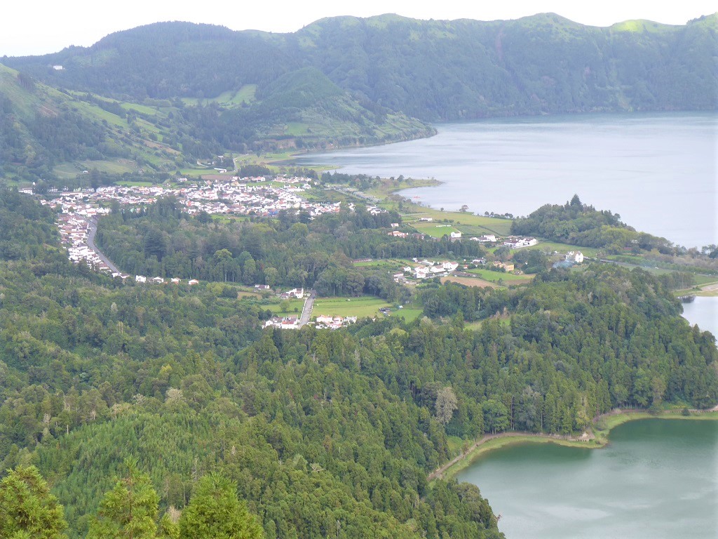
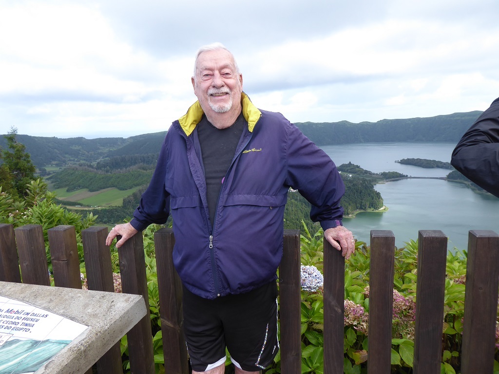
Sete Cidades - Azore Islands Portugal - 2022
|
|
|
|
Azore Islands Portugal
Sete Cidades, from a geostructural perspective, the Azores are located above an active triple junction between three of the world's major tectonic plates (the North American Plate, the Eurasian Plate and the African Plate), a condition that has translated into the existence of many faults and fractures in this region of the Atlantic. The westernmost islands of the archipelago (Corvo and Flores) are located on the North American Plate, while the remaining islands are located within the boundary that divides the Eurasian and African plates.
The principal tectonic structures that exist in the region of the Azores are the Mid-Atlantic Ridge, the Terceira Rift, the Azores Fracture Zone and the Glória Fault. The Mid-Atlantic Ridge is the main frontier between the North American Plate and the African-Eurasian Plates that crosses the Azores Plateau between the islands of Flores and Faial from north to south then to the southwest; it is an extensive form crossed by many transform faults running perpendicular to its north–south orientation, that is seismically active and susceptible to volcanism.
|
|
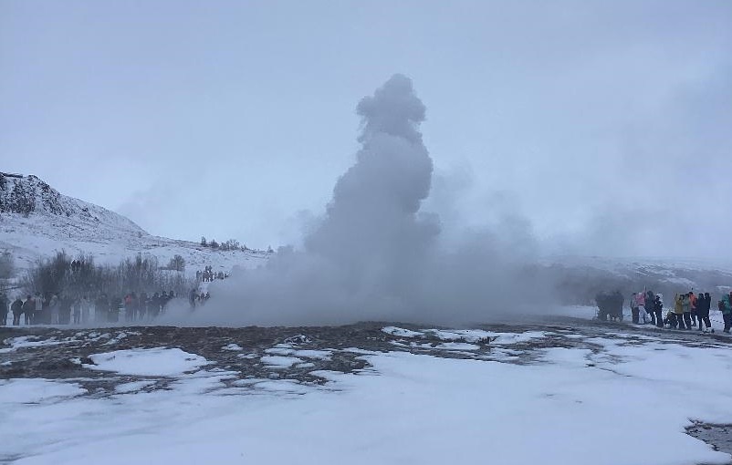
The Great Geysir - Iceland - 2025
|
|
Iceland
Geysir, sometimes known as The Great Geysir, is a geyser in south-western Iceland, that geological studies suggest started forming about 1150 CE. The English word geyser (a periodically spouting hot spring) derives from Geysir. The name Geysir itself is derived from the Icelandic verb geysa ("to go quickly forward"). Geysir lies in the Haukadalur valley on the slopes of Laugarfjall lava dome, which is also the home to Strokkur geyser about 50 metres (160 ft) to the south. The Strokkur geyser may be confused with it, and the geothermal field it is in is known usually as either, Geysir or Haukadalur.
Eruptions at Geysir can typically hurl boiling water up to 60 m (200 ft) in the air. However, eruptions are nowadays infrequent, and have in the past stopped altogether for many years at a time.
|
|
Los Gemelos (The Twins) - Galapagos Islands - Ecuador - 2026
|

|

|
|
The Galápagos Islands are an isolated set of volcanoes, consisting of shield volcanoes and lava plateaus, located 1,200 km (746 mi) west of Ecuador. They are driven by the Galapagos hotspot, and are between 4.2 million and 700,000 years of age. The largest island, Isabela, consists of six coalesced shield volcanoes, each delineated by a large summit caldera. Espanola, the oldest island, and Fernandina, the youngest, are also shield volcanoes, as are most of the other islands in the chain. The Galapagos Islands are perched on a large lava plateau known as the Galapagos Platform, which creates a shallow water depth of 360 to 900 m (1,181 to 2,953 ft) at the base of the islands, which stretch over a 174 mi (280 km) long diameter. Since Charles Darwin's famous visit to the islands in 1835, over 60 recorded eruptions have occurred in the islands, from six different shield volcanoes. Of the 21 emergent volcanoes, 13 are considered active.
|
|
Created on: 2000.12.10 |

|
Updated on: 2025.04.05 |