
 My friend Virginia and I decided to go to Ireland as neither of us had been there before. We met at the Portal World Travel agency with Jo Ann Giovannoni. Virginia knew her through a friend and I had called Jo Ann the day before to set up an appointment at ten a.m. on Tuesday, 2014.07.08.
We had visited the travel agency a week before and had a brochure to review. We liked the one tour - Irish Adventure - that circled the island. We decided to add an extra
My friend Virginia and I decided to go to Ireland as neither of us had been there before. We met at the Portal World Travel agency with Jo Ann Giovannoni. Virginia knew her through a friend and I had called Jo Ann the day before to set up an appointment at ten a.m. on Tuesday, 2014.07.08.
We had visited the travel agency a week before and had a brochure to review. We liked the one tour - Irish Adventure - that circled the island. We decided to add an extra 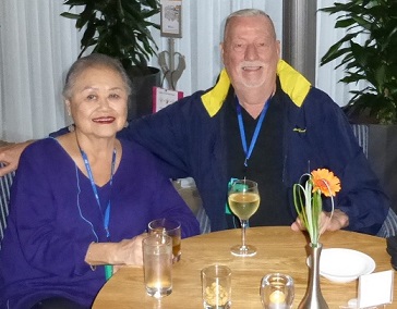 day to the eight day tour at the end as we would have an extra day in Dublin to relax before flying home. That was about $160.00 extra for the room or $80 to split the cost.
Jo Ann had the tour group check the airfare but later she tried and found a flight about $100.00 less so that paid for the extra day in Dublin. The hotels are Superior or First Class and there is Breakfast and Dinner at most stops. This tour is through C-I-E Internation wth tours through Ireland, Scotland, England and Wales.
The trip starts on October 14th and we will fly to New York and on to Ireland on
Delta Airlines arriving on Wednesday morning, October 15th and then do an afternoon tour of Dublin.
day to the eight day tour at the end as we would have an extra day in Dublin to relax before flying home. That was about $160.00 extra for the room or $80 to split the cost.
Jo Ann had the tour group check the airfare but later she tried and found a flight about $100.00 less so that paid for the extra day in Dublin. The hotels are Superior or First Class and there is Breakfast and Dinner at most stops. This tour is through C-I-E Internation wth tours through Ireland, Scotland, England and Wales.
The trip starts on October 14th and we will fly to New York and on to Ireland on
Delta Airlines arriving on Wednesday morning, October 15th and then do an afternoon tour of Dublin.
Portal World Travel Since 1947 - Jo Ann Gionannoni - 2609 Ocean Avenue San Francisco CA. 94132
415.334.5400
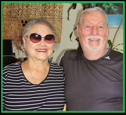
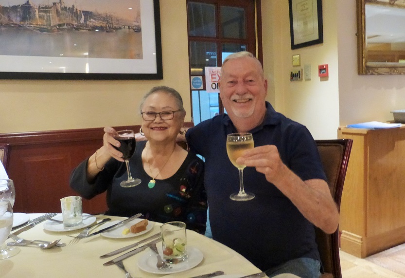
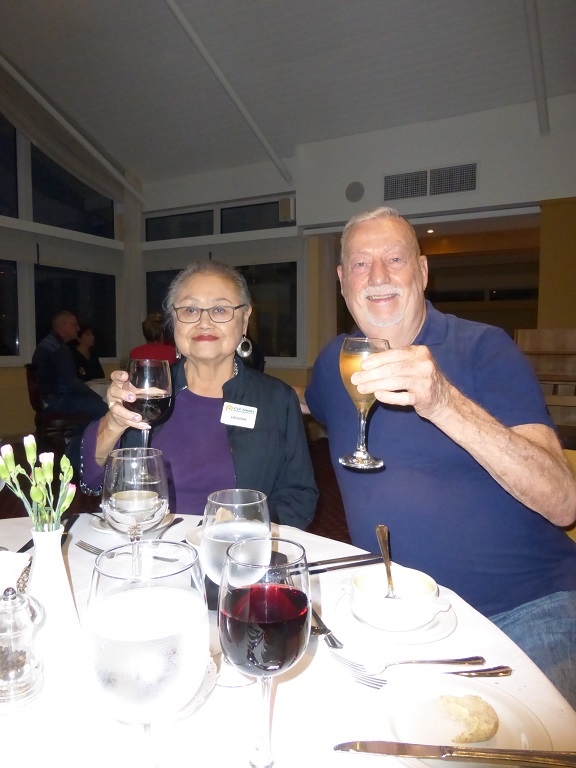
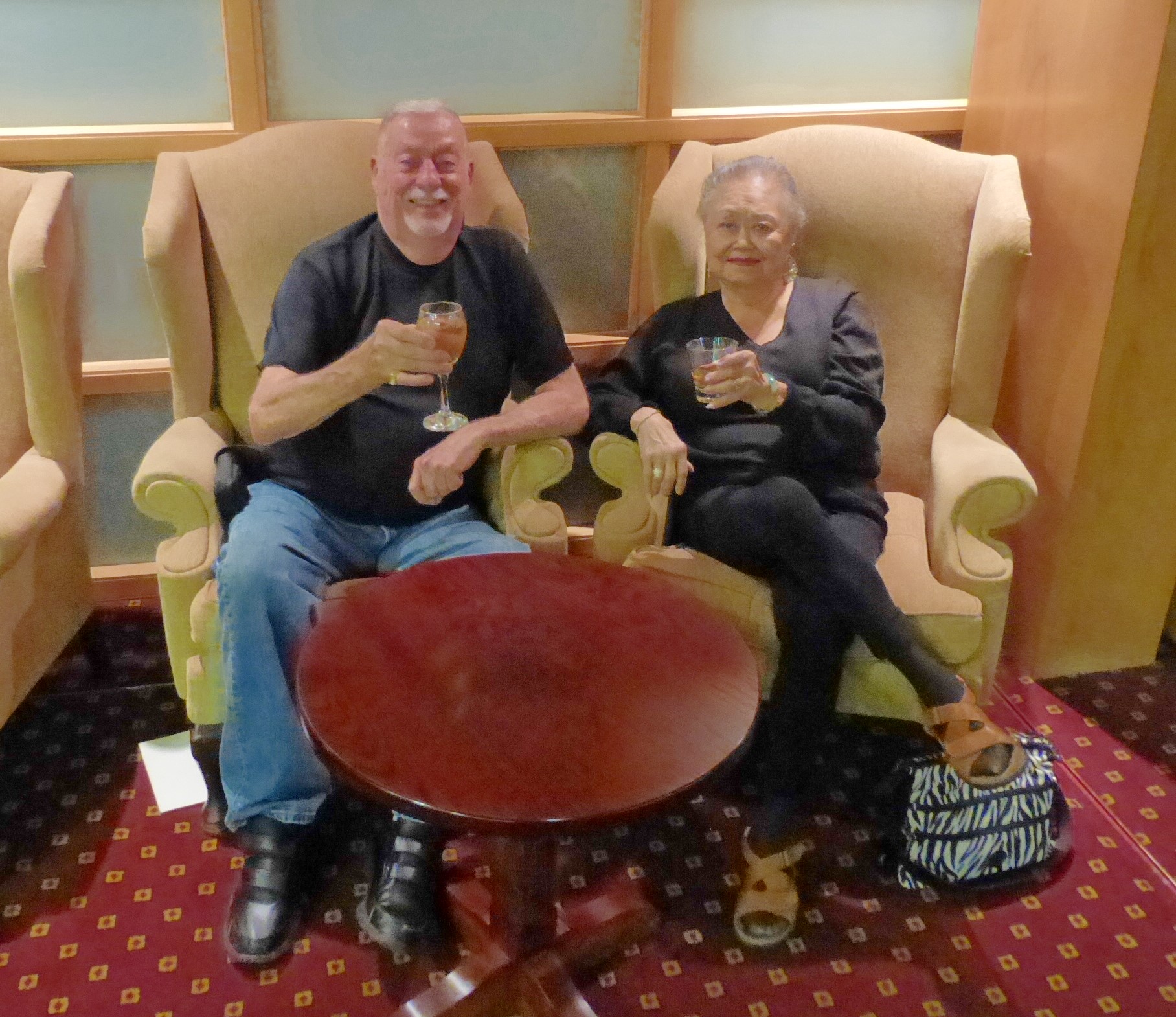
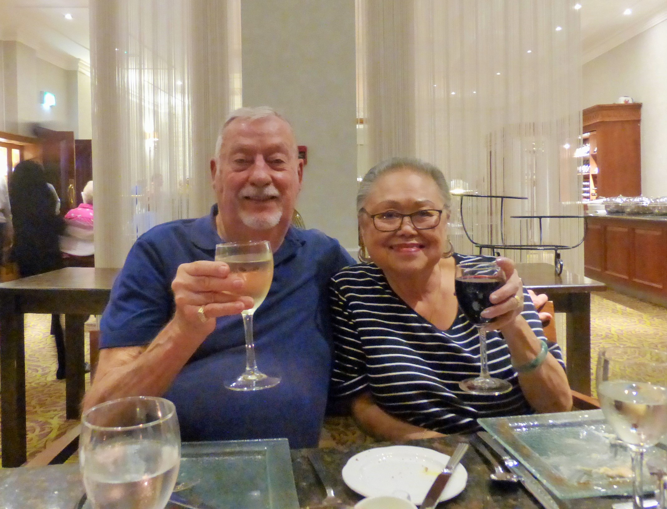
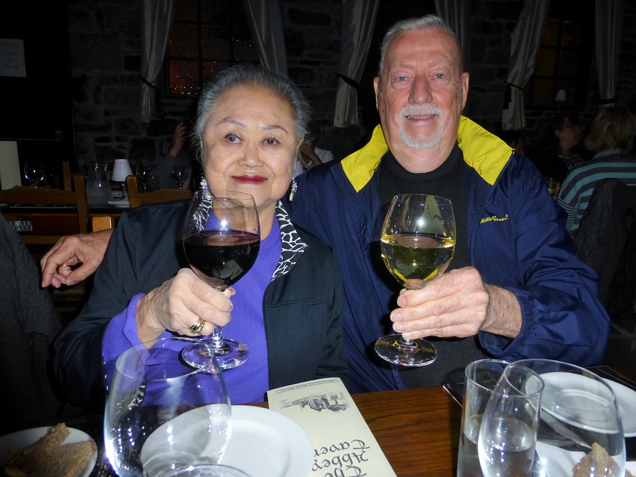
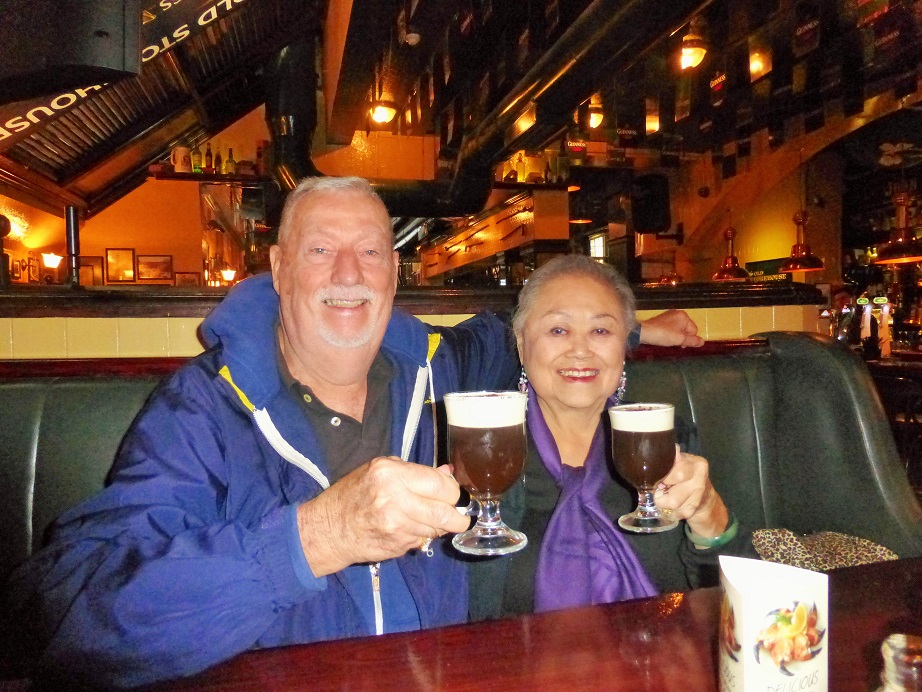
On the left is a photo of us enjoying our first drink in Ireland on October 16th, 2014. And on the right, we are at the travel agency as we pick up our airline tickets and hotel and bus vouchers.
|
|
Select this link to view the Itinerary
|
Select this link to view the History
|
|
Daily Diary of
Our Vacation & Photos: |
|
 Flight on - October 14: Delta Airlines - San Francisco/New York/Dublin
Leave
San Francisco at 11:20 a.m.
on Tuesday and arrive at the Kennedy Airport in New York at 8:00 pm. Leave Kennedy Airport at 9:46 p.m. and arriving at Dublin at 9:30 a.m. on Wednesday the 15th.
|
|
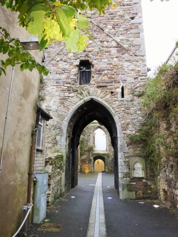
Day 1 - October 15: Dublin Tour & Book of Kells
The tour starts at Dublin Airport and you are transferred to your hotel. At 2:00 pm tour central Dublin to see stately Georgian houses, colorful squares, public buildings and more.
Visit Trinity College�s campus to view the 8th century illuminated manuscript of the Book of Kells.
Sip a welcome drink and discuss your itinerary with your guide and will help you choose a restaurant to dine in independently.
Maldron Hole Cardiff Lane
- Sir John Rogersons Quay - Dublin 2, Dublin Ireland - +353-1-643-9500
|
|
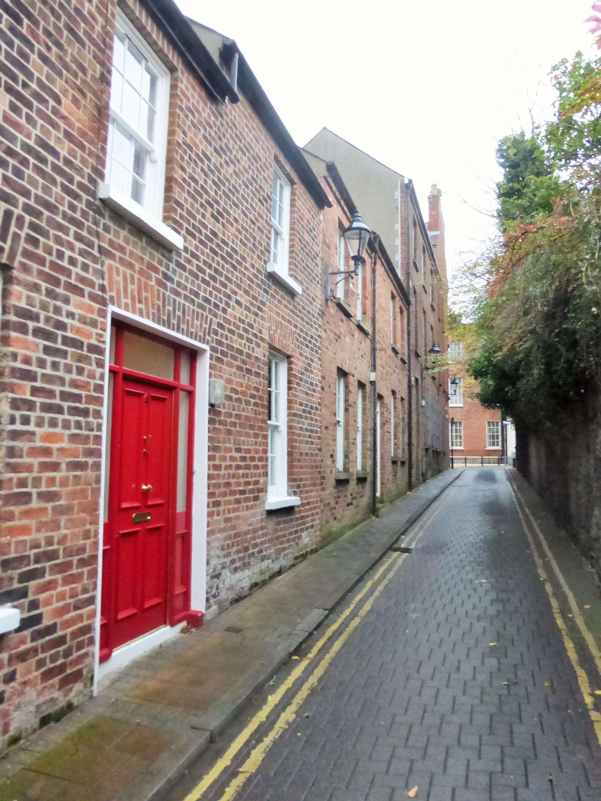
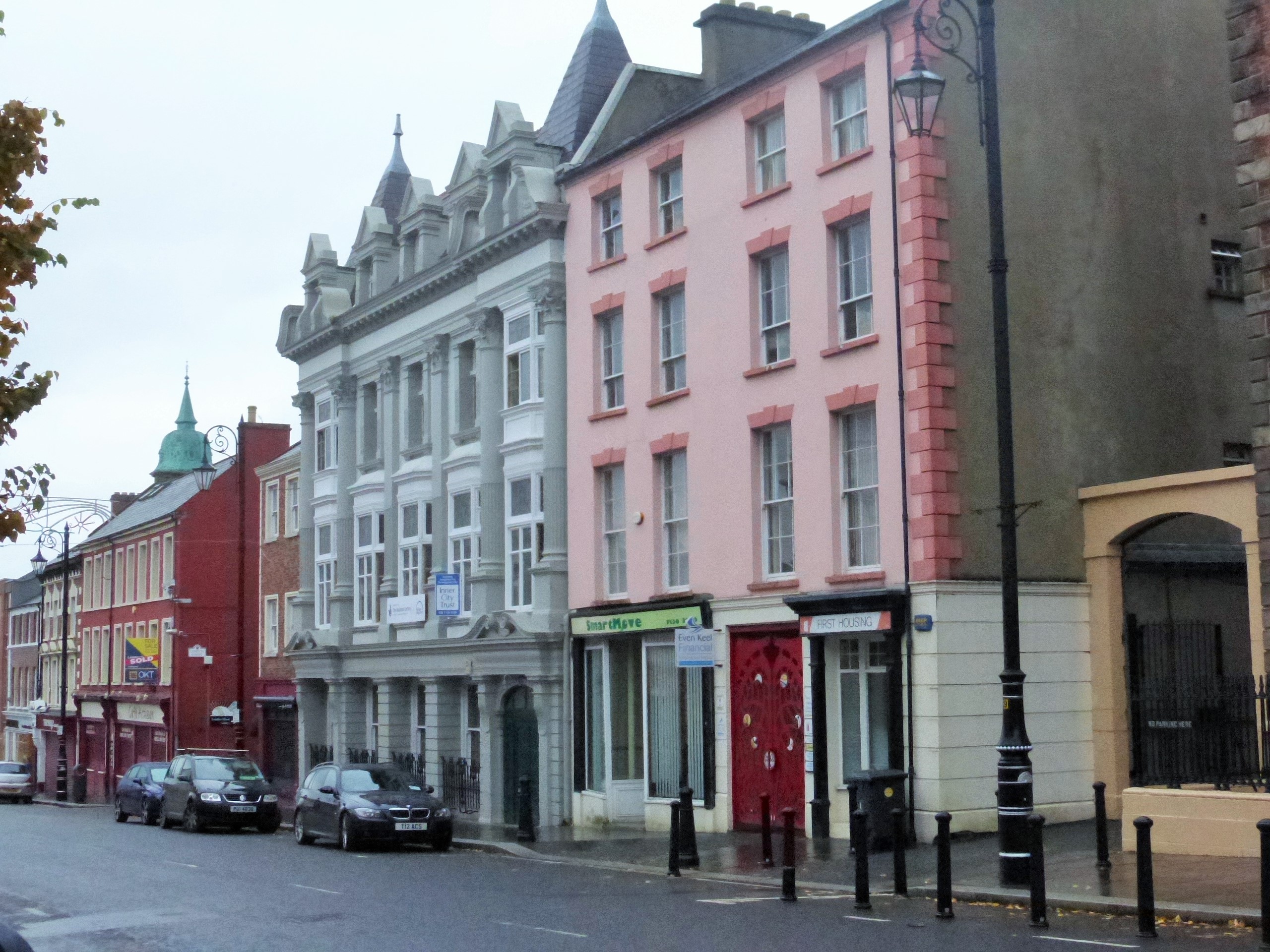
Day 1 - October 15: Dublin Tour
 |
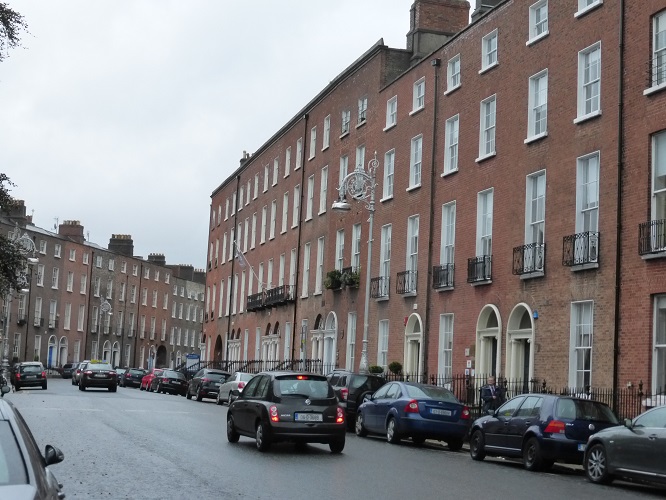 |
Looking Down Town
|
Rows of English Designed Flats |
 |
 |
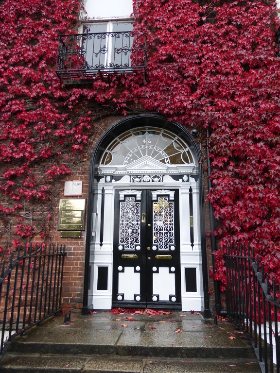
The Most Photographed Door in Ireland
|
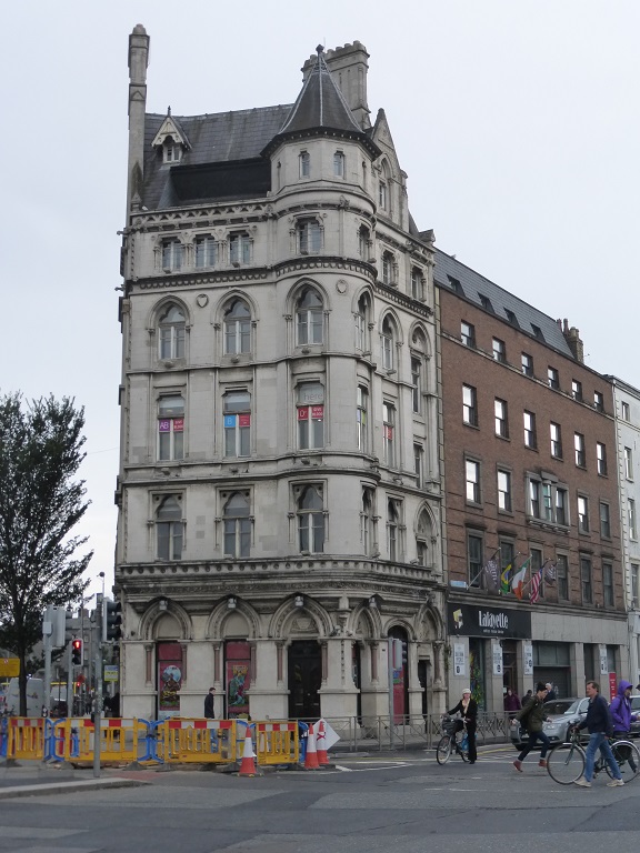
Fantastic Old Buildings |
 |
 |
|
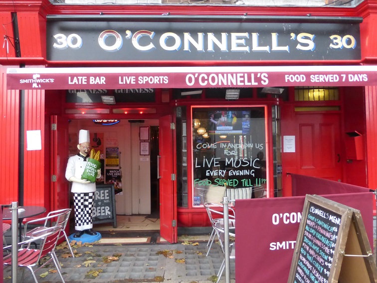
O'Connell's Pub
|
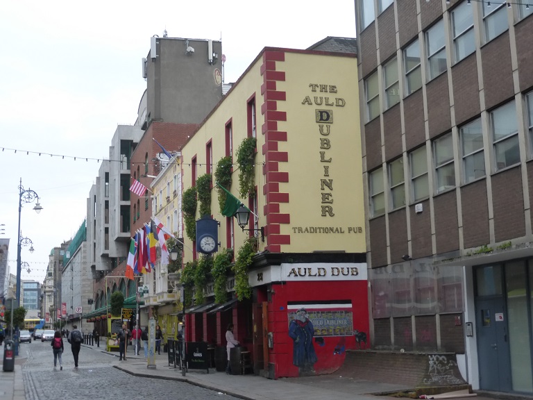
The Auld Dubliner |
 |
 |
|
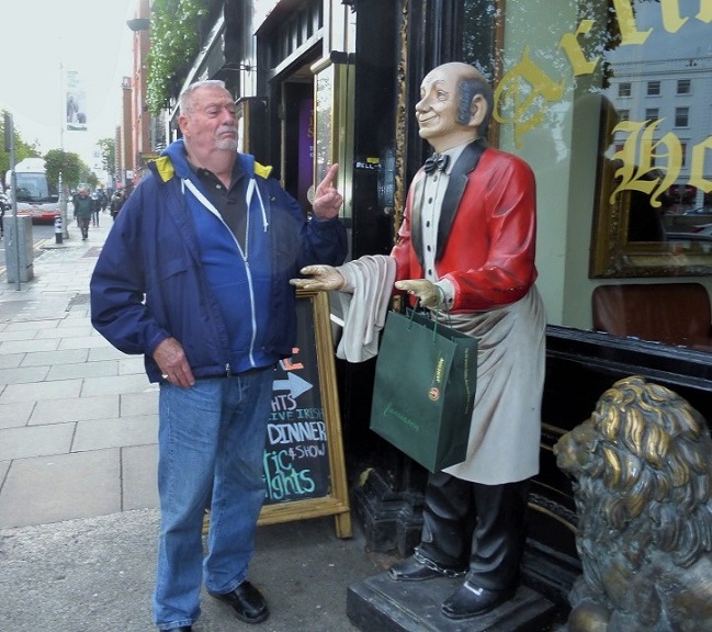
Chuck Disciplining His Butler
|
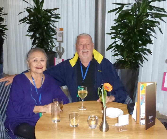
Our First Cocktails in Ireland |
Day 1 - October 15: Book of Kells
 |
 |
|
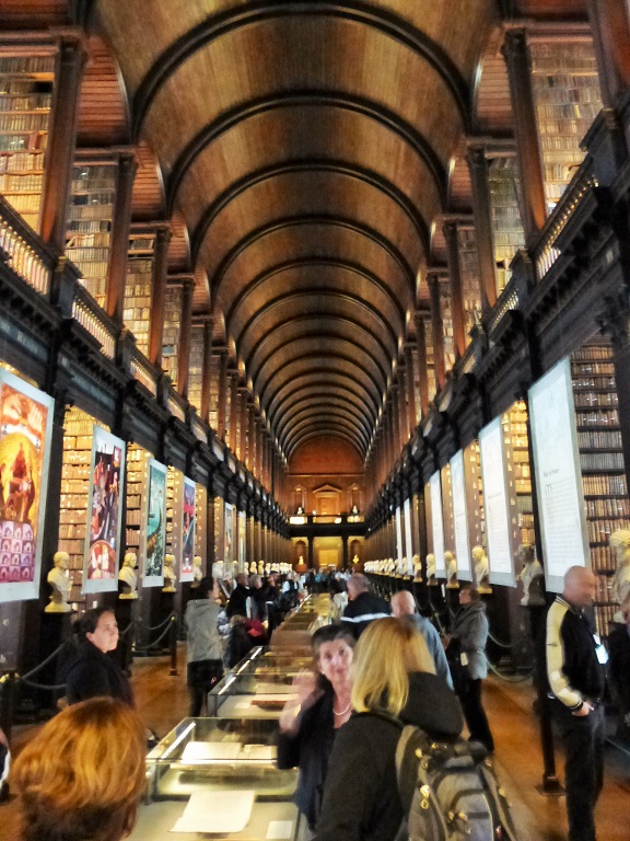
Trinity College Library - Book of Kells
|
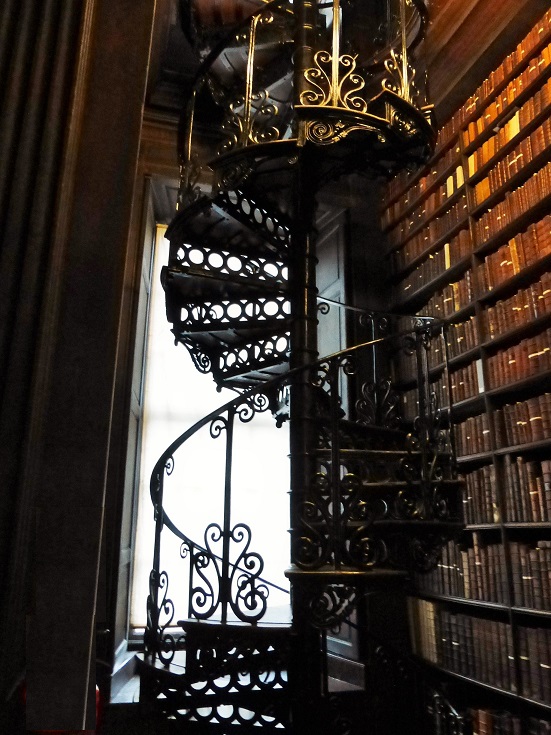
Beautiful Iron Stair Case |
 |
 |
|
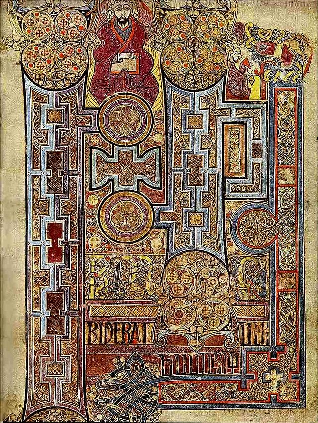
The Book of Kells, (folio 292r), circa 800 C.E., The Gospel of John
|
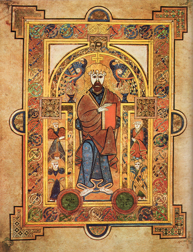
Folio 32v Shows Christ Enthroned. |
Trinity College Library
Trinity College Library Dublin is the library of Trinity College and the University of Dublin. It is the largest library in Ireland and, as a legal deposit or "copyright library", it has rights to receive material published in the Republic of Ireland free of charge; it is also the only Irish library to hold such rights for the United Kingdom. The Library is the permanent home to the famous Book of Kells. Two of the four volumes are on public display, one opened to a major decorated page and the other to a typical page of text. The volumes and pages shown are regularly changed. Members of the University of Dublin also have access to the libraries of Tallaght Hospital and the Irish School of Ecumenics, Milltown.
Book of Kells
The Book of Kells (Irish: Leabhar Cheanannais) (Dublin, Trinity College Library, MS A. I., sometimes known as the Book of Columba) is an illuminated manuscript Gospel book in Latin, containing the four Gospels of the New Testament together with various prefatory texts and tables. It was created in a Columban monastery in either Britain or Ireland, or indeed may have had contributions from various Columban institutions from both Britain and Ireland. It is believed to have been created ca. 800 AD. The text of the Gospels is largely drawn from the Vulgate, although it also includes several passages drawn from the earlier versions of the Bible known as the Vetus Latina. It is a masterwork of Western calligraphy and represents the pinnacle of Insular illumination. It is also widely regarded as Ireland's finest national treasure.
The illustrations and ornamentation of the Book of Kells surpass that of other Insular Gospel books in extravagance and complexity. The decoration combines traditional Christian iconography with the ornate swirling motifs typical of Insular art. Figures of humans, animals and mythical beasts, together with Celtic knots and interlacing patterns in vibrant colours, enliven the manuscript's pages. Many of these minor decorative elements are imbued with Christian symbolism and so further emphasise the themes of the major illustrations.
The manuscript today comprises 340 folios and, since 1953, has been bound in four volumes. The leaves are on high-quality calf vellum, and the unprecedentedly elaborate ornamentation that covers them includes ten full-page illustrations and text pages that are vibrant with decorated initials and interlinear miniatures and mark the furthest extension of the anti-classical and energetic qualities of Insular art. The Insular majuscule script of the text itself appears to be the work of at least three different scribes. The lettering is in iron gall ink, and the colours used were derived from a wide range of substances, many of which were imports from distant lands.
The manuscript takes its name from the Abbey of Kells, which was its home for centuries. Today, it is on permanent display at Trinity College Library, Dublin. The Library usually displays two of the current four volumes at a time, one showing a major illustration and the other showing typical text pages, and the entire manuscript can be viewed on the Library's Digital Collections Repository.
|
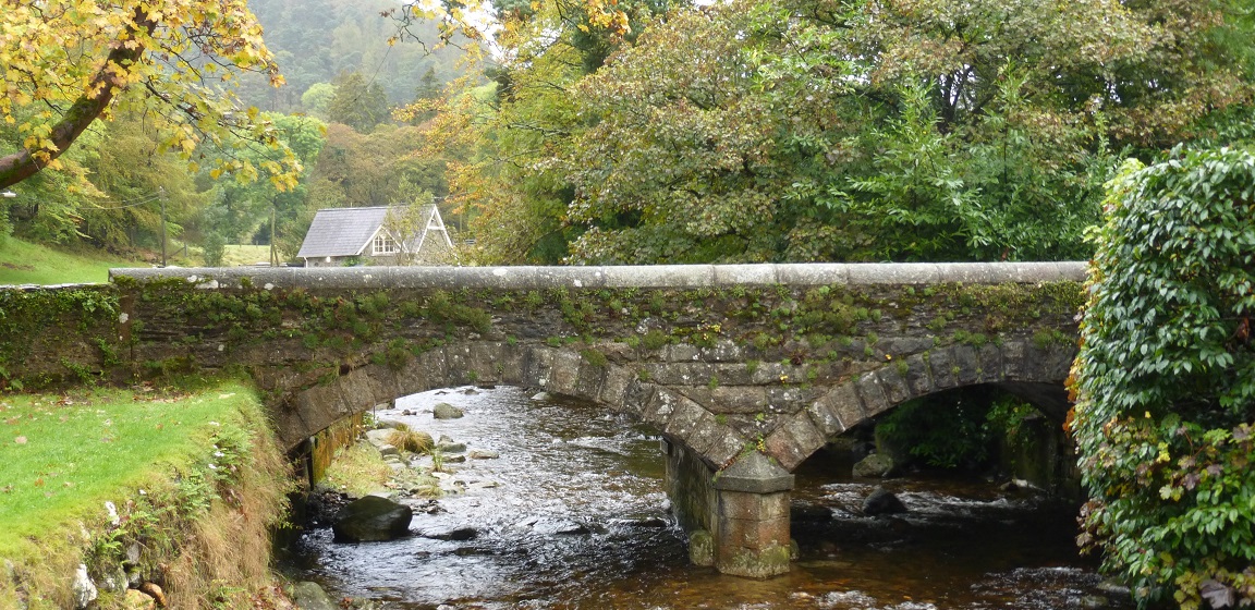
Day 2 - October 16: Glendalough & the Dunbrody Famine Ship
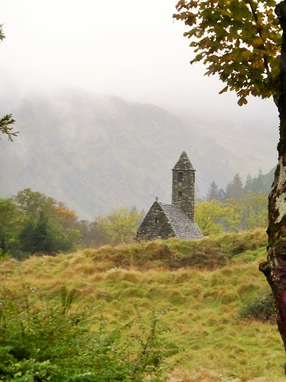
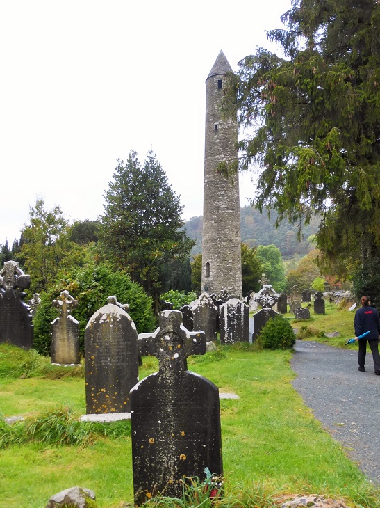
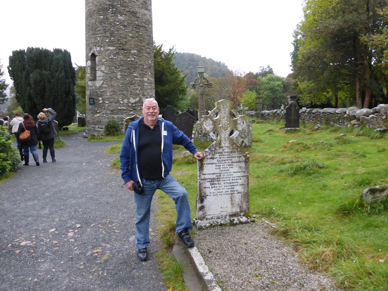
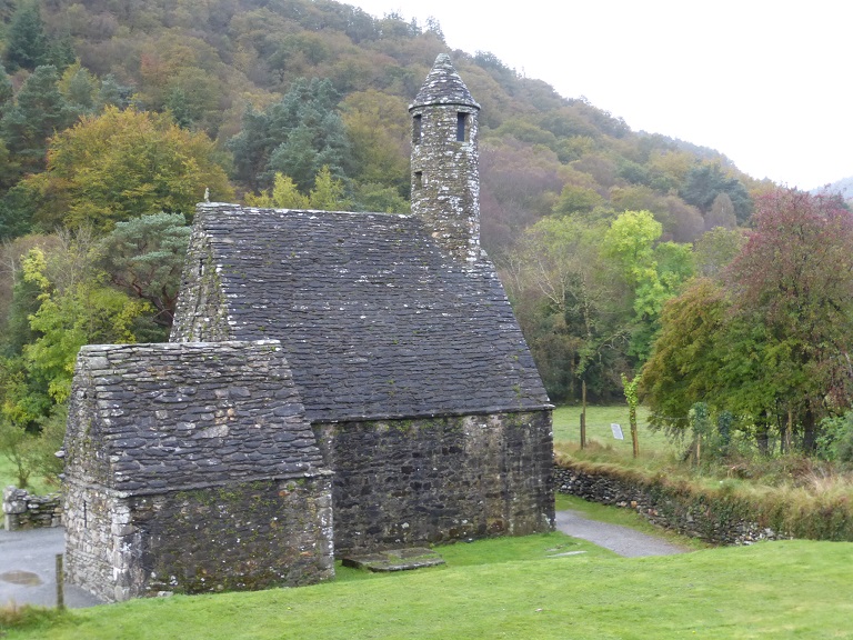
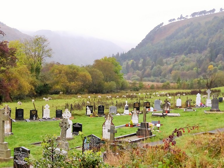
Leave Dublin and visit 6th century Glendalough monastic site with its round tower and church ruins, set in a picturesque valley in the Wicklow Mountains. Learn about St. Kenvin's 6th century monastery in the Glendalough Visitor Center and walk around the site to see its round tower, church ruins and Celtic crosses.
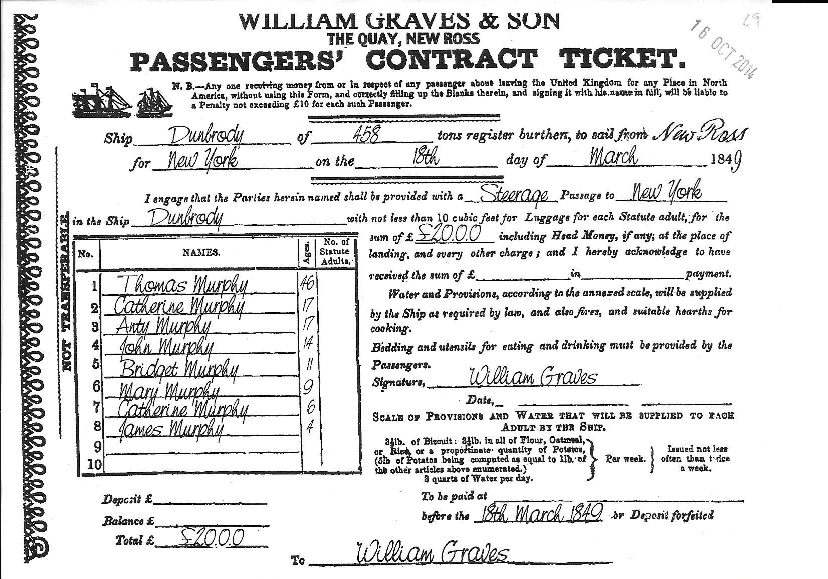
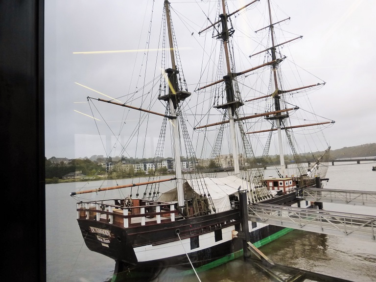
Continue your drive south to New Ross and tour the Dunbrody Famine Ship to learn about emigration.
Drive to your hotel in Waterford and, after dinner take a brief walking tour around the narrow streets of the historice city with a local guide.
(B, D)
Dooley's Hotel
- 30 The Quay - Waterford Co Waterford Ireland - +353-51-873-531
Day 2 - October 16: Second Glendalough Monastic Site
|
 |
|
|
Irelands Green Colors and Bridges
|
 |
 |
|
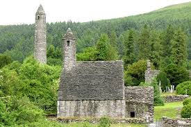
St. Kevin's Church or "Kitchen"
|
100 Foot Bell Tower |
 |
 |
|
Celtic Tomb Stones
|
St. Kevin's Church - Last One Standing with a Stone Roof |
 |
 |
|
Views from the Grounds
|
Area Around Glendalough |
Glendalough or Glendaloch (Irish: Gleann D� Loch, meaning "glen of two lakes") is a glacial valley in County Wicklow, Ireland. It is renowned for its Early Medieval monastic settlement founded in the 6th century by St Kevin, a hermit priest, and partly destroyed in 1398 by English troops.
Kevin, a descendant of one of the ruling families in Leinster, studied as a boy under the care of three holy men, Eoghan, Lochan, and Eanna. During this time, he went to Glendalough. He was to return later, with a small group of monks to found a monastery where the 'two rivers form a confluence'. Kevin's writings discuss his fighting "knights" at Glendalough; scholars today believe this refers to his process of self-examination and his personal temptations. His fame as a holy man spread and he attracted numerous followers. He died in about 618. For six centuries afterwards, Glendalough flourished and the Irish Annals contain references to the deaths of abbots and raids on the settlement.
Around 1042, oak timber from Glendalough was used to build the longest (30 m) Viking longship ever recorded. A modern replica of that ship was built in 2004 and is currently located in Roskilde, Denmark.
At the Synod of Rath Breasail in 1111, Glendalough was designated as one of the two dioceses of North Leinster.
The Book of Glendalough was written there about 1131.
St. Laurence O'Toole, born in 1128, became Abbot of Glendalough and was well known for his sanctity and hospitality. Even after his appointment as Archbishop of Dublin in 1162, he returned occasionally to Glendalough, to the solitude of St. Kevin's Bed. He died in Eu, in Normandy in 1180.
In 1214, the dioceses of Glendalough and Dublin were united. From that time onwards, the cultural and ecclesiastical status of Glendalough diminished. The destruction of the settlement by English forces in 1398 left it a ruin but it continued as a church of local importance and a place of pilgrimage.
Glendalough features on the 1598 map "A Modern Depiction of Ireland, One of the British Isles" by Abraham Ortelius as "Glandalag".
Descriptions of Glendalough from the 18th and 19th centuries include references to occasions of "riotous assembly" on the feast of St. Kevin on 3 June.
The present remains in Glendalough tell only a small part of its story. The monastery in its heyday included workshops, areas for manuscript writing and copying, guest houses, an infirmary, farm buildings and dwellings for both the monks and a large lay population. The buildings which survive probably date from between the 10th and 12th centuries.
St. Kevin's Church or "Kitchen"
This stone-roofed building originally had a nave only, with entrance at the west end and a small round-headed window in the east gable. The upper part of the window can be seen above what became the chancel arch, when the chancel (now missing) and the sacristy were added later. The steep roof, formed of overlapping stones, is supported internally by a semi-circular vault. Access to the croft or roof chamber was through a rectangular opening towards the western end of the vault. The church also had a timber first floor. The belfry with its conical cap and four small windows rises from the west end of the stone roof in the form of a miniature round tower.
Day 2 - October 16: Second Stop at the Dunbury Coffin Ship
|
|
Actual Passenger's Contract
|
 |
 |
|
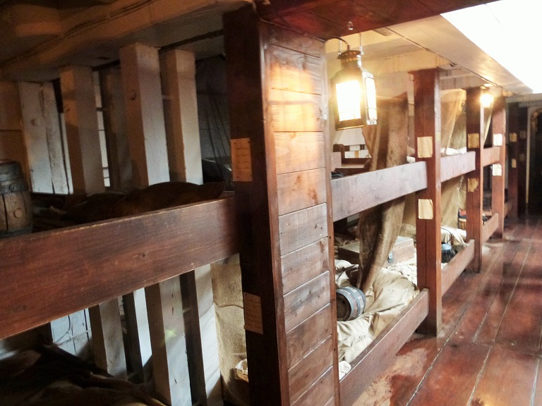
Transport Ship - Converted to Carry Irish Famine Victims
|
Betweem Each Pillar the Space for Families of Up to Ten! |
 |
 |
|
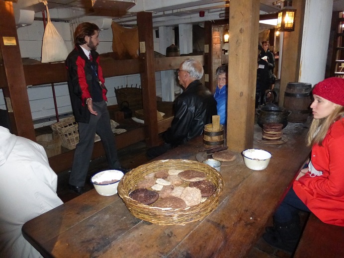
Guided Tour - Little to Eat or Drink
|
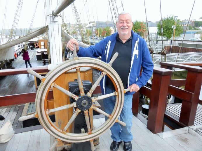
Chuck at the Helm! |
Coffin Ship
The term coffin ships is used to refer to the ships that carried Irish immigrants escaping the Great Irish Famine as well as Highlanders displaced by the Highland Clearances. These ships, crowded and disease-ridden, with poor access to food and water, resulted in the deaths of many people as they crossed the Atlantic, and led to the Typhus epidemic of 1847 at quarantine stations in Canada. Owners of coffin ships provided as little food, water, and living space as was legally possible � if they obeyed the law at all.
While coffin ships were the cheapest way to cross the Atlantic, mortality rates of 30% aboard the coffin ships were common. It was said that sharks could be seen following the ships, because so many bodies were thrown overboard.
Legislation to protect emigrant passengers, the Passenger Vessels Act, was first enacted in Britain in 1803 and continued to evolve in the following decades. A revised Act in 1828, for example, marked the first time that the British government took an active interest in emigration matters. Within a few years, regulations were in force to determine the maximum number of passengers that a ship could carry, and to ensure that sufficient food and water be provided for the voyage.
But the legislation was not always enforceable, and unscrupulous shipowners and shipmasters found ways to circumvent the law. In addition, ships sailing from non-British ports were not subject to the legislation. As a consequence, thousands of emigrants experienced a miserable and often dangerous journey. By 1867, regulations were more effective, thus providing people with the promise of a safe, if not comfortable, voyage.
|
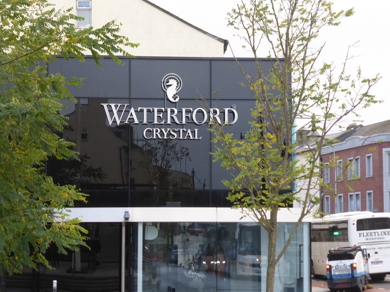
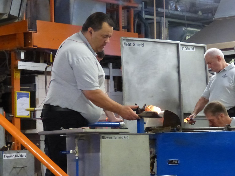
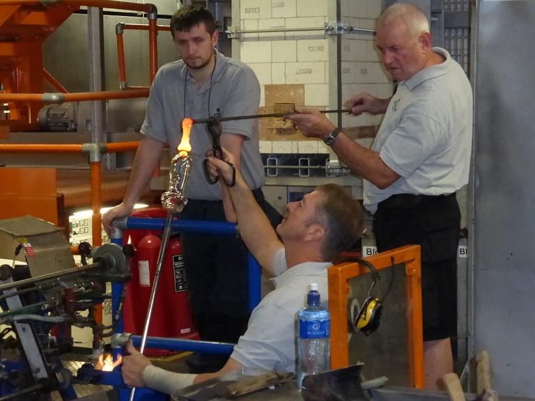
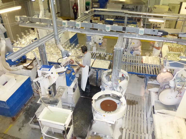
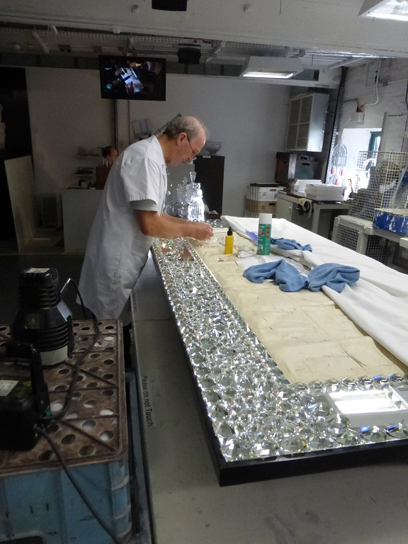
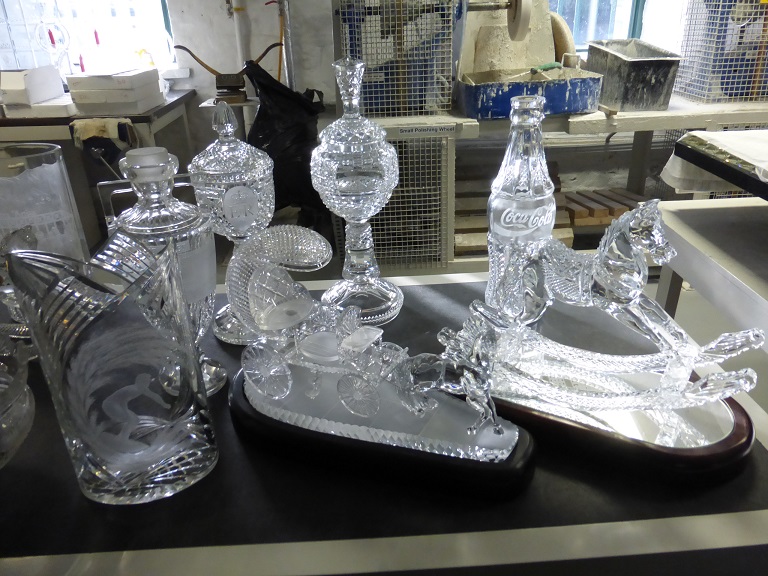
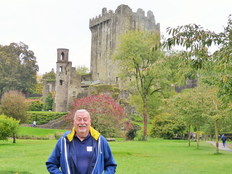
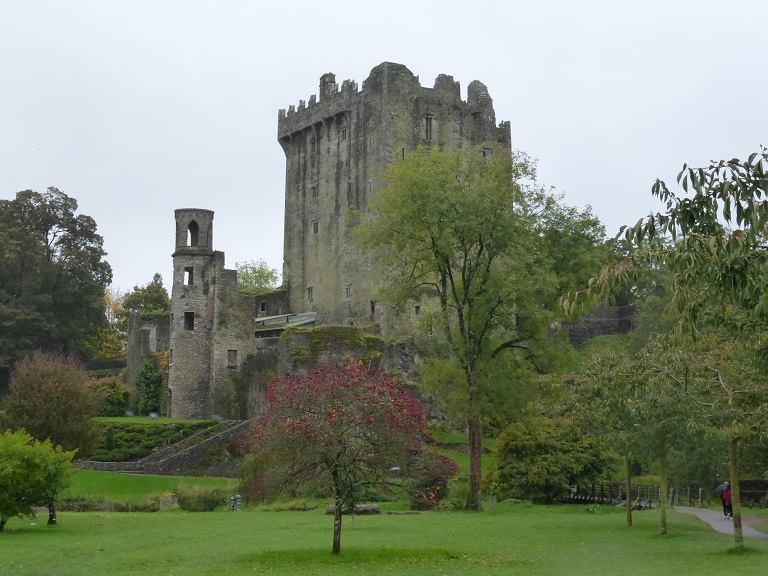
Day 3 - October 17: Waterford Crystal & Blarney Castle
Watch glass blowing and cutting at the House of Waterford Crystal and see one of a kind masterpieces.
Drive along the south coast via Dungarvan to Cobh, the last port of call for the Titanic and then go for a walking tour.
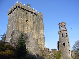
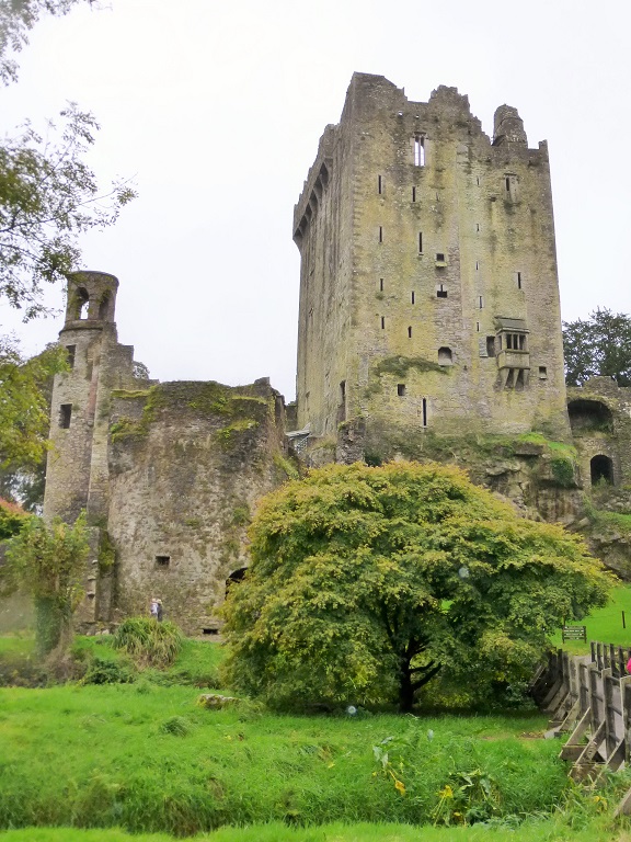
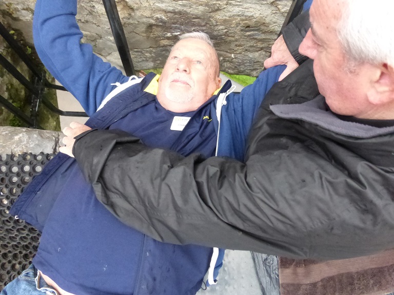
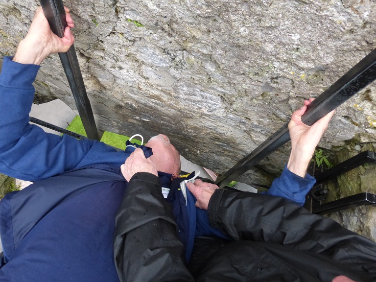
Drive to Blarney and climb the steps of Blarney Castle to kiss the �Stone of Eloquence� and shop at the Blarney Woollen Mills.
,P.
Then drive through the rugged scenery to Killarney and relax before dinner.
(B, D)
Castlerosse Hotel
- Lower Lake - Killarney Co Kerry Ireland - +353-64-6631144
Day 3 - October17: Dunbury Coffin Ship
|
 |
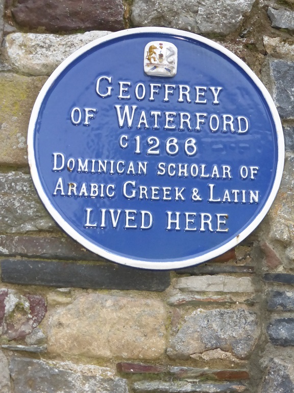
Day 3 - October17: Geoffrey of Waterford ~ 1266
 |
 |
|
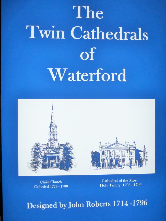
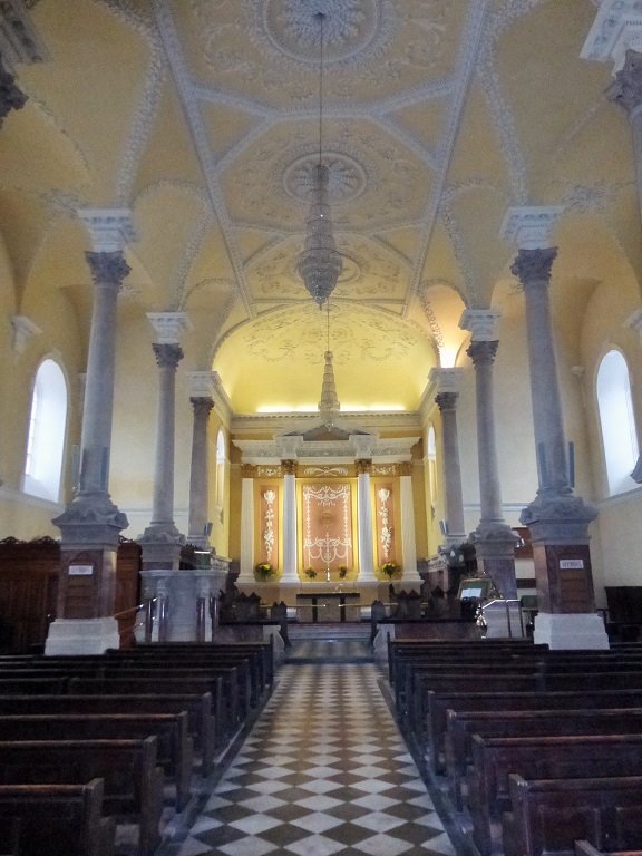
Christ Church - 1774 to 1780
|
Designed by John Roberts |
 |
 |
Geoffrey of Waterford Plaque - 1266 C.E.
|
Stone Buildings |
 |
 |
|
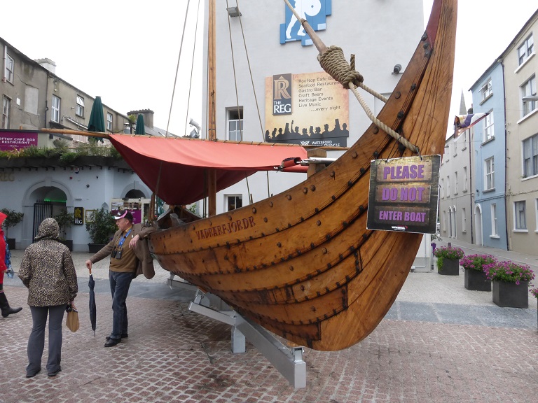
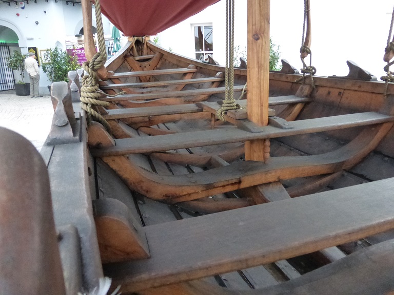
Vikings Played an Important Role in Ireland
|
Boats Were Small and Easily Manuervered on Rivers |
 |
 |
|
Red and White Wine
|
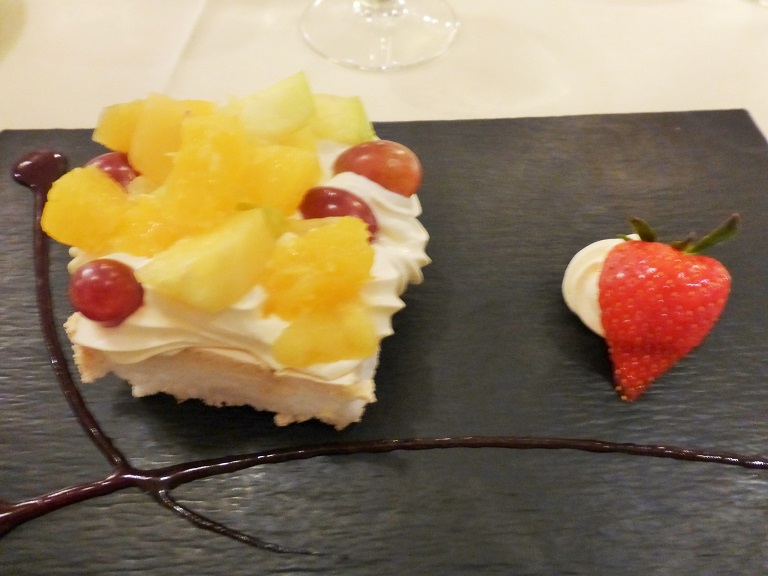
Great Deserts |
Waterford
Waterford (from Old Norse Ve�rafjor�r, meaning "ram fjord"; Irish: Port L�irge, meaning "L�rag's port") is a city in Ireland. It is located in the South-East Region and is also part of the province of Munster.
With a population of 46,732, Waterford is the oldest and fifth most populous city in the State and the 32nd most populous area of local government.
Following the Local Government Reform Act 2014, Waterford City and County Council is the local government authority for the city. The authority came into operation on 1 June 2014. Prior to this the city had its own local council, Waterford City Council. The new Council is the result of a merger of Waterford City Council and Waterford County Council. The Council has 32 representatives (councillors) who are elected from five electoral areas. The city itself forms three of the electoral areas � which when combined form the Metropolitan District of Waterford � and returns a total of 18 councillors to Waterford City and County Council. Residents in these areas are restricted to voting for candidates located in their ward for local elections. The office of the Mayor of Waterford was established in 1377. A mayor is then elected by the councillors from the two electoral areas of the Metropolitan District of Waterford every year, and there is no limit to the number of terms an individual may serve. Mary O'Halloran who was mayor during 2007�2008 was the first woman to hold the post. The current mayor is John Cummins.
Viking raiders first established a settlement near Waterford in 853. It and all the other longphorts were vacated in 902, the Vikings having been driven out by the native Irish. The Vikings re-established themselves in Ireland at Waterford in 914, led at first by Ottir Iarla (Jarl Ottar) until 917, and after that by Ragnall ua �mair and the U� �mair dynasty, and built what would be Ireland's first city. Among the most prominent rulers of Waterford was Ivar of Waterford.
In 1167, Diarmait Mac Murchada, the deposed King of Leinster, failed in an attempt to take Waterford. He returned in 1170 with Cambro-Norman mercenaries under Richard de Clare, 2nd Earl of Pembroke (known as Strongbow); together they besieged and took the city after a desperate defence. In furtherance of the Norman invasion of Ireland, King Henry II of England landed at Waterford in 1171. Waterford and then Dublin were declared royal cities, with Dublin also declared capital of Ireland.
Day 3 - October17: Waterford Crystal Manufacturing
 |
 |
|
Waterford Crystal Display Room
|
Molten Glass to be Molded |
 |
 |
|
Putting a base on the Vase
|
Polishing on a Diamond Wheel |
 |
 |
|
Special Request - A Special Glue is Used to Attach to Base
|
Special One of a Kind Requests |
Waterford Crystal
Waterford Crystal is a manufacturer of crystal. It is named after the city of Waterford, Ireland. Waterford Crystal is owned by WWRD Holdings Ltd, a luxury goods group which also owns and operates the Wedgwood and Royal Doulton brands.
In January 2009 its Waterford base was closed down due to the bankruptcy of the Wedgwood Group. After several difficulties and takeovers, it re-emerged later that year. In June 2010, Waterford Crystal relocated almost back to its original roots, on The Mall in Waterford City. This new location is now home to a manufacturing facility that melts over 750 tonnes of crystal a year. This new facility offers visitors the opportunity to take guided tours of the factory and also offers a retail store, showcasing the world's largest collection of Waterford Crystal.
The origins of the crystal production in Waterford dates back to 1783 when George and William Penrose started their business. It produced extremely fine flint glass that became world-renowned. However, their company closed in 1851.
In 1947, Czech immigrant Charles Bacik, grandfather of Irish senator Ivana Bacik, established a glass works in the city, due to the superb reputation of the original glassware.[citation needed] Skilled crystal workers were not available in Ireland so continental Europeans were used. Aided by fellow countryman and designer Miroslav Havel,[3] the company started operations in a depressed Ireland. By the early 1950s it had been taken over as a subsidiary of the Irish Glass Bottle company, owned by Joseph McGrath, Richard Duggan and Spencer Freeman of the Irish Hospitals' Sweepstake, heavy investors in Irish business at that time.
In 1970 John Aynsley and Sons was taken over by Waterford and renamed Aynsley China Ltd.
Jasper Conran began designing his signature range of crystal for Waterford in 1999. The endeavour has evolved into four unique lines for Waterford and a complementary tableware collection in fine bone china for Wedgwood in 2001. In May 2005, Waterford Wedgwood announced the closure of its factory in Dungarvan in order to consolidate all operations into the main factory in Kilbarry, Waterford City, where 1,000 people were employed by the company. The move resulted in nearly 500 Dungarvan workers losing their jobs.
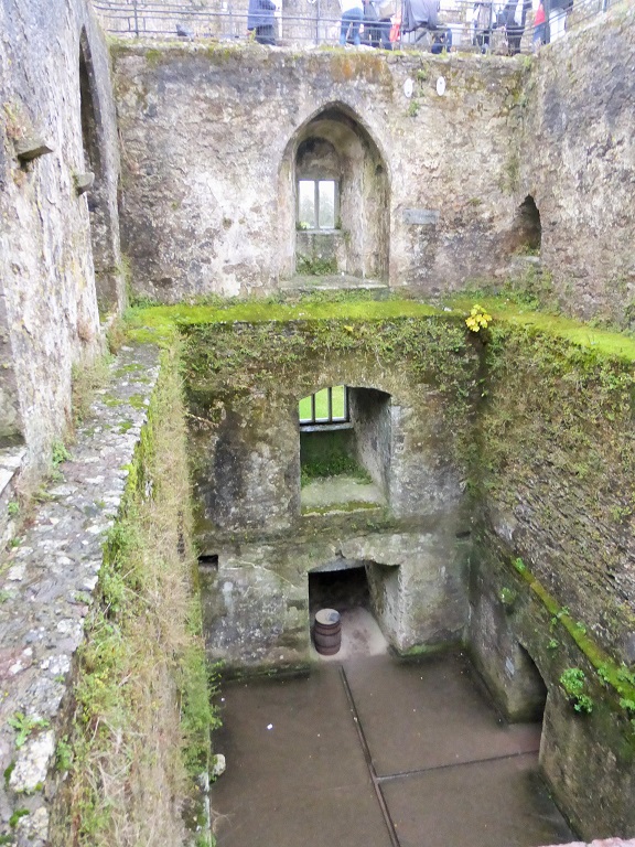
Blarney Castle (Irish: Caisle�n na Blarnan)
 |
 |
|
Approaching Blarney Castle
|
The Main Feasting Room |
 |
 |
|
Beautiful Landscapes
|
Do I Look Nervous? |
 |
 |
|
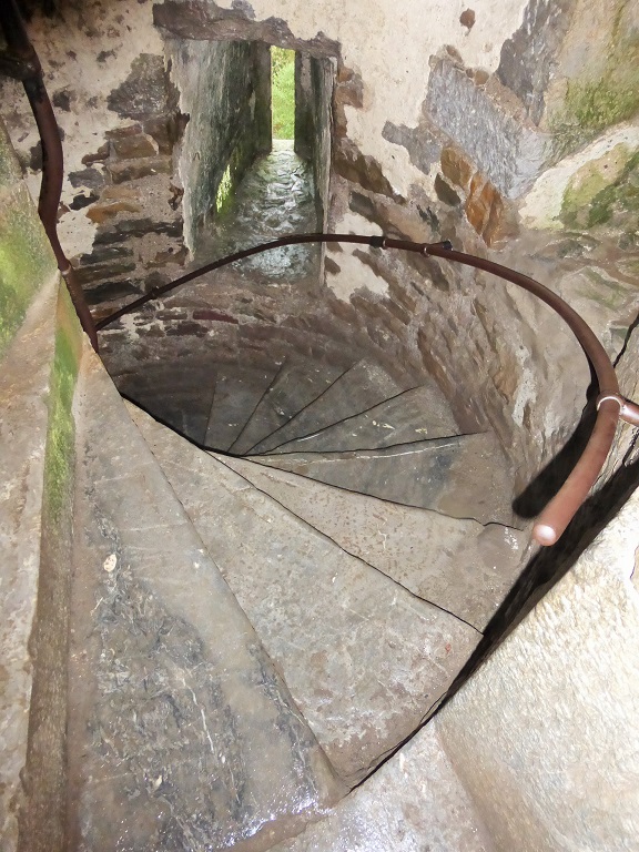
Chuck Kissing the Blarney Stone!
|
Eight Stories of Steep Dangerous Stairs |
 |
 |
|
Blarney Castle from A Far
|
More Wine |
Blarney Castle (Irish: Caisle�n na Blarnan)
Blarney Castle (Irish: Caisle�n na Blarnan) is a medieval stronghold in Blarney, near Cork, Ireland, and the River Martin. Though earlier fortifications were built on the same spot, the current keep was built by the MacCarthy of Muskerry dynasty, a cadet branch of the Kings of Desmond, and dates from 1446. The noted Blarney Stone is found among the machicolations of the castle.
The castle originally dates from before 1200, when a wooden structure was believed to have been built on the site, although no evidence remains of this. Around 1210 this was replaced by a stone fortification. It was destroyed in 1446, but subsequently rebuilt by Cormac Laidir MacCarthy, Lord of Muscry, who also built castles at Kilcrea and Carrignamuck.
The castle was besieged during the Irish Confederate Wars and was seized in 1646 by Parliamentarian forces under Lord Broghill. However after the Restoration the castle was restored to Donough MacCarty, who was made 1st Earl of Clancarty.
During the Williamite War in Ireland in the 1690s, the then 4th Earl of Clancarty (also named Donough MacCarty) was captured and his lands (including Blarney Castle) were confiscated by the Williamites.
The castle was sold and changed hands a number of times-Sir Richard Pyne, the Lord Chief Justice of Ireland, owned it briefly- before being purchased in the early 1700s by Sir James St. John Jefferyes, then Governor of Cork City.
Members of the Jefferyes family would later build a mansion near the keep. This house was destroyed by fire however, and in 1874 a replacement baronial mansion�known as Blarney House�was built overlooking the nearby lake.
In the mid 19th century the Jefferyes and Colthurst families were joined by marriage, and the Colthurst family still occupy the demesne. In May 2008, the present estate owner, Sir Charles St John Colthurst, Baronet, succeeded in a court action to eject a man who has lived on his land for 44 years. The man's great-grandfather was the first to occupy the estate cottage.
The castle is now a partial ruin with some accessible rooms and battlements. At the top of the castle lies the Stone of Eloquence, better known as the Blarney Stone. Tourists visiting Blarney Castle may hang upside-down over a sheer drop to kiss the stone, which is said to give the gift of eloquence. There are many legends as to the origin of the stone, but some say that it was the Lia F�il�a magical stone upon which Irish kings were crowned.
Surrounding the castle are extensive gardens. There are paths touring the grounds with signs pointing out the various attractions such as several natural rock formations which have been given fanciful names, such as Druid's Circle, Witch's Cave and the Wishing Steps. Blarney House, also open to the public, is a Scottish baronial-style mansion that was built on the grounds in 1874.
|
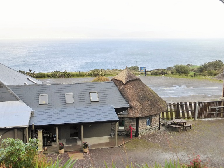
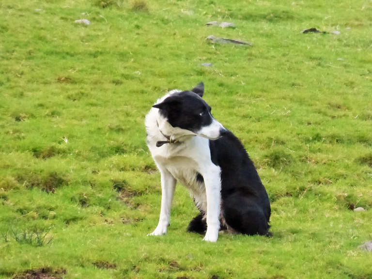
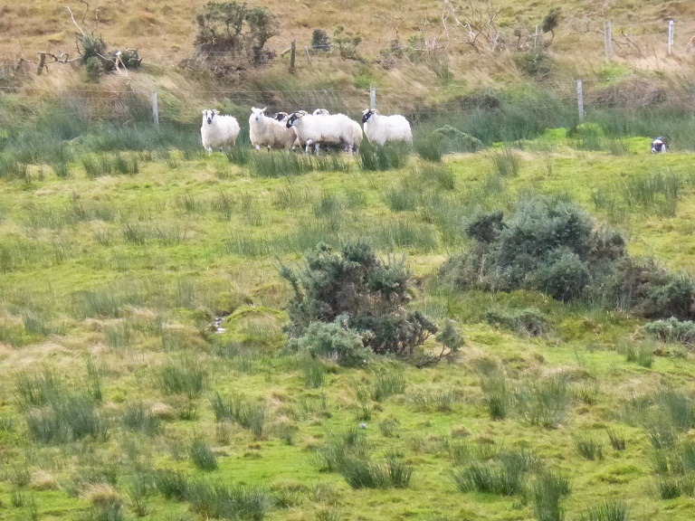
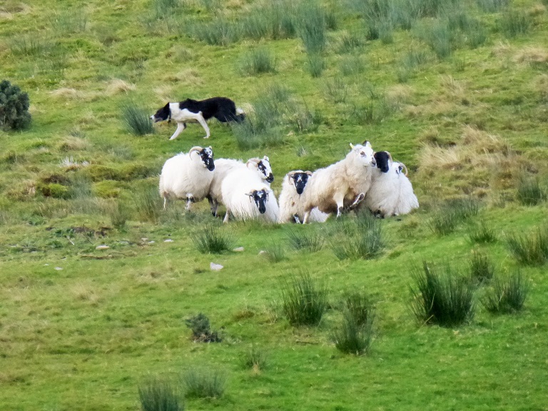
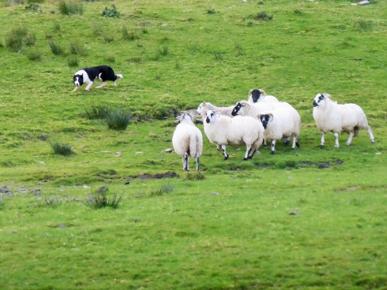
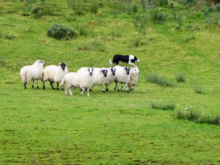
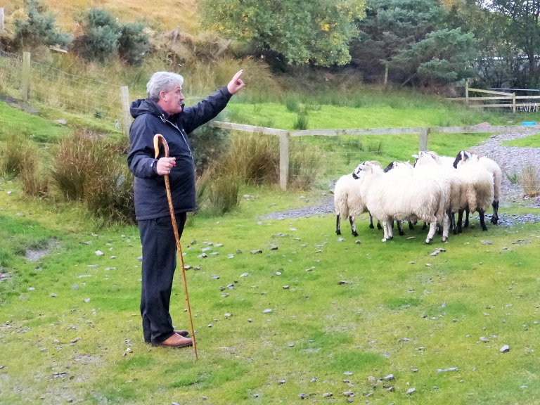
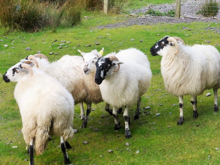
Day 4 - October 18: Border Collies - Sheep Herding
Day 4 - October 18: Ring of Kerry & Skellig Experience
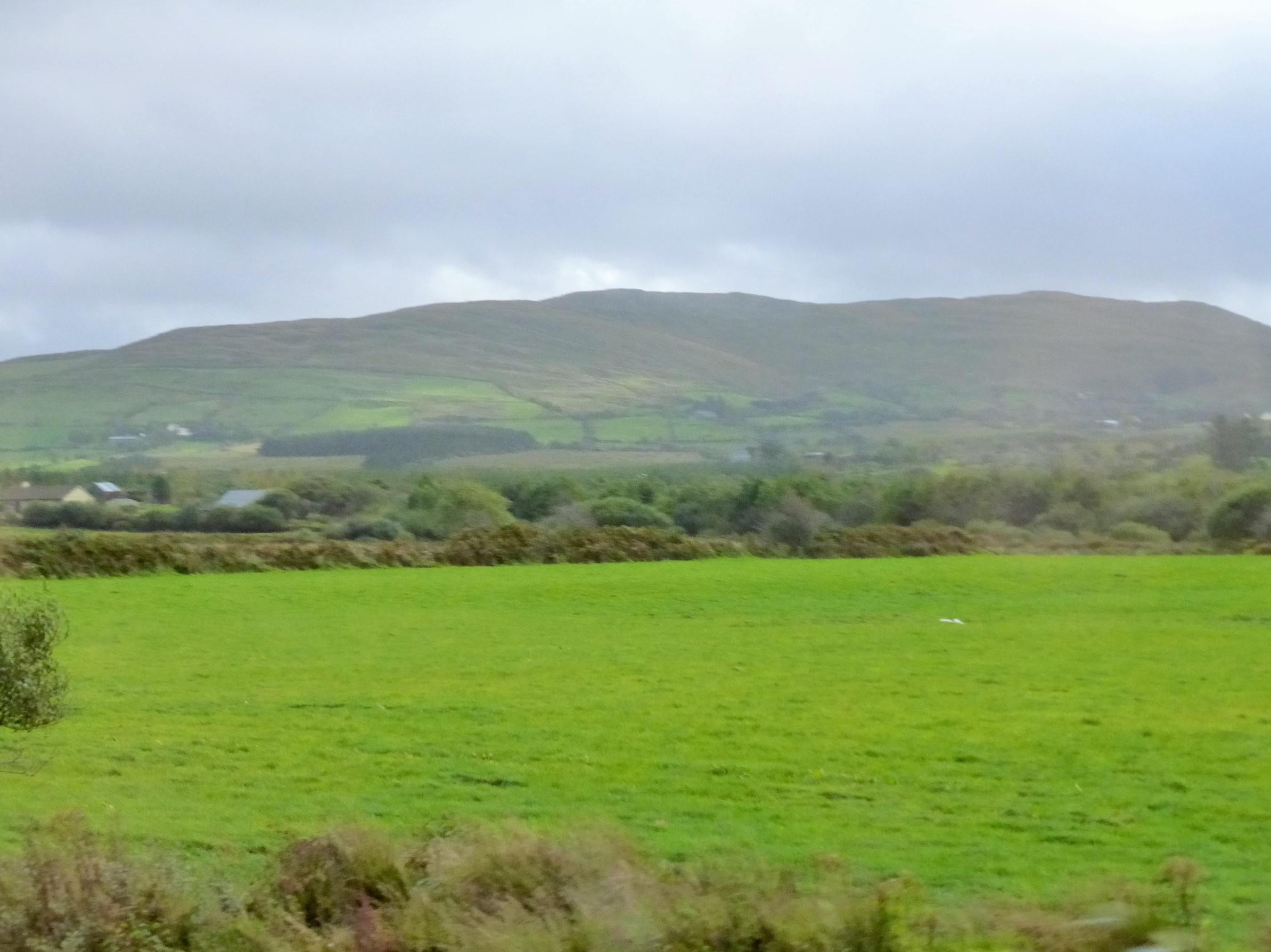
Experience the popular Ring of Kerry tour where the road winds between mountains and coast offering scenic views at every turn. The road winds between the Macgillycuddy's Reeks Mountains on one side and the Atlantic coastline on the other.
Stop to admire breathtaking beauty and take photos. Watch trained dogs herd flocks of sheep and visit the Skellig Experience.
Drive through Killorglin and Cahirciveen and stop for a casual lunch. Cross by bridte to Valencia Island and visit the Skellig Experience to learn about the rocky islands off the end of the peninisula where monks lived in early Christian times. Stop in the pretty village of Sneem and also at Moll's Gap to panoramic mountain views.
After a pub lunch, drive around the rest of the Ring of Kerry to reach Killarney.
(B, L)
Castlerosse Hotel
- Lower Lake - Killarney Co Kerry Ireland - +353-64-6631144
Day 4 - October 18: Border Collies - Sheep Herding
|
 |
 |
 |
|
Thatched Roof on Sheep Herder's Home
|
Collie Ready to Herd Sheep |
 |
 |
|
Sheep at the Crest of the Hill
|
Beginning to Herd the Sheep |
 |
 |
|
Coming Down Toward Us
|
Closer and Closer |
 |
 |
|
Sheep Herder - Fantastic Exhibition
|
Sheep Relaxing Until the Next Show Time! |
Day 4 - October 18: Ring of Kerry & Skellig Experience
 |
 |
|
Green Country Side
|
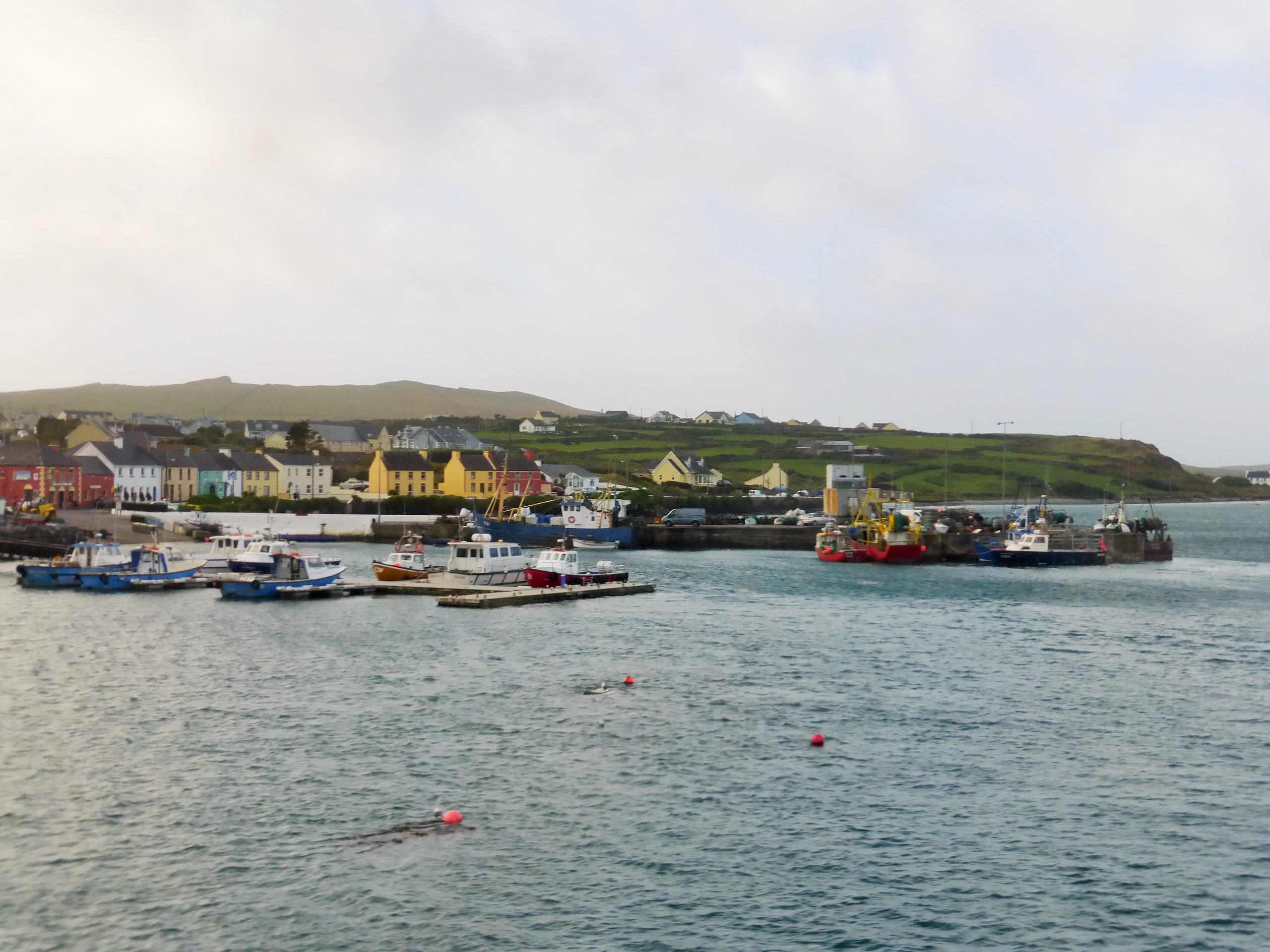
Town of Skellig |
 |
 |
|
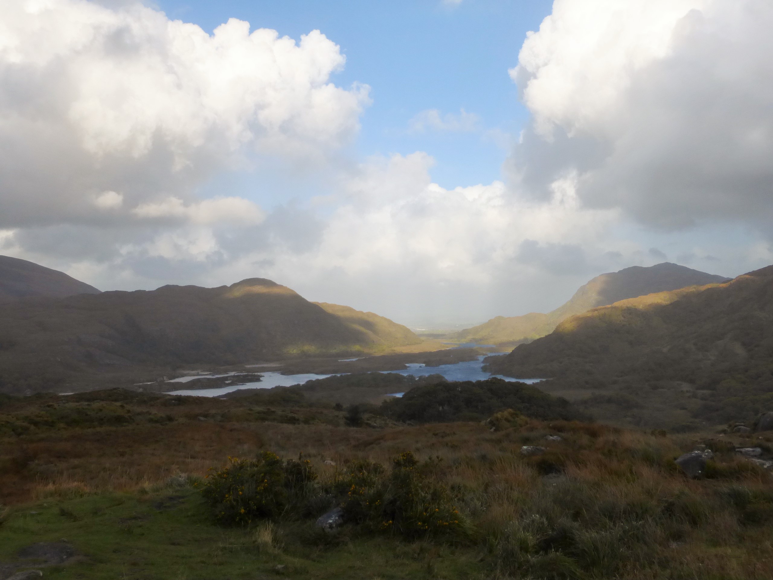
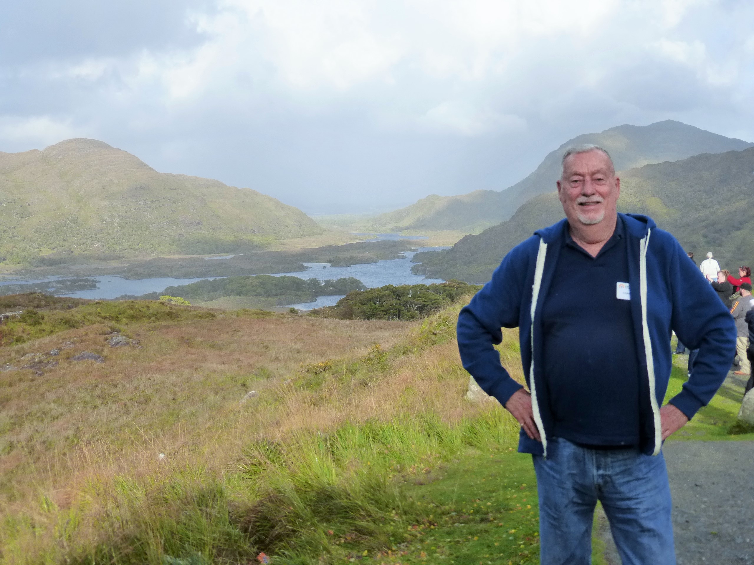
Killarney National Park
|
Chuck and the Lakes |
 |
 |
|
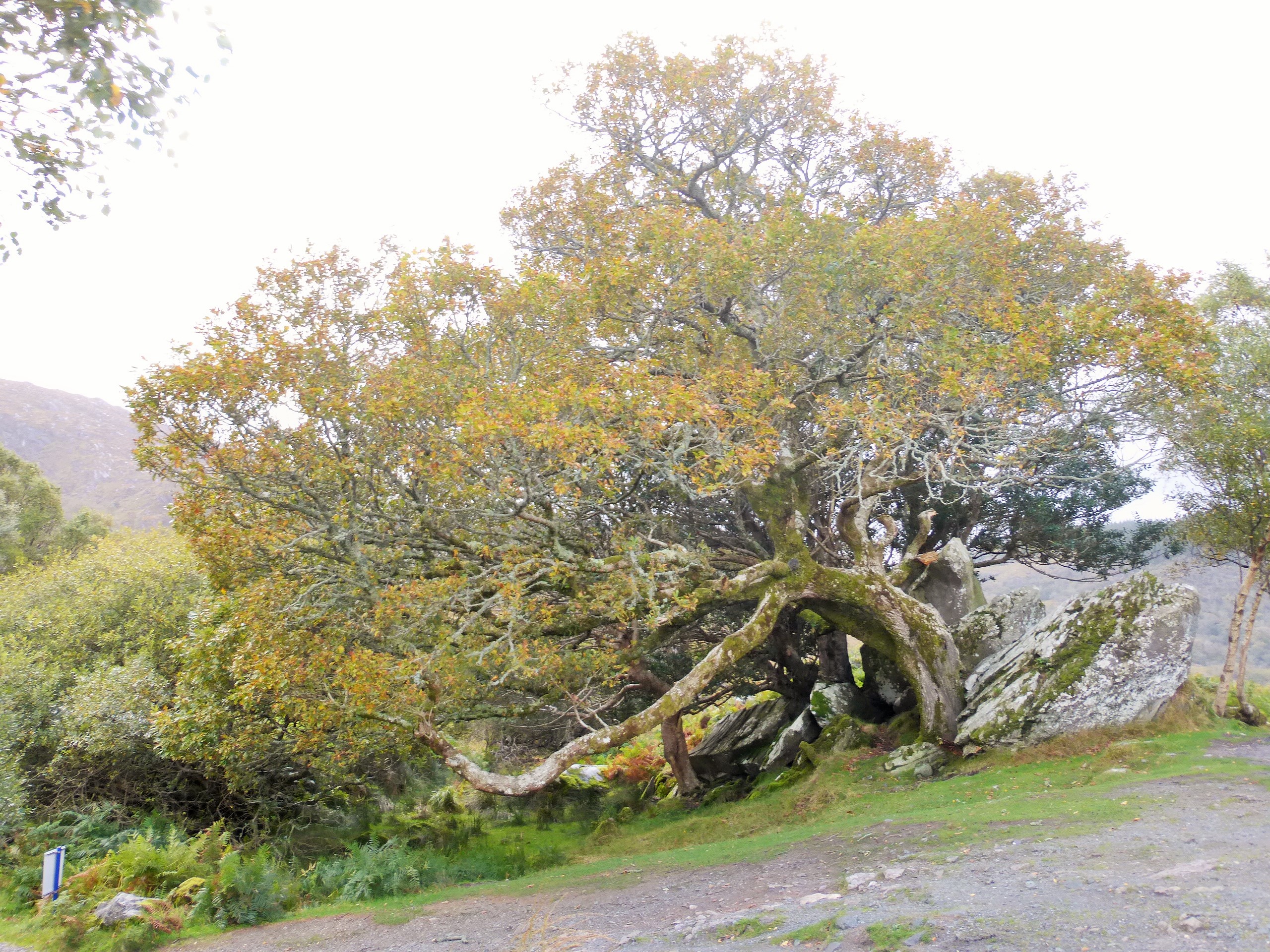
Interesting Trees
|
Cocktails After a Long Bus Ride |
Most of the spots that you will want to see are along the Kenmare Road (N71). Sights to see include the lakes (Lower Lake (Lough Leanne), Middle Lake and Upper Lake), the Torc Waterfall (about a sixty-foot drop) and Ladies view and a panoramic landscape across the lakes of the Park towards the Gap of Dunloe. The rumor is that the "ladies" involved in naming the view were Queen Victoria and the her ladies-in-waiting. Regardless, the view from the overlook is stunning.
This visitor attraction was developed by Cork Kerry Tourism in 1991-1992 to make the four treasures of the off shore Skellig Islands more easily understood by all. The exhibition building is a purpose built visitor centre opened in 1992, designed to be rugged in feeling and finishes, to reflect the experience which will be undertaken by visitors. The use of concrete vaults with grass topping is designed to echo the wild quality of the south west of Ireland and to blend in with the surrounding hills.
The exhibition has four themes. The history and archaeology of Skellig Michaels Early Christian monastery. The Sea Birds, their habitat, their world wide travels. The Lighthouses which have given 161 years of service to mariners. The Underwater Skellig, which has colour and magic equal to any sea in the world.
The Exhibition Centre has an 80 seat auditorium where a 14 minute film presentation * An Island On The Edge Of The World * takes visitors to the magical place Skellig Michael.
Over 1400 years ago Skellig Michael became home to a small group of men seeking religious solitude and isolation on one of the most extraordinary locations on earth. In this short documentary we take an audio visual journey through this ISLAND ON THE EDGE OF THE WORLD and into the lives of the monks that came to inhabit it We see the remarkable structures and steps they built and their unique way of life completely apart from the rest of the world.
|
Day 5 - October 19: Cliffs of Moher & Galway
Travel north from Killarney and take a ferry ride across the River Shannon Estuary.
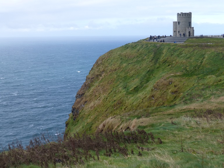
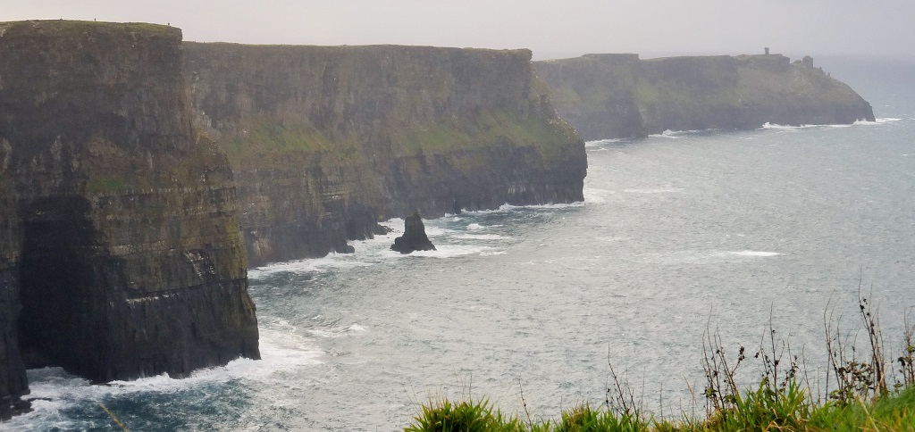
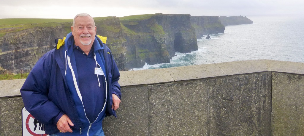
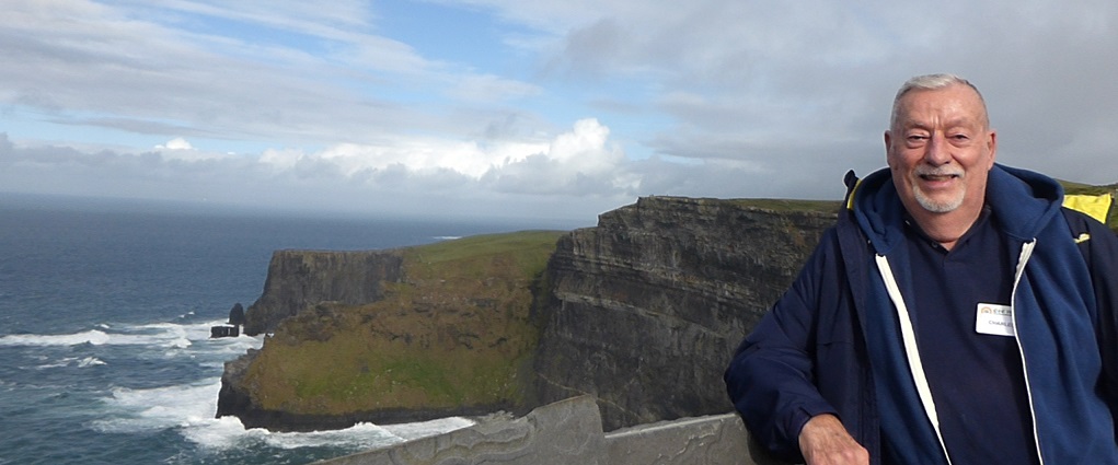
View the awesome Cliffs of Moher rising to heights of 700 feet above the wild Atlantic swells.
Drive through the rounded limestone hills of Burren and around Galway Bay.
Take a short orientation tour of Central Galway before checking in to your hotel.
(B, D)
Ardilaun Hotel
- Taylors Hill - Galway Co Calway Ireland - +353-91-521433
|
 |
Day 5 - October 19: Cliffs of Moher
 |
 |
|
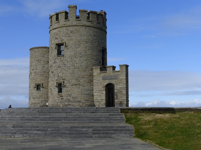
O'Brien's Tower
|
O'Brien's Tower |
|
|
Cliffs of Moher
|
|
|
Cliffs of Moher - View to the Left of O'Brien's Tower
|
|
|
Cliffs of Moher - View to the Right of O'Brien's Tower
|
 |
 |
|
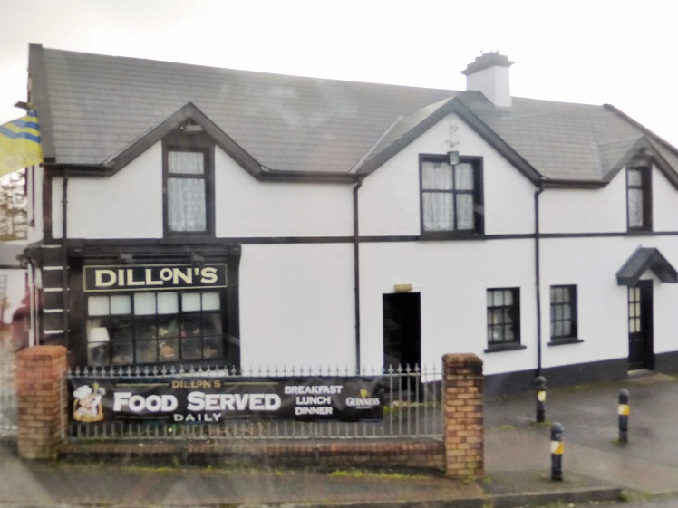
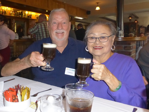
Dillon's Pub
|
Our First Irish Coffee in Ireland |
Cliffs of Moher
The Cliffs of Moher (Irish: Aillte an Mhothair) are located at the southwestern edge of the Burren region in County Clare, Ireland. They rise 120 metres (390 ft) above the Atlantic Ocean at Hag's Head, and reach their maximum height of 214 metres (702 ft) just north of O'Brien's Tower, eight kilometres to the north. The tower is a round stone tower near the midpoint of the cliffs built in 1835 by Sir Cornelius O'Brien. From the cliffs and from atop the tower, visitors can see the Aran Islands in Galway Bay, the Maumturks and Twelve Pins mountain ranges to the north in County Galway, and Loop Head to the south. The cliffs rank amongst the top visited tourist sites in Ireland, and receive almost one million visitors a year.
The cliffs take their name from an old fort called Moher that once stood on Hag's Head, the southernmost point of the cliffs. The writer Thomas Johnson Westropp referred to it in 1905 as Moher U� Ruis or Moher U� Ruidhin. The fort still stood in 1780 and is mentioned in an account from John Lloyd's a Short Tour Of Clare (1780). It was demolished in 1808 to provide material for a new telegraph tower. The present tower near the site of the old Moher U� Ruidhin was built as a lookout tower during the Napoleonic wars.
|
Day 6 - October 20: Yeats' Grave & Derry Walk
Drive north through the pilgrimage town of Knock to Sligo to view the grave of the Nobel Prize-winning poet, W. B. Yeats.
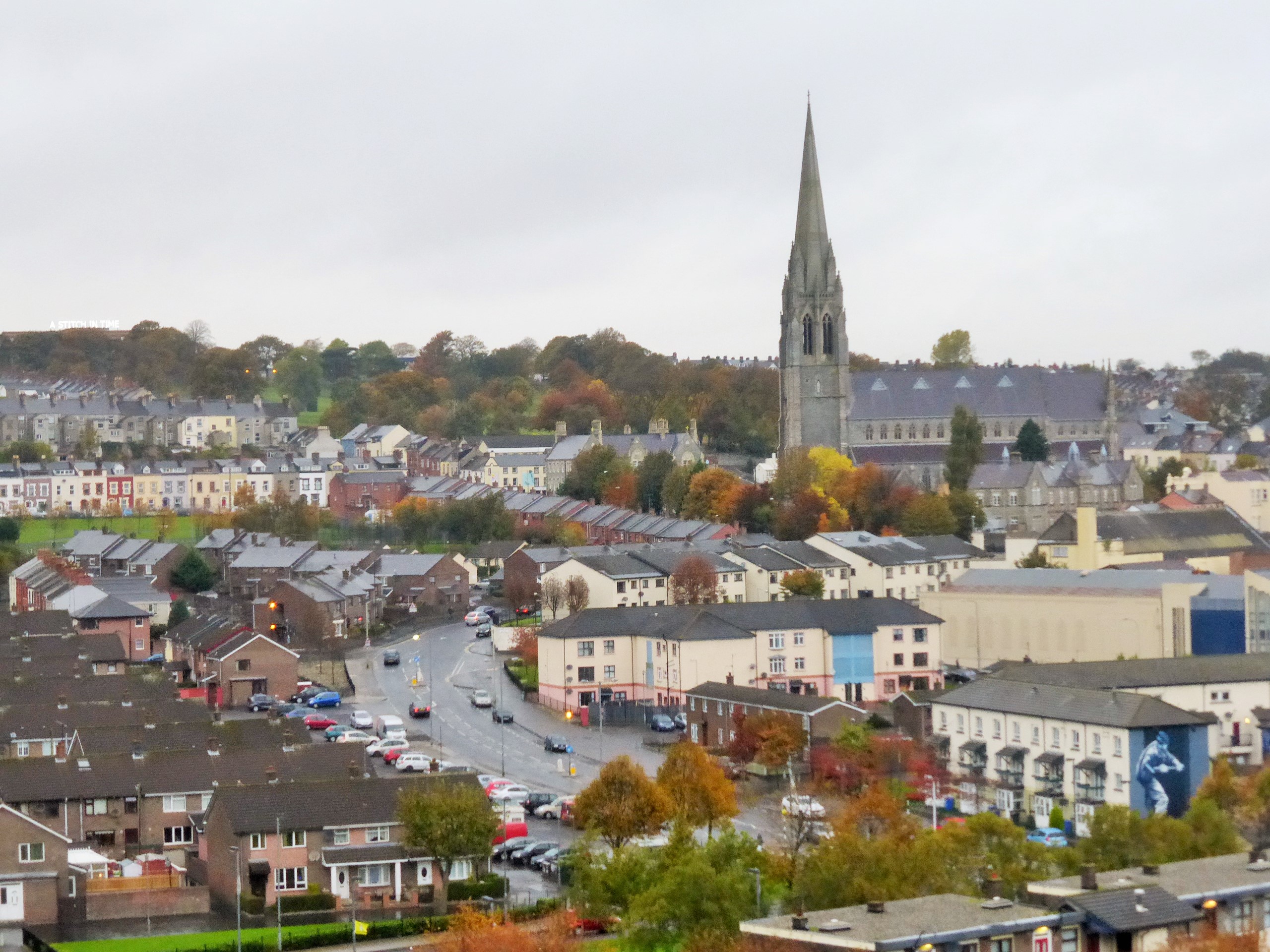
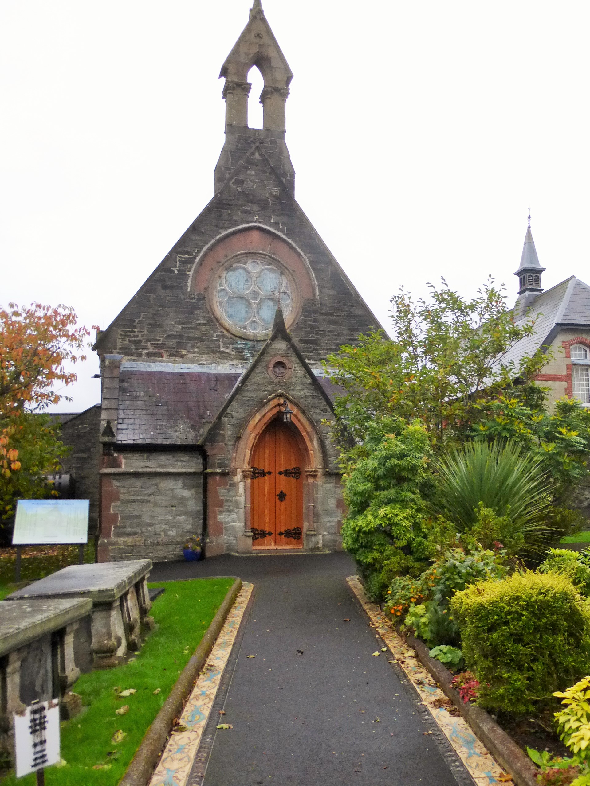
Travel around Donegal Bay and through the majestic and rugged scenery of Donegal to Derry.
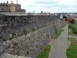
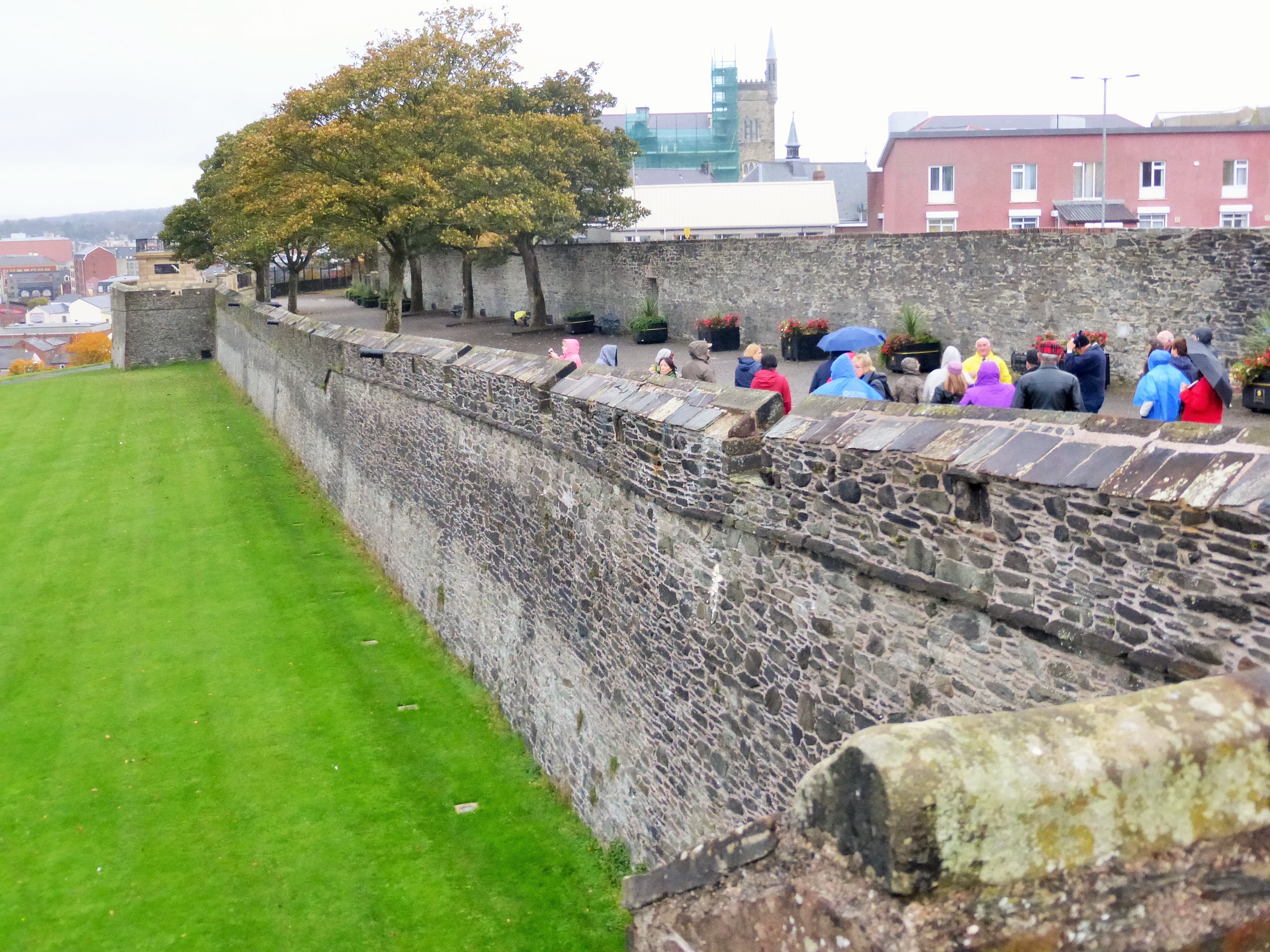
Take a guided walk around the medieval walls, which completely encircle the old part of the city and date from 1613 C.E.
(B, D)
Everglades Hotel
- Prehen Road - Derry Co Derry BT47 2PA - Northern Ireland - +44-48-71340013
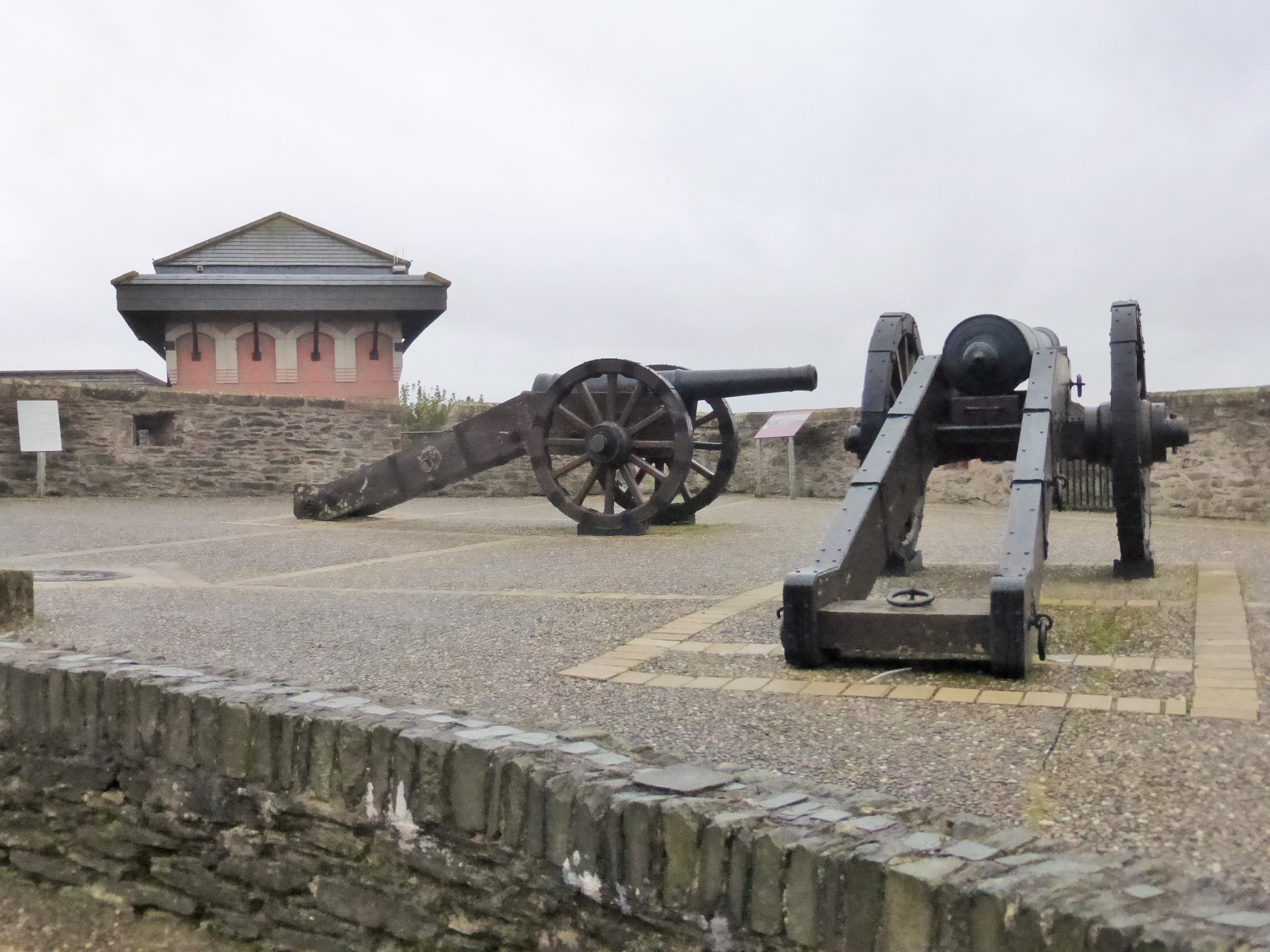
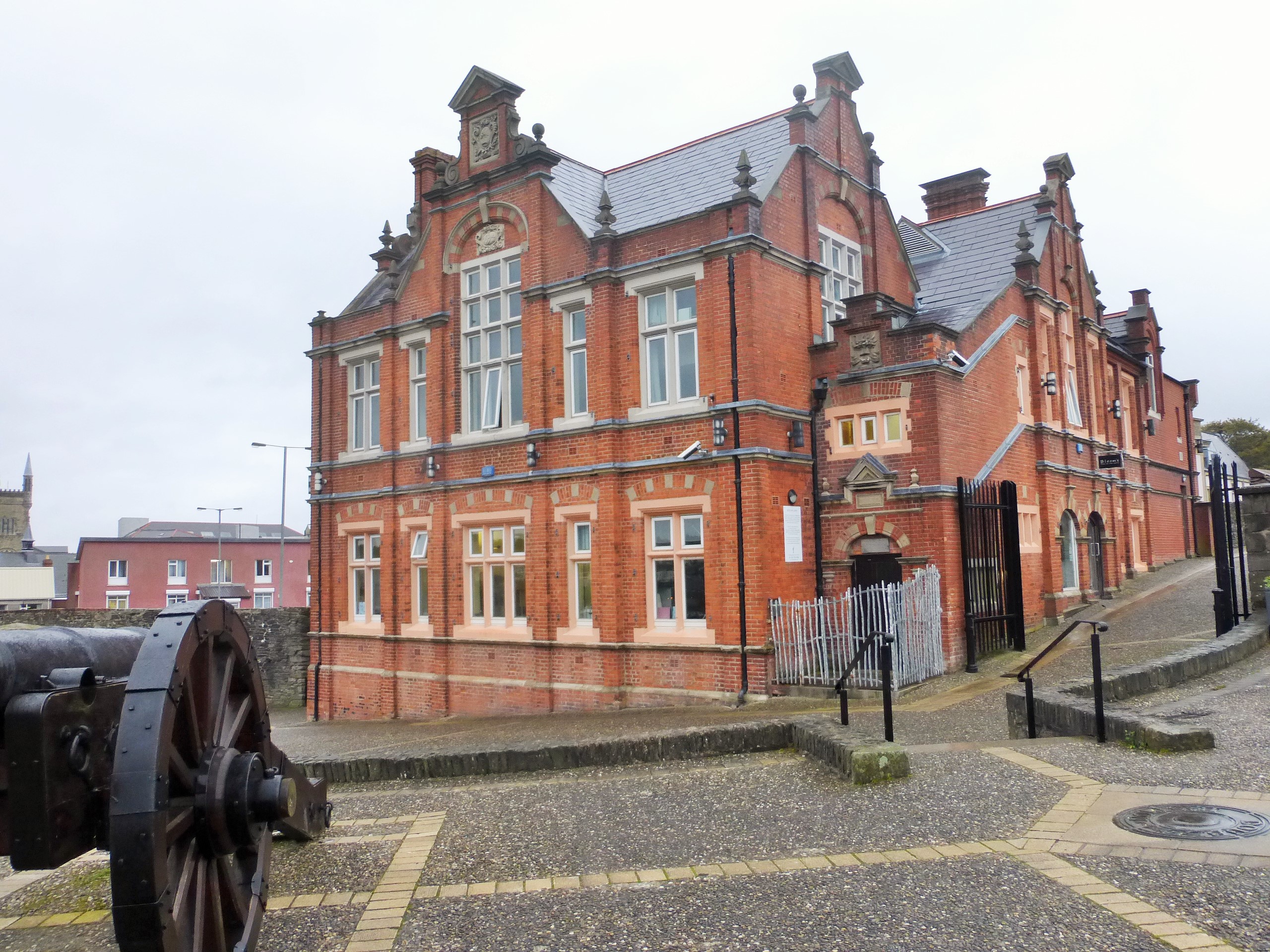
Day 6 - October 20: Derry Walk - Medieval Walls Constructed Around 1613 C.E.
|
 |
 |
 |
Canons
|
Derry's Wall |
 |
 |
Buildings on the Walls
|
Distant Church |
 |
 |
Smallest Church
|
Smallest Street |
 |
 |
Colorful Buildings Along the Way
|
Cocktails in the Everglades Hotel - Derry |
Derry's Walled City
Derry's walled city is Ireland's earliest example of town planning. It is thought to have been modelled on the French Renaissance town of Vitry-le-Fran�ois, designed in 1545 by Italian engineer Hieronimo Marino; both are based on the grid plan of a Roman military camp, with two main streets at right angles to each other, and four city gates, one at the end of each street.
Completed in 1619, Derry's city walls are about 8m high and 9m thick, with a circumference of about 1.5km, and are the only city walls in Ireland to survive almost intact. The four original gates (Shipquay, Ferryquay, Bishop's and Butcher's) were rebuilt in the 18th and 19th centuries, when three new gates (New, Magazine and Castle) were added. Derry's nickname, the Maiden City, derives from the fact that the walls have never been breached by an invader.
The walls were built under the supervision of the Honourable The Irish Society, an organisation created in 1613 by King James and the London livery companies to fund and oversee the fortification of Derry and the plantation of surrounding county with Protestant settlers. The society still exists today, though now its activities are mainly charitable, and it still owns Derry's city walls.
Ever since the reign of Queen Mary (1553-1558) the English had wanted to occupy and fortify Derry as they considered it the cornerstone of their conquest of Ulster. In September 1566 they finally achieved their aim when Colonel Edward Randolph, who commanded a military force under Queen Elizabeth's Lord Deputy Sir Henry Sidney, built the first English fortification of Derry. He expelled all the Irish inhabitants of the town and erected earthworks for the defence of the garrison. Randolph was destined to die a few months later when his forces clashed with those of Shane O'Neill, Earl of Tyrone, who was attempting to wipe out the garrison.
These first military defences encompassed the site of Derry's first cathedral, the Teampall M�r, built in 1164 near St Columba's original monastery. Today the Long Tower Church stands in the same area.
In April 1567 an accidental fire spread to the Teampall M�r which was being used as a magazine for gun powder, causing a great explosion. This destroyed the cathedral along with other church buildings and the soldiers' quarters. As a direct result, the English forces sailed back home - leaving Derry in ruins for many years.
spaceIn 1600 the English returned, still determined to gain firm control of the area by establishing a permanent garrison in Derry. Sir Henry Docwra was sent by Lord Deputy Mountjoy to occupy and fortify the town with a large force of men. His main task was to keep in check the Ulster Chieftains and try to get them to co-operate with the Crown. He landed virtually unopposed at Culmore on 16 May and, after fortifying the existing castle there, marched to Derry several days later.
|
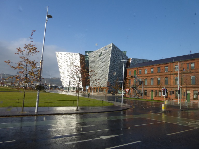
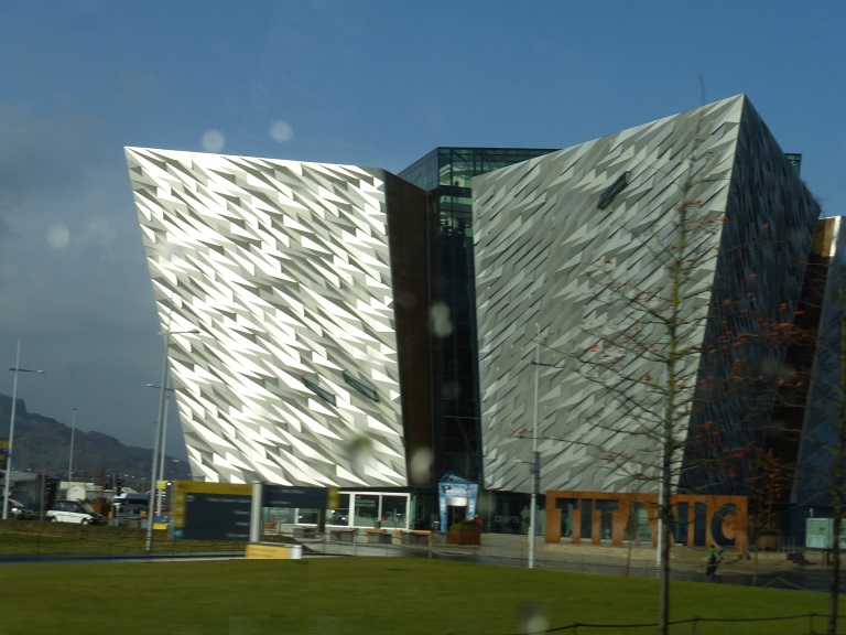
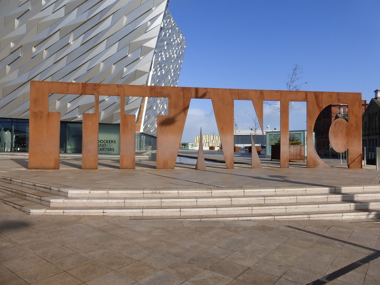
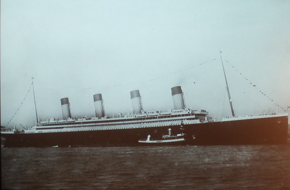
Day 7 - October 21: Giant's Causeway - Titanic Museum & Farewell Irish Dinner Show
Visit the Giant�s Causeway, enormous hexagonal columns formed by volcanic activity over 60 million years ago.
Drive to Belfast for a visit to Titanic Belfast. The state-of-the-art attraction is
devoted to the development and construction of the ill-fated liner that was built in the nearby docks.
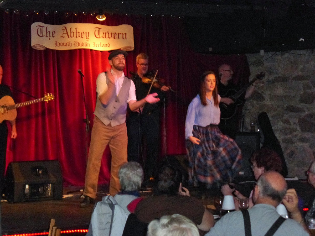
Continue south to Dublin city and drive to the Abbey Tavern for a farwell dinner and entertained with traditional Irish songs and step-dancing.
(B, D)
Croke Park Hotel
- Jone's Road - Dublin Dublin 3 Ireland - +353-1-8714444
Day 7 - October 21: The Giants Causeway
|
 |
|
|
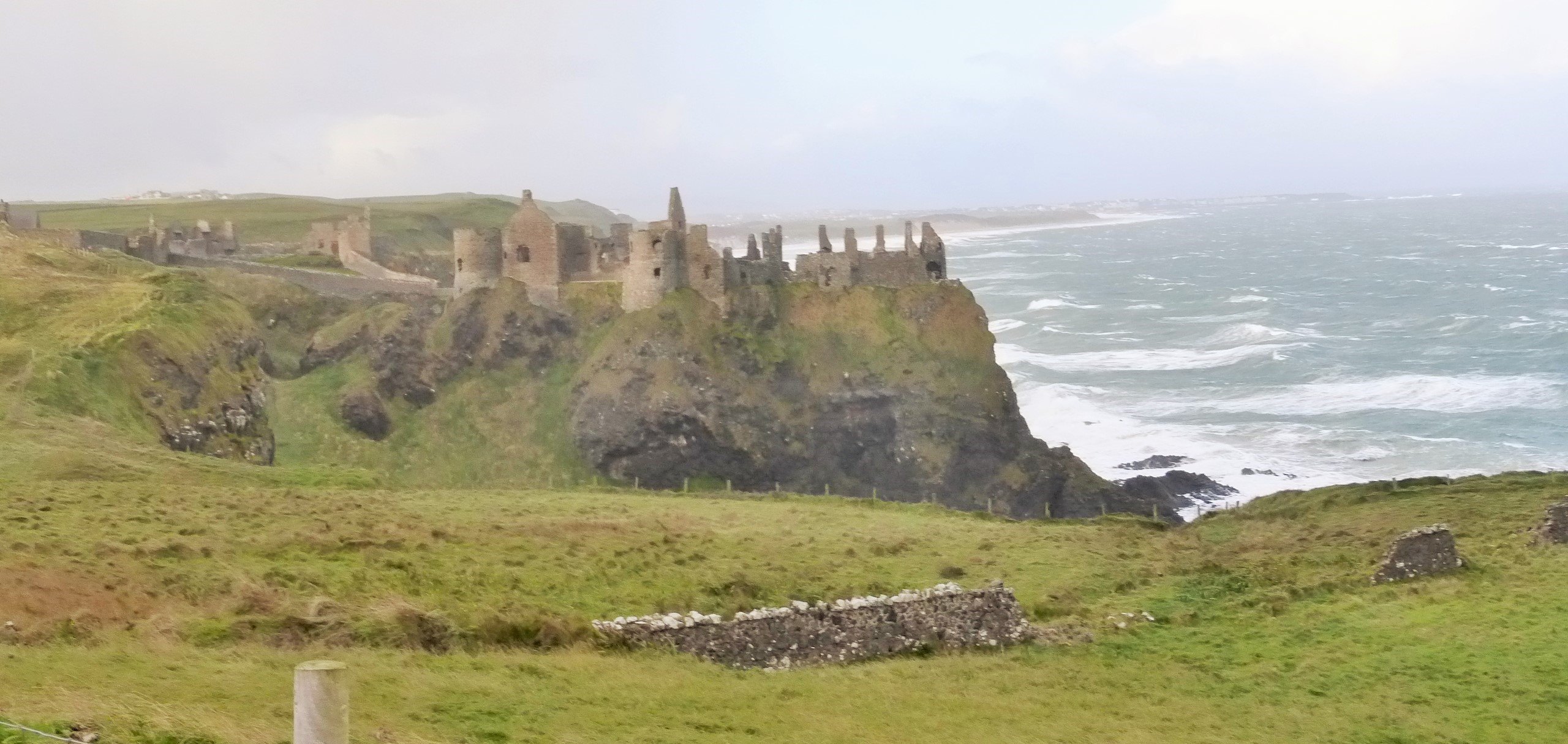
Castle on the Way to The Giant Causeway
|
|
|
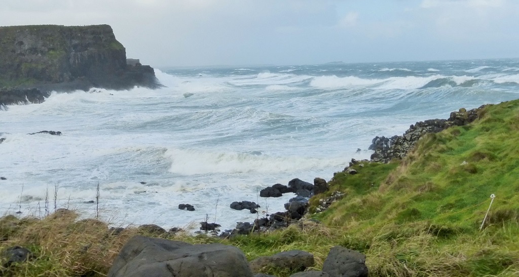
40 Foot Waves - 90 Mile an Hour Winds - Hail - End of the Hurrican that Hit Bermuda!
|
|
|
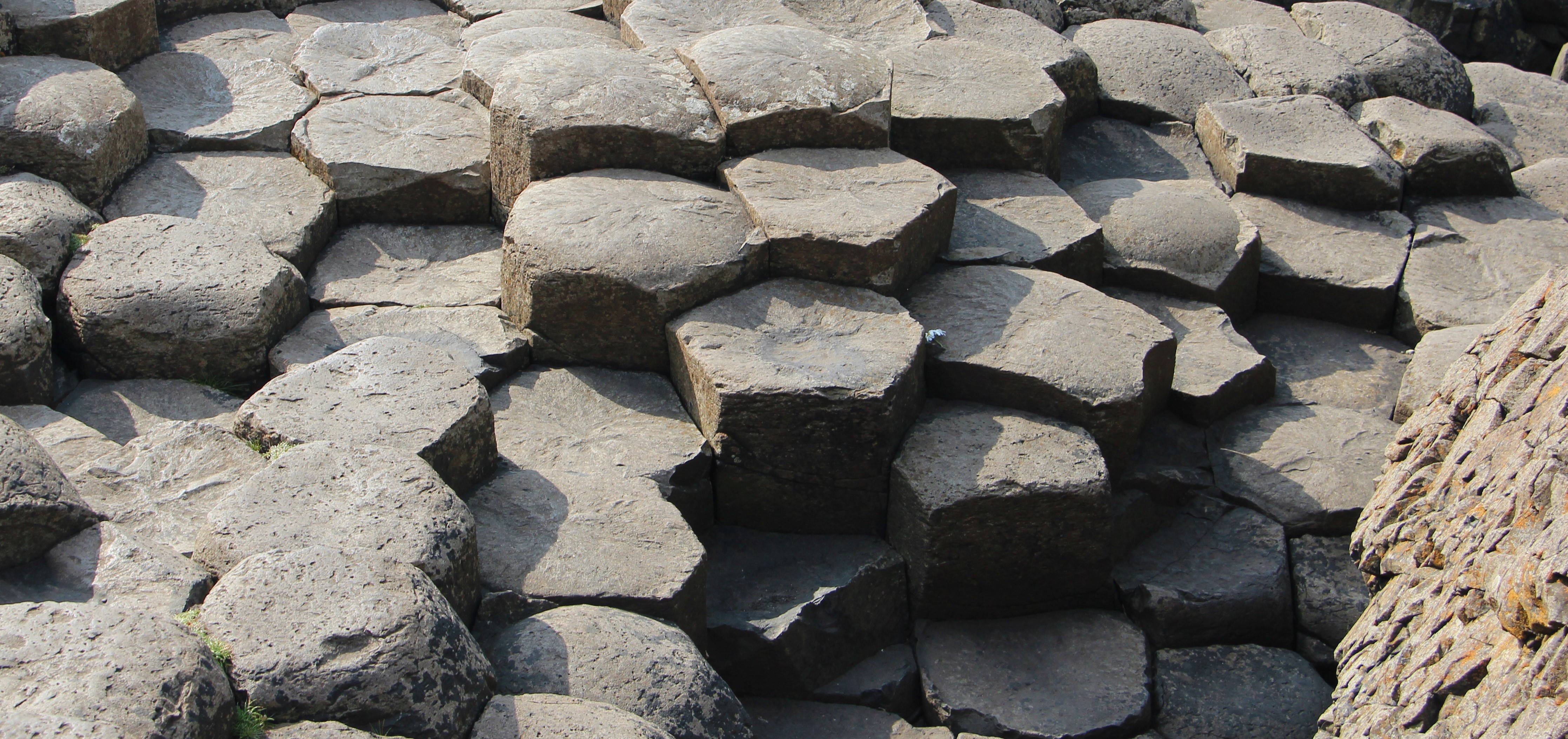
My Only Photo of the Volcanic Hexagonal Shapes Due to the 90 Mile an Hour Winds!
|
Giant's Causeway
The Giant's Causeway (known as Cloch�n an Aifir or Cloch�n na bhFomh�rach in Irish and tha Giant's Causey in Ulster-Scots) is an area of about 40,000 interlocking basalt columns, the result of an ancient volcanic eruption.
It is located in County Antrim on the northeast coast of Northern Ireland, about three miles (4.8 km) northeast of the town of Bushmills. It was declared a World Heritage Site by UNESCO in 1986, and a national nature reserve in 1987 by the Department of the Environment for Northern Ireland. In a 2005 poll of Radio Times readers, the Giant's Causeway was named as the fourth greatest natural wonder in the United Kingdom. The tops of the columns form stepping stones that lead from the cliff foot and disappear under the sea. Most of the columns are hexagonal, although there are also some with four, five, seven or eight sides. The tallest are about 12 metres (39 ft) high, and the solidified lava in the cliffs is 28 metres (92 ft) thick in places.
Much of the Giant's Causeway and Causeway Coast World Heritage Site is today owned and managed by the National Trust and it is one of the most popular tourist attractions in Northern Ireland. The remainder of the site is owned by the Crown Estate and a number of private landowners.
Around 50 to 60 million years ago, during the Paleogene Period, Antrim was subject to intense volcanic activity, when highly fluid molten basalt intruded through chalk beds to form an extensive lava plateau. As the lava cooled, contraction occurred. Horizontal contraction fractured in a similar way to drying mud, with the cracks propagating down as the mass cooled, leaving pillar like structures, which are also fractured horizontally into "biscuits". In many cases the horizontal fracture has resulted in a bottom face that is convex while the upper face of the lower segment is concave, producing what are called "ball and socket" joints. The size of the columns is primarily determined by the speed at which lava from a volcanic eruption cools. The extensive fracture network produced the distinctive columns seen today. The basalts were originally part of a great volcanic plateau called the Thulean Plateau which formed during the Paleogene.
According to legend, the columns are the remains of a causeway built by a giant. The story goes that the Irish giant Fionn mac Cumhaill (Finn MacCool), from the Fenian Cycle of Gaelic mythology, was challenged to a fight by the Scottish giant Benandonner. Fionn accepted the challenge and built the causeway across the North Channel so that the two giants could meet. In one version of the story, Fionn defeats Benandonner. In another, Fionn hides from Benandonner when he realises that his foe is much bigger than he. Fionn's wife, Oonagh, disguises Fionn as a baby and tucks him in a cradle. When Benandonner sees the size of the 'baby', he reckons that its father, Fionn, must be a giant among giants. He flees back to Scotland in fright, destroying the causeway behind him so that Fionn could not follow. Across the sea, there are identical basalt columns (a part of the same ancient lava flow) at Fingal's Cave on the Scottish isle of Staffa, and it is possible that the story was influenced by this.
In overall Irish mythology, Fionn mac Cumhaill is not a giant but a hero with supernatural abilities. In Fairy and Folk Tales of the Irish Peasantry (1888) it is noted that, over time, "the pagan gods of Ireland [...] grew smaller and smaller in the popular imagination, until they turned into the fairies; the pagan heroes grew bigger and bigger, until they turned into the giants". There are no surviving pre-Christian stories about the Giant's Causeway, but it may have originally been associated with the Fomorians (Fomh�raigh); the Irish name Cloch�n na bhFomh�raigh or Cloch�n na bhFomh�rach means "stepping stones of the Fomh�raigh". The Fomh�raigh are a race of supernatural beings in Irish mythology who were sometimes described as giants and who may have originally been part of a pre-Christian pantheon
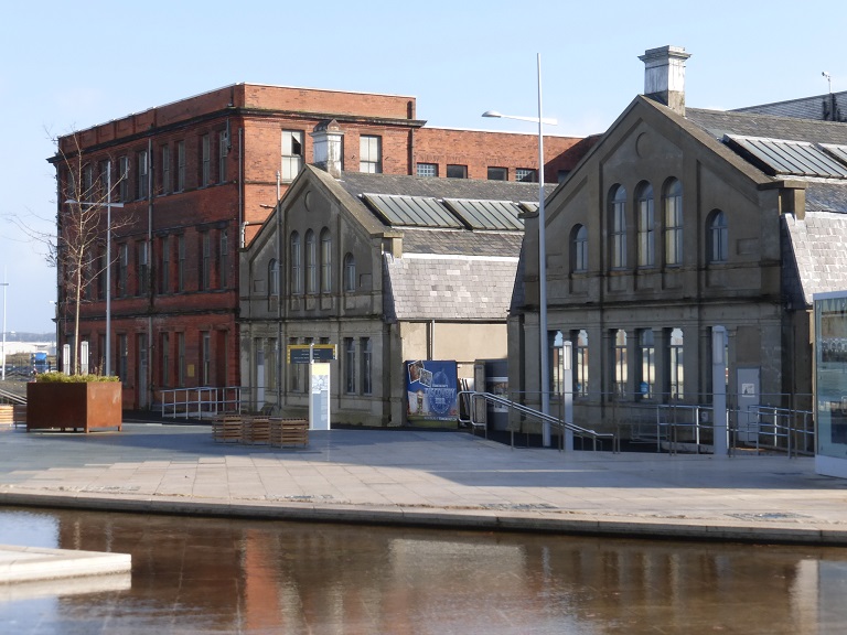
Day 7 - October 21: Titanic Belfast Museum
|
|
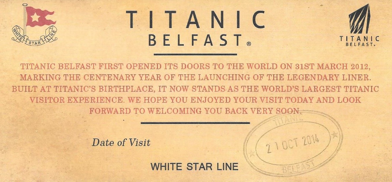
Titanic Museum Ticket
|
 |
 |
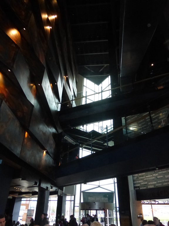
Entering the Titanic Museum
|
 |
 |
Titianic's Name in Iron
|
Original Buildings - Site Where the Ship was Built |
 |
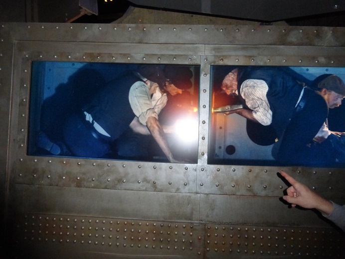 |
Launching of the Titanic
|
Work Men Putting on Rivits |
 |
 |
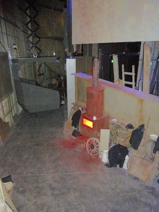
Work Areas
|
Interior of the Museum |
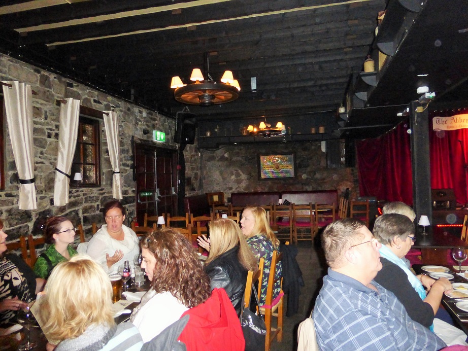
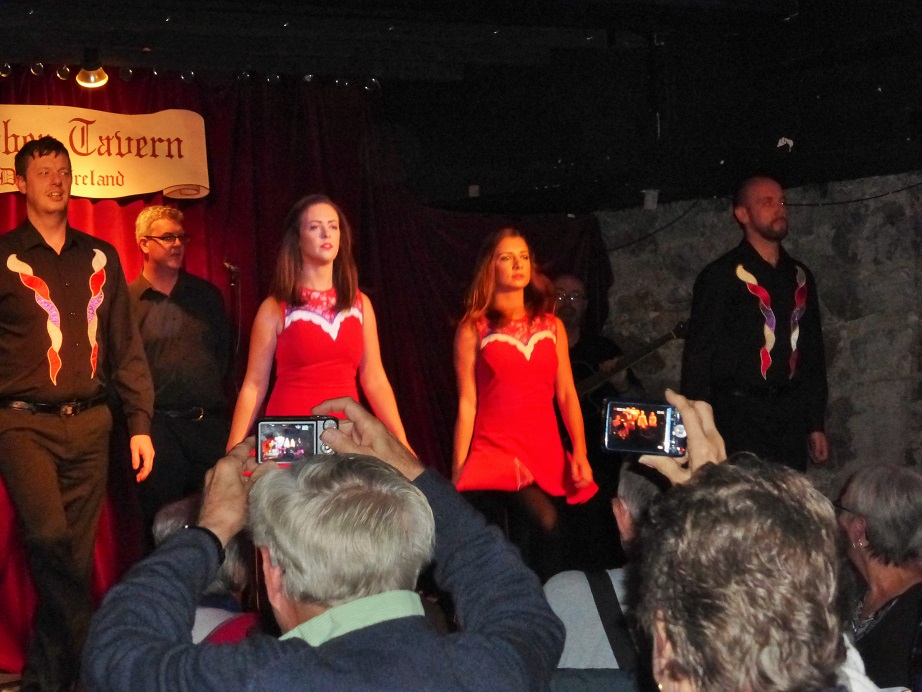
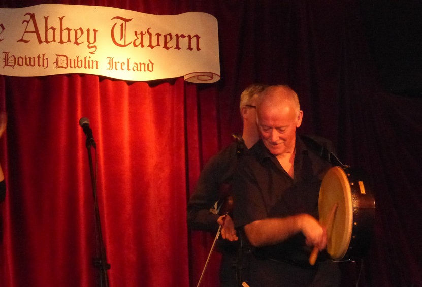
Day 7 - October 21: Abbey Tavern Farewell Dinner
 |
 |
The Abbey Tavern
|
Cocktails and Dinner |
 |
 |
Girls Were Very Serious
|
The Drummer and Singer was Funny |
 |
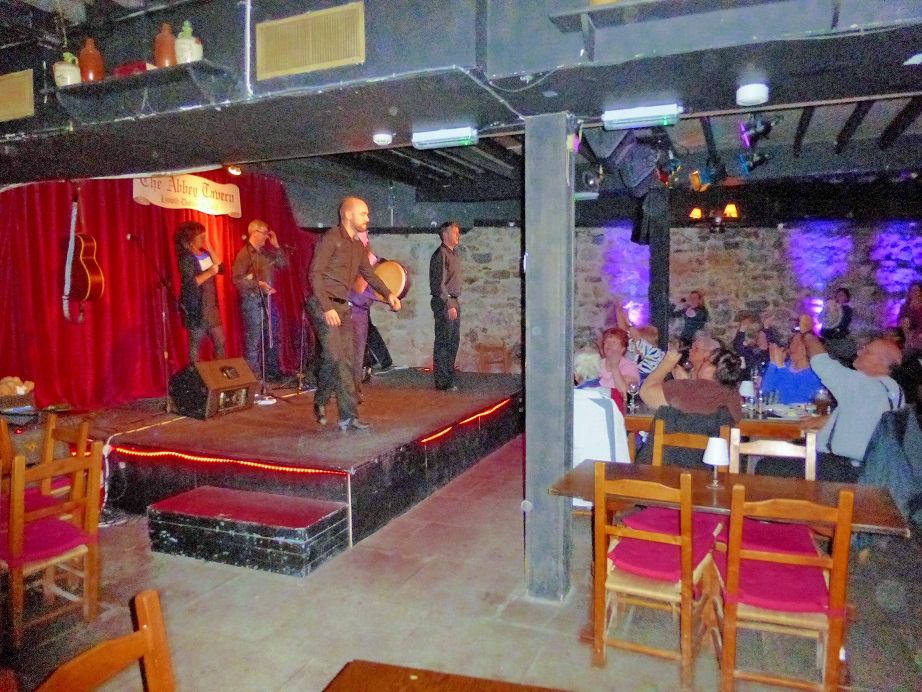 |
Great Dancing by the Young Man
|
View of the Tavern and Stage |
|
Day 8 - October 22: Tour Ends - We continue for an additional day.
An extra day to tour Dublin. Use your vouchers for an independent open-top bus tour and a visit to either Guinness Storehous or the Old Jameson Distillery to lean how these nenowned products are created and enjoy a sample!
Croke Park Hotel
- Jone's Road - Dublin Dublin 3 Ireland - +353-1-8714444
|
 |
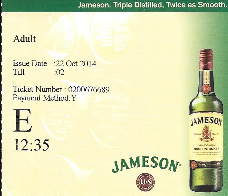
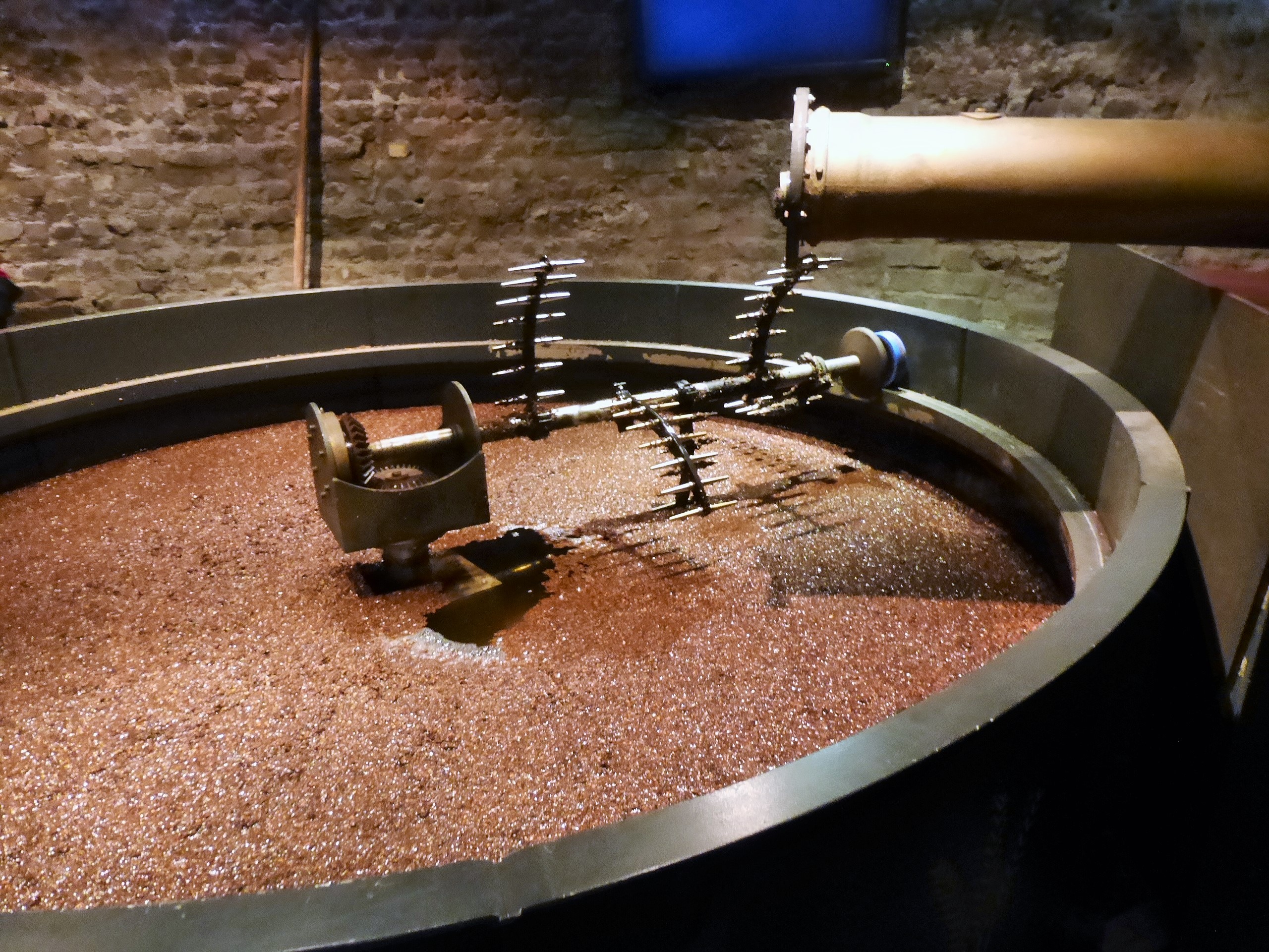
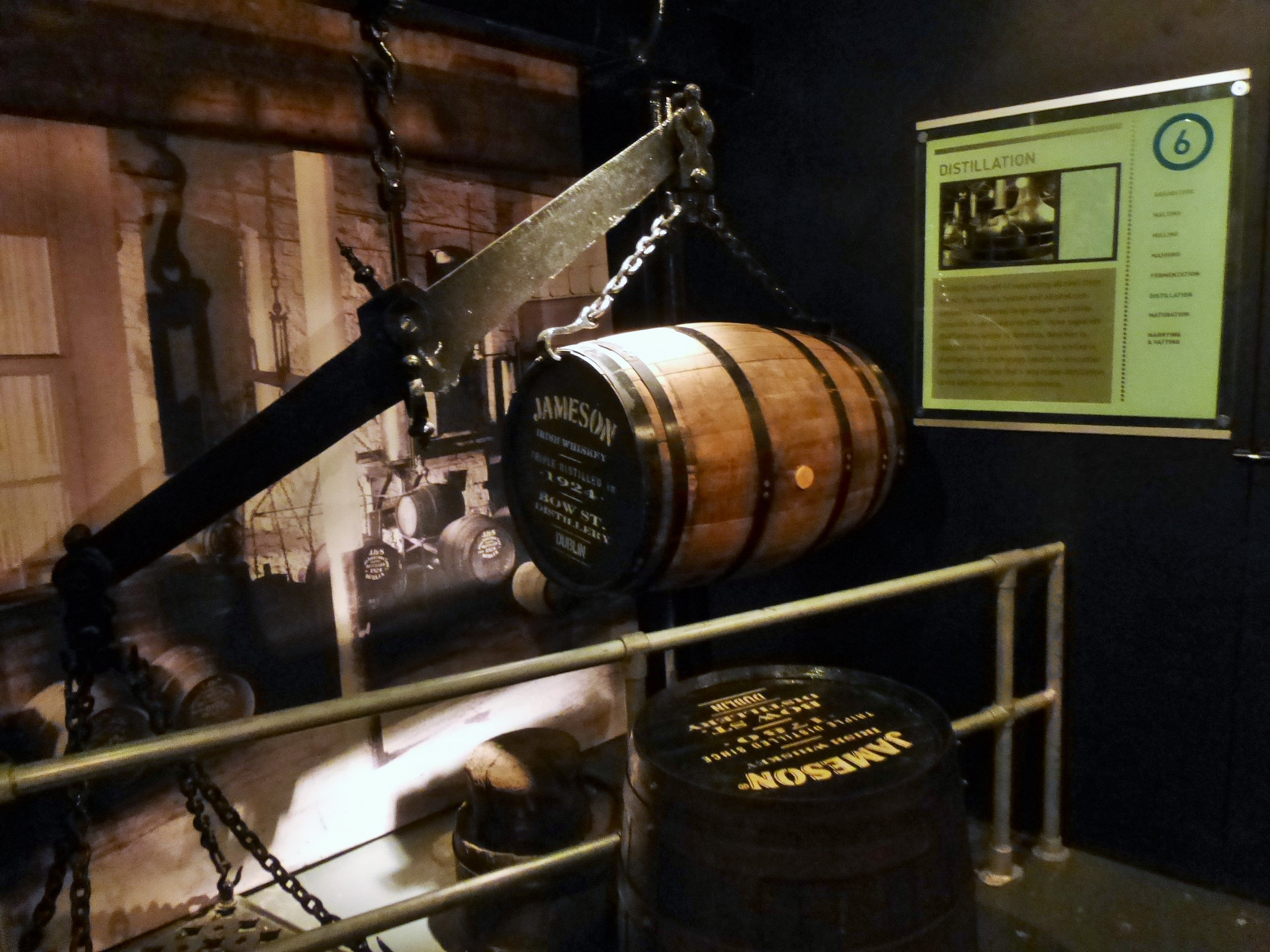
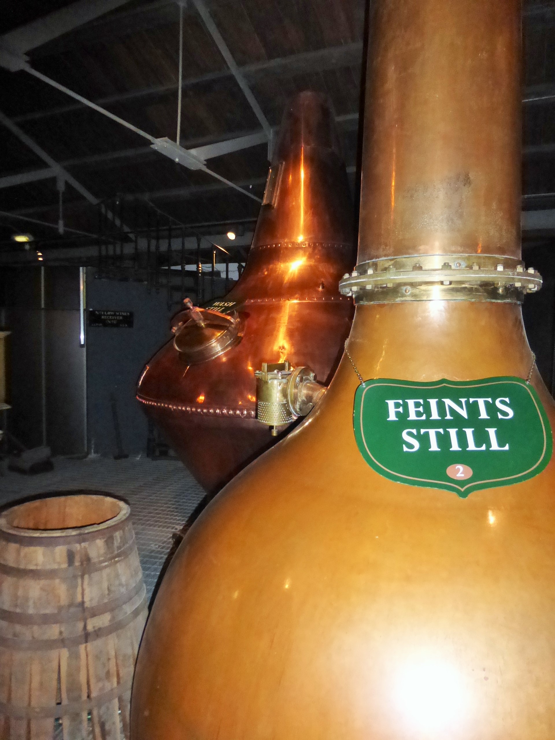
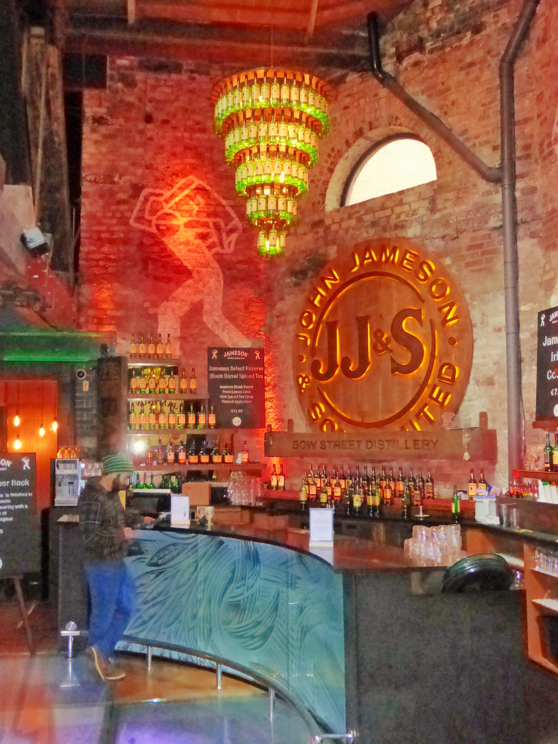
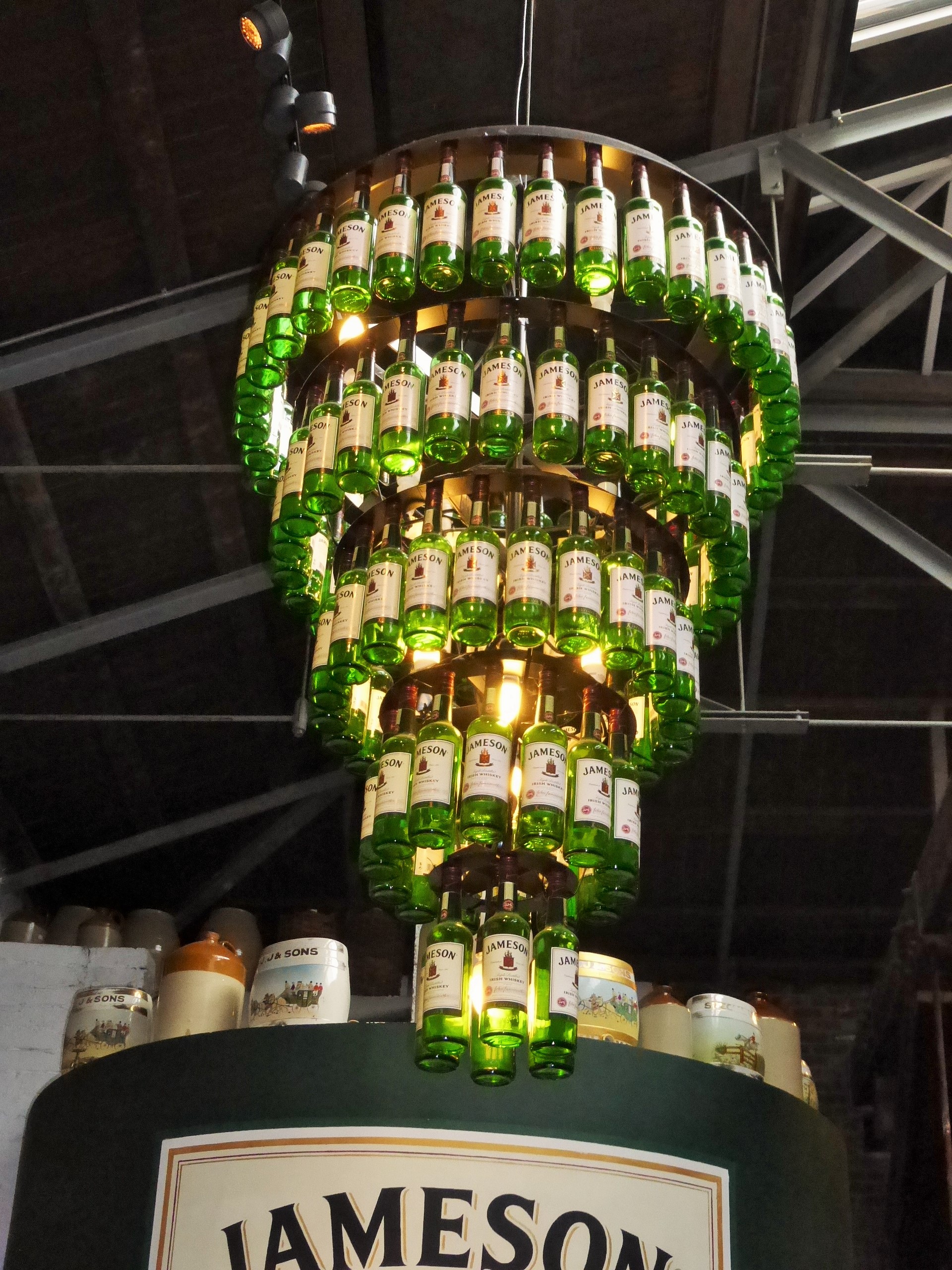
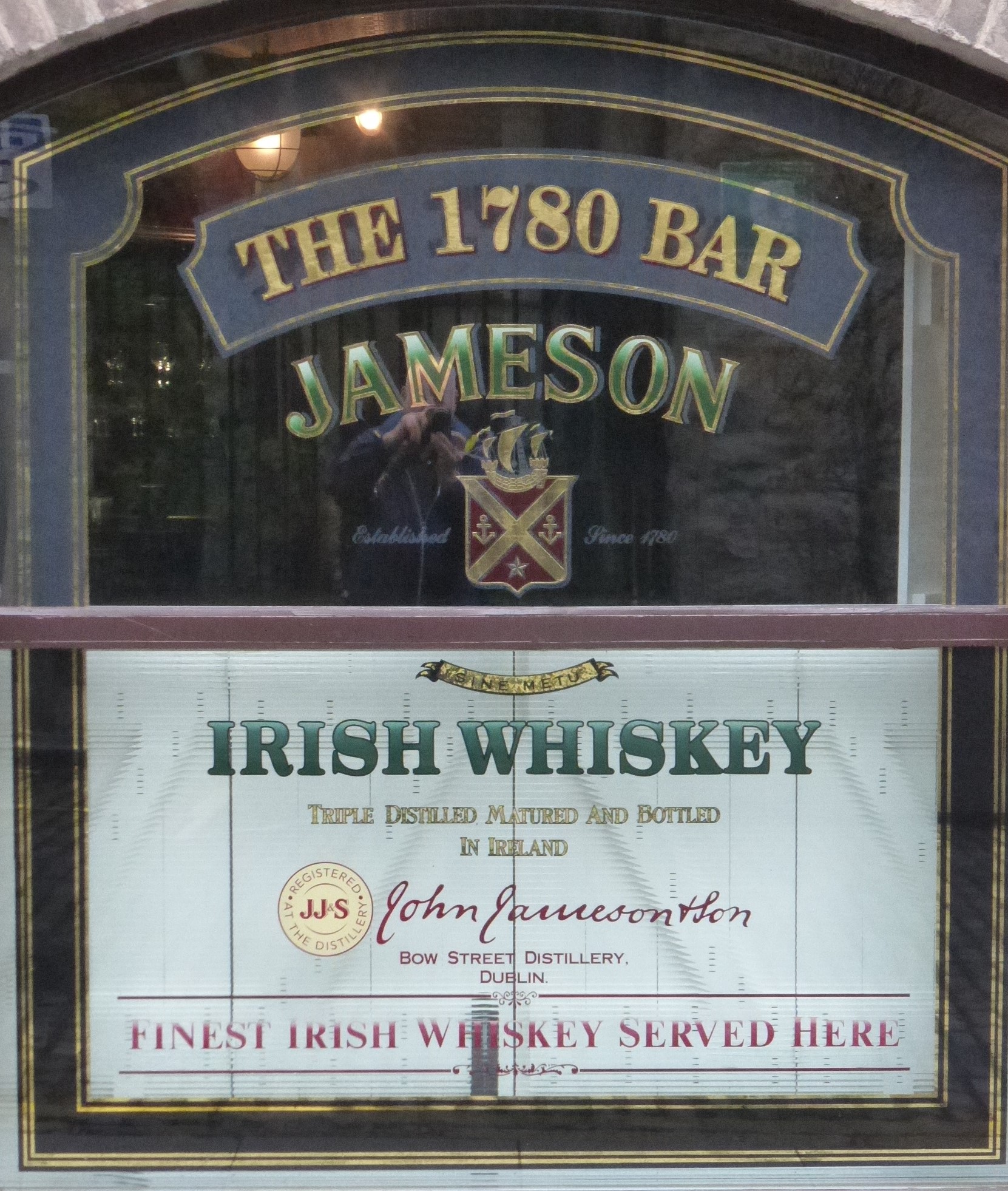
Day 8 - October 22: Jameson Whiskey Distrillery Tour
 |
|
Entry Ticket
|
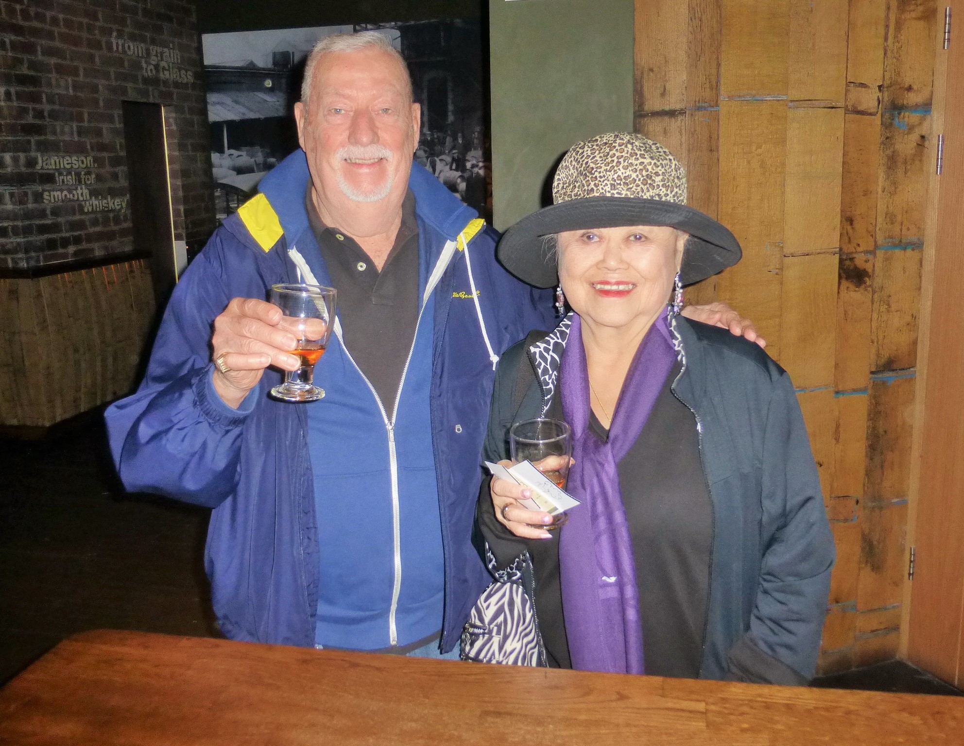
Chuck & Virginia Whiskey Tasting |
 |
 |
Rye Treated Before Going to Heating and Processing
|
Barrels from Kentucky, Portugal and Spain |
 |
 |
Distilled Three Times
|
Jameson Cocktail Lounge |
 |
 |
Whiskey Bottle Chandelier
|
Jameson Whiskey Logo |
Day 8 - October 22: Dublin Walk & a Great Pub Lunch at the Old Storehouse with New Friends!
 |
 |
Old Post Office
|
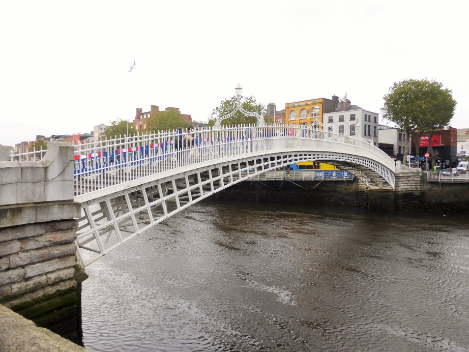
The Ha'penny Bridge built in 1816 over the River Liffey |
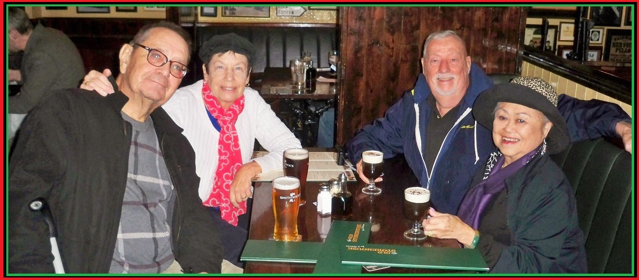 |
William and Linda Hubner, Virginia and Chuck. We left the Jameson Distrillry and decided to walked around town and we found this delightful Pub.
|
 |
 |
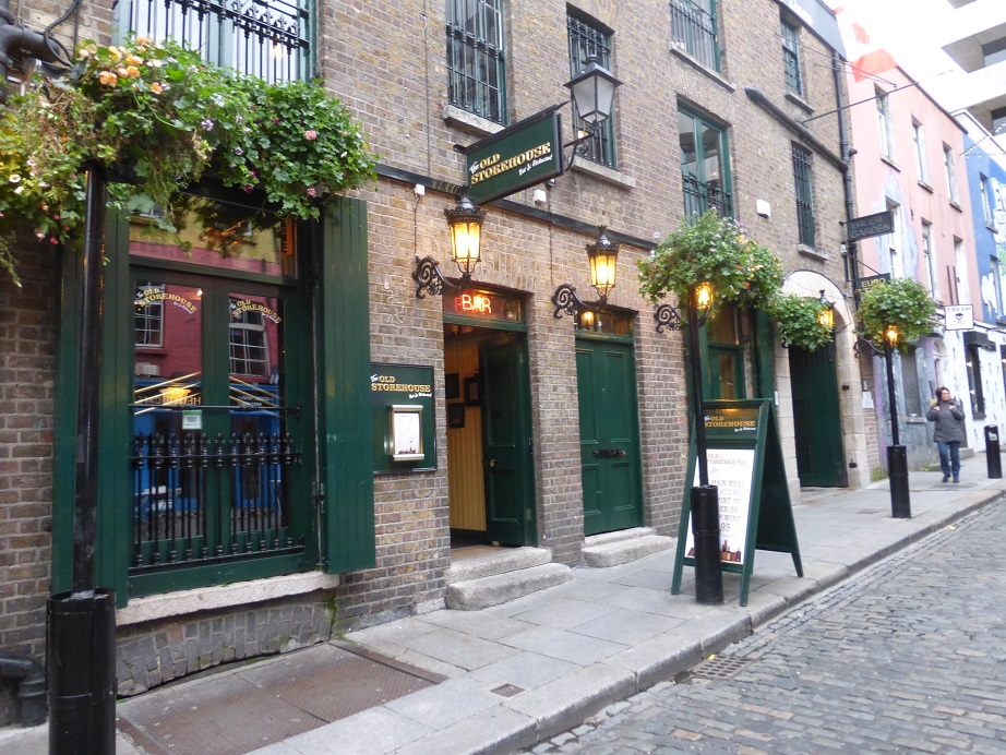
The Old Storehouse Pub
|
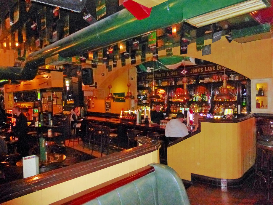
The Inside of the Pub |
 |
 |
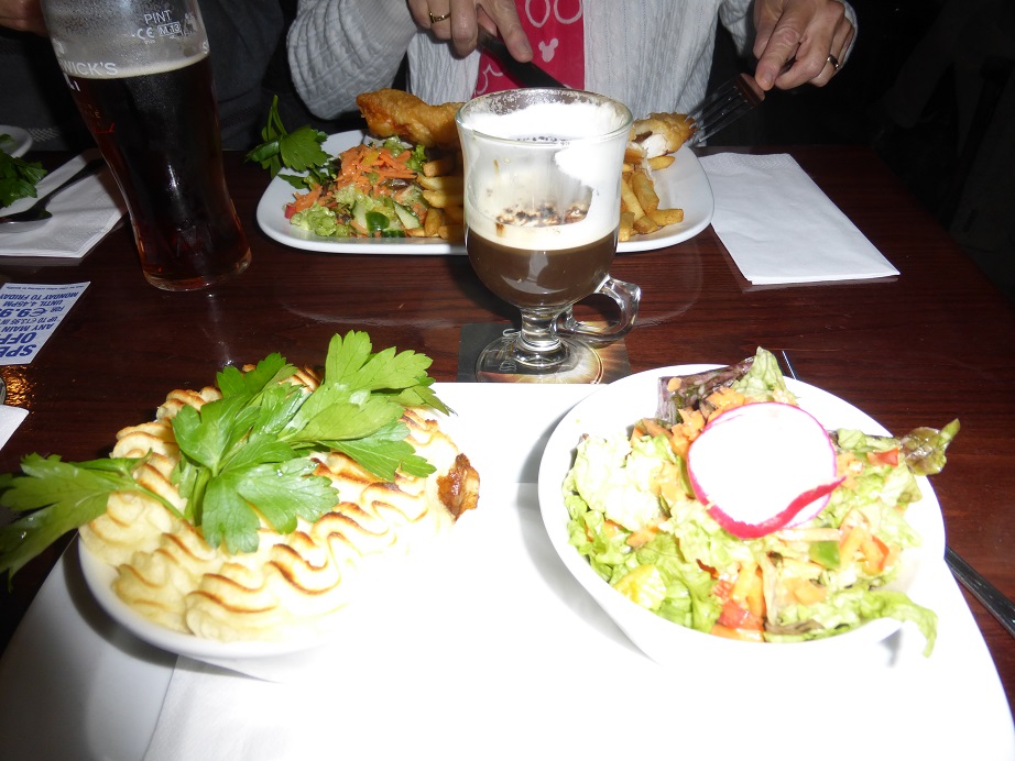
I had the Sheperds Pie
|
Our Last Irish Coffee in Ireland! |
|
Day 9 - October 23: Depart to Airport
Leave the Croke Park Hotel
- Jone's Road - Dublin Dublin 3 Ireland - +353-1-8714444
and depart from
Dublin Ireland at 11:15 a.m.
and landing in Kennedy Airport New York at 1:55 p.m. Leaving Kennedy Airport at 4:15 p.m. and
landing at SFO San Francisco at 8:03 p.m.
|
 |
|
Created on: 2014.07.91 |
|
 |
|
Updated on: 2020.09.13 |

